
Last Checked: October 2, 2026. Researched and edited by Rakibul Hasan.
The best hiking trails in the USA are not all summit climbs. A short wetland boardwalk can reward patient wildlife watching, while a desert ascent or an Alaska icefield trail can occupy most of a day. These 50 routes emphasize a useful choice: what you will see, where to start, how far the selected route goes, and what could change the plan.
This is an editorial selection, not a measured national ranking or a claim that every route is currently open. It focuses on national-park hikes with official route information, ranging from easy nature walks to demanding mountain days. Numbers are for navigation, not quality scores. For park entrance costs, passes and a broader itinerary, use our 50 best national parks guide.
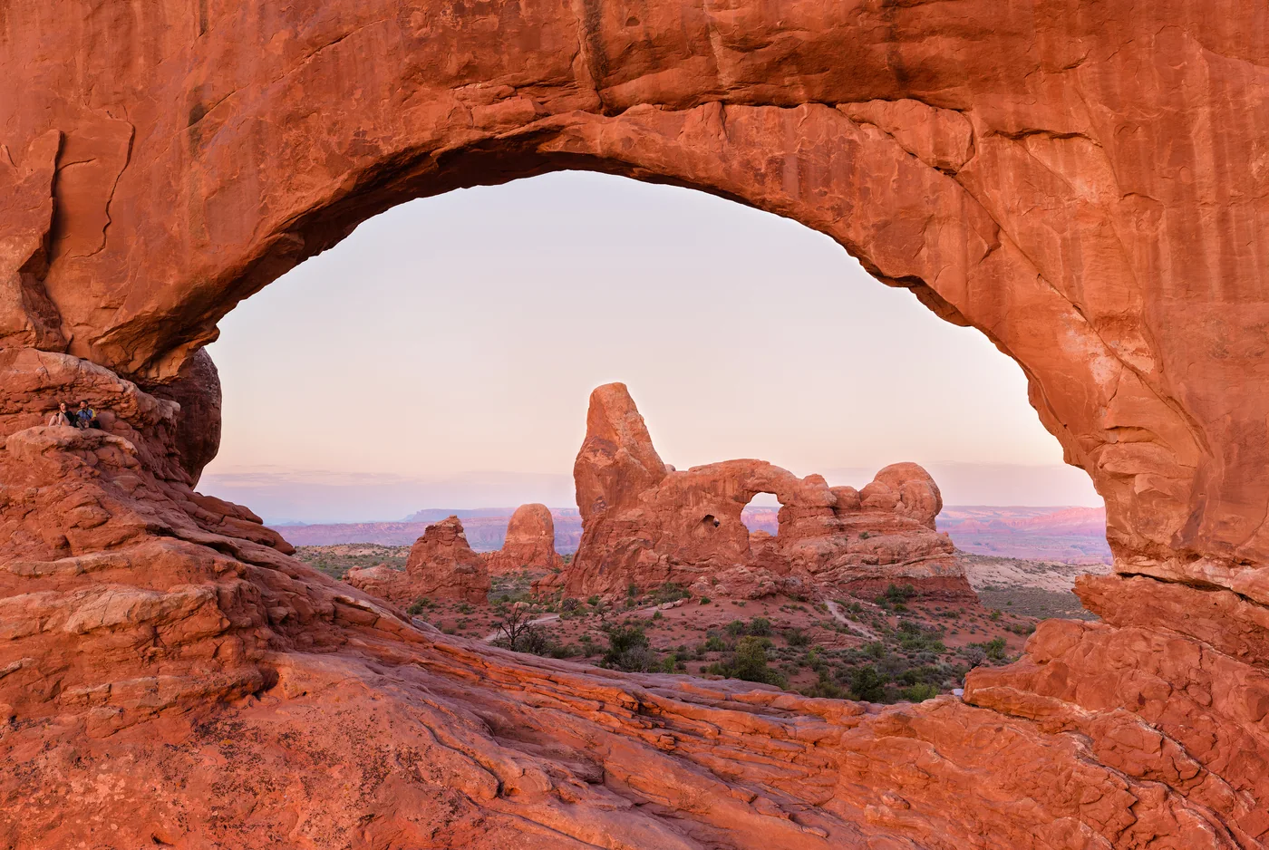
Featured photo: Skyline Trail looking south, Dllu / Wikimedia Commons, CC BY-SA 4.0. Resized and converted to WebP; this adapted image remains under the same license. The photograph illustrates the landscape, not current trail conditions.

How to choose among these hikes
For an easy first outing: start with Lower Yosemite Fall, Hidden Valley, Trail of the Cedars, Bear Lake, Anhinga or Glacier View Loop. Short does not mean accessible to every visitor: check stairs, surface and current conditions in the individual entry.
For moderate walks: consider Marymere Falls, String Lake, Emerald Lake, Queens Garden–Navajo Loop, Stony Man or Hickman Bridge. Compare the climb and footing as well as the mileage; a level boardwalk and a rocky ascent are very different uses of an hour.
For challenging days: Skyline, the Ozette coastal loop, Alum Cave Bluffs, Cassidy Arch and Harding Icefield reward hikers who can plan around terrain and weather. Ooh Aah Point and Sliding Sands begin by descending: save energy and water for the climb out.
By scenery: Skyline and Harding Icefield emphasize mountains; Ozette and Gorham Mountain offer coastal settings; Ryan Mountain and Delicate Arch showcase desert terrain. Marymere, Grotto and Pīpīwai provide waterfall objectives, while Hall of Mosses, Ledges and Gumbo Limbo make the forest itself the destination. Waterfall flow is seasonal, not guaranteed.
How we verified distance and difficulty
Each entry links to a National Park Service route page, map or trail guide. Distance refers to the stated start and turnaround: loop, round trip or the explicit out-and-back conversion. An approach from another parking lot can add mileage. Where NPS pages differ, the entry explains the route or reports a range rather than pretending to have survey-level precision.
We keep official difficulty labels when available. Labels marked editorial weigh length, climbing, surface, exposure and environmental demands: easy generally means shorter and less strenuous; moderate adds sustained distance or rougher terrain; challenging involves significant effort or conditions requiring more preparation. These are comparisons, not assurances of personal suitability.
Elevation figures retain their source meaning. Vertical rise, total accumulated gain and descent followed by a return climb are not interchangeable. “Not published” means we have not substituted an unverified tracking-app number. Time estimates include a modest sightseeing allowance and are planning estimates unless attributed to NPS; fitness, children, photography, snow and tides can change them substantially.
50 hiking trails at a glance
Scroll the table horizontally on a small screen. Select a trail name for the detailed starting point and risks.
| Trail | Location | Distance and route | Difficulty | Elevation |
|---|---|---|---|---|
| 1. Lower Yosemite Fall | Yosemite, California | 1 mile loop | Easy (NPS) | 50 ft |
| 2. Ozette Triangle: Cape Alava and Sand Point | Olympic, Washington | 9-mile loop: 3.3 miles to Cape Alava, 2.9 miles along the coast and 2.8 miles from Sand Point | Challenging (editorial), because of distance, beach terrain and tides | No reliable cumulative gain used |
| 3. Hidden Valley | Joshua Tree, California | 1 mile loop | Easy (NPS) | 100 ft |
| 4. Ryan Mountain | Joshua Tree, California | 3 miles round trip | Challenging (NPS: strenuous) | 1,050 ft |
| 5. Harmony Borax Works | Death Valley, California | 0.4 mile loop | Easy (NPS) | 50 ft |
| 6. Hall of Mosses | Olympic, Washington | 0.8 mile loop | Easy (editorial) | Not quantified in cited guide |
| 7. Marymere Falls | Olympic, Washington | 1.8 miles round trip | Moderate (editorial) | Not quantified in cited guide |
| 8. Nisqually Vista | Mount Rainier, Washington | 1.2 miles, lollipop loop | Easy (NPS) | 200 ft |
| 9. Skyline Trail | Mount Rainier, Washington | 5.5 miles loop | Challenging (editorial) | 1,700 ft |
| 10. Watchman Peak | Crater Lake, Oregon | 1.6 miles round trip | Moderate (NPS) | 420 ft |
| 11. Sun Notch | Crater Lake, Oregon | 0.8 mile loop | Easy (editorial) | 150 ft |
| 12. Trail of the Cedars | Glacier, Montana | 0.9 mile loop | Easy (NPS) | 83 ft |
| 13. Avalanche Lake | Glacier, Montana | About 5 miles round trip | Moderate (editorial) | Not quantified in cited trail page |
| 14. Grand Prismatic Overlook | Yellowstone, Wyoming | 1.2 miles round trip | Easy (NPS) | 105 ft |
| 15. Storm Point | Yellowstone, Wyoming | 2.3 miles loop | Easy (NPS) | Not quantified in cited trail page |
| 16. String Lake Loop | Grand Teton, Wyoming | 3.7 miles loop | Easy (NPS) | 325 ft |
| 17. Jenny Lake Loop | Grand Teton, Wyoming | 7.1 miles loop | Moderate (NPS) | 1,040 ft |
| 18. Bear Lake Loop | Rocky Mountain, Colorado | 0.6 mile loop | Easy (editorial) | 71 ft |
| 19. Emerald Lake | Rocky Mountain, Colorado | 3.4 miles round trip | Moderate (editorial) | 771 ft |
| 20. South Kaibab to Ooh Aah Point | Grand Canyon, Arizona | 1.8 miles round trip | Challenging (editorial) | 790 ft descent, then climb back |
| 21. Riverside Walk | Zion, Utah | About 2 miles round trip | Easy (NPS) | 154 ft outbound gain in NPS assessment; return adds climbing |
| 22. Watchman Trail | Zion, Utah | 3.3 miles round trip, including overlook circuit | Moderate (NPS) | 479 ft outbound gain to overlook; circuit adds about 80 ft |
| 23. Queen’s Garden–Navajo Combination | Bryce Canyon, Utah | 2.9 miles loop | Moderate (NPS) | 625 ft |
| 24. Bristlecone Loop | Bryce Canyon, Utah | 1 mile loop | Easy (NPS) | 200 ft |
| 25. Delicate Arch | Arches, Utah | 3 miles round trip | Challenging (editorial) | 480 ft |
| 26. Landscape Arch | Arches, Utah | About 1.9 miles round trip | Easy (NPS) | Minor rolling hills; no single current total used |
| 27. Mesa Arch | Canyonlands, Utah | 0.6 mile round-trip circuit | Easy (NPS) | Not quantified in cited guide |
| 28. Upheaval Dome, first overlook | Canyonlands, Utah | 0.6 mile round trip | Moderate (NPS) | 100 ft elevation change |
| 29. Door Trail boardwalk | Badlands, South Dakota | 0.26 mile round trip, boardwalk only | Easy (NPS) | Not quantified in cited guide |
| 30. Notch Trail | Badlands, South Dakota | About 1.25–1.5 miles round trip | Challenging (NPS: moderate to strenuous) | Not quantified in cited guide |
| 31. Ledges Trail | Cuyahoga Valley, Ohio | 1.8 miles loop, plus parking connectors | Moderate (editorial) | Not quantified in cited park overview |
| 32. Brandywine Gorge Loop | Cuyahoga Valley, Ohio | 1.5 miles loop | Moderate (editorial) | 160 ft elevation change |
| 33. Alum Cave Bluffs | Great Smoky Mountains, Tennessee | 4.6 miles round trip | Challenging (editorial) | Not quantified in cited current route page |
| 34. Grotto Falls via Trillium Gap | Great Smoky Mountains, Tennessee | 2.6 miles round trip | Moderate (editorial) | Not quantified in cited page |
| 35. Stony Man | Shenandoah, Virginia | 1.6 miles round trip, including summit loop | Easy (NPS: easiest) | 340 ft |
| 36. Dark Hollow Falls | Shenandoah, Virginia | 1.4 miles round trip | Moderate (NPS) | 440 ft |
| 37. Jordan Pond Path | Acadia, Maine | About 3.3 miles loop | Moderate (NPS) | No single total used; uneven shoreline terrain |
| 38. Gorham Mountain Loop | Acadia, Maine | 3.5 miles loop | Moderate (editorial) | Not quantified in cited route text |
| 39. Anhinga Trail | Everglades, Florida | 0.8 mile round trip | Easy (editorial) | Essentially level; no numeric total published here |
| 40. Gumbo Limbo Trail | Everglades, Florida | 0.4 mile round-trip circuit | Easy (editorial) | Essentially level; no numeric total used |
| 41. Horseshoe Lake Trail | Denali, Alaska | 2 miles round trip from the railroad-crossing trailhead | Moderate (editorial) | About 250 feet down to the lake, then back up; not a cumulative-gain measurement |
| 42. Savage River Loop | Denali, Alaska | 2-mile loop | Easy (editorial); uneven ground | No significant elevation gain reported by NPS |
| 43. Kīlauea Iki Trail | Hawaiʻi Volcanoes, Hawaii | 3.3-mile loop from Kīlauea Iki Overlook | Moderate to challenging (NPS) | 400-foot descent and return ascent |
| 44. Devastation Trail | Hawaiʻi Volcanoes, Hawaii | 1 mile round trip | Easy (NPS), with some steep paved grades | Numeric total not published in the cited guide |
| 45. Pīpīwai Trail | Haleakalā, Hawaii | 4 miles round trip | Moderately strenuous (NPS) | 800 feet |
| 46. Keoneheʻeheʻe (Sliding Sands): first overlook | Haleakalā, Hawaii | 2 miles round trip: 1 mile down, then back up | Moderate (NPS), amplified by altitude | About 500 feet down, then 500 feet of return climbing |
| 47. Harding Icefield Trail | Kenai Fjords, Alaska | 7.8 miles round trip from the trail register; add the approach from the nature center | Strenuous (NPS) | 3,102 feet of vertical rise on the NPS trail map |
| 48. Glacier View Loop | Kenai Fjords, Alaska | 1-mile loop | Easy (editorial); NPS describes an accessible loop | Numeric gain not published in the cited guide |
| 49. Hickman Bridge | Capitol Reef, Utah | 1.8 miles round trip, based on the NPS 0.9-mile one-way listing | Moderate (NPS) | 400 feet of elevation change (NPS) |
| 50. Cassidy Arch | Capitol Reef, Utah | 3.4 miles round trip, based on the NPS 1.7-mile one-way listing | Strenuous (NPS) | 670 feet of elevation change (NPS) |
Map: locate the parks before choosing trailheads
This official NPS map locates park areas and includes units beyond this list. It is not a custom map of our 50 trailheads and must not be used for on-trail navigation. Match the park and state in the table, then open the official trail source for its route map and exact starting area.
Open the official park finder if the map does not load. Download the relevant park map before leaving reliable service.
The 50 hikes: routes, starting points and tradeoffs
1. Lower Yosemite Fall
Location: Yosemite National Park, California.
Start: Lower Yosemite Fall trailhead, Yosemite Valley.
Distance: 1 mile loop.
Elevation: 50 ft.
Difficulty: Easy (NPS).
Time needed: 30–60 minutes.
Why hike it: Choose this for a close-scale introduction to the Valley rather than a strenuous climb. The short circuit leaves time to pause in the forest and look upward.
Seasonal planning: Spring for water; fall for a quieter seasonal contrast. Check the forecast and current park notices before leaving.
Access and permits: No day-entry reservation in 2026; entrance fee applies.
Important risks: Wet pavement can be slippery. Yosemite Falls was dry at the October 2 review; this is not a promise of an autumn waterfall.
Official Lower Yosemite Fall route information · Official park alerts and trip planning
2. Ozette Triangle: Cape Alava and Sand Point
Location: Olympic National Park, Washington.
Start: Ozette trailhead near the ranger station.
Distance: 9-mile loop: 3.3 miles to Cape Alava, 2.9 miles along the coast and 2.8 miles from Sand Point.
Elevation: No reliable cumulative gain used.
Difficulty: Challenging (editorial), because of distance, beach terrain and tides.
Time needed: 5–7 hours, with a tide-dependent schedule.
Why hike it: Combine forest boardwalks with a substantial stretch of wild Pacific shoreline. The beach section makes this a different proposition from a conventional nine-mile inland loop; plan around the coast rather than a fixed walking pace.
Seasonal planning: Drier late spring through early fall, subject to coastal conditions. Check the forecast and current park notices before leaving.
Access and permits: Day-hike entrance rules apply; wilderness camping requires a separate permit. Check coastal conditions before committing to the loop.
Important risks: Tides can block coastal passage, while slippery boardwalks, rocks and driftwood slow travel. Carry an official tide table and route map; do not attempt to outpace rising water.
Official Ozette Triangle: Cape Alava and Sand Point route information · Official park alerts and trip planning
3. Hidden Valley
Location: Joshua Tree National Park, California.
Start: Hidden Valley picnic area.
Distance: 1 mile loop.
Elevation: 100 ft.
Difficulty: Easy (NPS).
Time needed: About 1 hour.
Why hike it: A compact circuit among boulders gives first-time desert walkers a lot to observe without committing to a long route. Keep the outing on the trail instead of turning it into an unplanned scramble.
Seasonal planning: Cooler months. Check the forecast and current park notices before leaving.
Access and permits: No separate day-hike reservation listed; park entrance rules and current closures still apply.
Important risks: Rocky footing, heat and limited shade; bring water from outside the trail area.
Official Hidden Valley route information · Official park alerts and trip planning
4. Ryan Mountain
Location: Joshua Tree National Park, California.
Start: Ryan Mountain parking area between Sheep Pass and Ryan campgrounds.
Distance: 3 miles round trip.
Elevation: 1,050 ft.
Difficulty: Challenging (NPS: strenuous).
Time needed: 1.5–2.5 hours.
Why hike it: Choose Ryan when you want an uphill workout and a wider view of the park’s terrain. It pairs poorly with an already overheated or exhausted group.
Seasonal planning: Cooler months. Check the forecast and current park notices before leaving.
Access and permits: No separate day-hike reservation listed; park entrance rules and current closures still apply.
Important risks: Sustained climbing and full sun; avoid hot conditions and carry sufficient water.
Official Ryan Mountain route information · Official park alerts and trip planning
5. Harmony Borax Works
Location: Death Valley National Park, California.
Start: Harmony Borax Works parking area off CA-190 near Furnace Creek.
Distance: 0.4 mile loop.
Elevation: 50 ft.
Difficulty: Easy (NPS).
Time needed: About 30 minutes.
Why hike it: The paved circuit ties the desert landscape to its industrial history. It is a useful short stop for a mixed-ability group, with more context than a roadside photograph alone.
Seasonal planning: Cooler months. Check the forecast and current park notices before leaving.
Access and permits: No separate day-hike reservation listed; park entrance rules and current closures still apply.
Important risks: Very exposed to heat; a short paved trail is still inappropriate in dangerous temperatures.
Official Harmony Borax Works route information · Official park alerts and trip planning
6. Hall of Mosses
Location: Olympic National Park, Washington.
Start: Hoh Rain Forest Visitor Center area.
Distance: 0.8 mile loop.
Elevation: Not quantified in cited guide.
Difficulty: Easy (editorial).
Time needed: 45–60 minutes.
Why hike it: Slow walking is the point here: look at the forest’s layers and the way moss changes the shape of branches. Allow more time than the mileage alone suggests.
Seasonal planning: Spring–fall; check storm access. Check the forecast and current park notices before leaving.
Access and permits: No separate day-hike reservation listed; park entrance rules and current closures still apply.
Important risks: Roots, mud and slippery surfaces; check Hoh Road and storm-related closures.
Official Hall of Mosses route information · Official park alerts and trip planning
7. Marymere Falls
Location: Olympic National Park, Washington.
Start: Storm King Ranger Station, Lake Crescent.
Distance: 1.8 miles round trip.
Elevation: Not quantified in cited guide.
Difficulty: Moderate (editorial).
Time needed: 1–1.5 hours.
Why hike it: A forest approach and waterfall make this a satisfying single outing near Lake Crescent. Combine it with lakeshore time rather than another distant district.
Seasonal planning: Spring–fall. Check the forecast and current park notices before leaving.
Access and permits: No separate day-hike reservation listed; park entrance rules and current closures still apply.
Important risks: The full route is not a flat accessible path; expect wet steps and uneven footing near the falls.
Official Marymere Falls route information · Official park alerts and trip planning
8. Nisqually Vista
Location: Mount Rainier National Park, Washington.
Start: West corner of the lower Paradise parking lot.
Distance: 1.2 miles, lollipop loop.
Elevation: 200 ft.
Difficulty: Easy (NPS).
Time needed: 45–60 minutes.
Why hike it: Four viewpoints let you compare the glacier valley from slightly different angles. It is a good shorter alternative to an all-day alpine loop.
Seasonal planning: Snow-free summer–early fall. Check the forecast and current park notices before leaving.
Access and permits: No additional hike reservation; no park timed entry in 2026.
Important risks: Initial stairs and sloping pavement; winter snow changes this into a snowshoe outing. Paved does not mean wheelchair accessible.
Official Nisqually Vista route information · Official park alerts and trip planning
9. Skyline Trail
Location: Mount Rainier National Park, Washington.
Start: Paradise Meadows / Skyline Trailhead.
Distance: 5.5 miles loop.
Elevation: 1,700 ft.
Difficulty: Challenging (editorial).
Time needed: 4–6 hours.
Why hike it: This is a full mountain day through Paradise’s changing elevations, not an extension to a quick visitor-center stop. Keep a shorter option available if cloud or fatigue reduces the value of continuing.
Seasonal planning: Snow-free late summer–early fall. Check the forecast and current park notices before leaving.
Access and permits: No ordinary day-hike reservation; overnight and climbing rules are separate. No timed entry in 2026.
Important risks: Lingering snow, steep slopes, altitude and sudden weather. Follow the marked High Skyline route where directed; do not shortcut across icy slopes.
Official Skyline Trail route information · Official park alerts and trip planning
10. Watchman Peak
Location: Crater Lake National Park, Oregon.
Start: Watchman Overlook, West Rim Drive.
Distance: 1.6 miles round trip.
Elevation: 420 ft.
Difficulty: Moderate (NPS).
Time needed: 1–1.5 hours.
Why hike it: The climb provides a more sustained viewing experience than a quick pullout. Leave enough time for the descent if you go late in the day.
Seasonal planning: Snow-free summer–early fall. Check the forecast and current park notices before leaving.
Access and permits: No separate day-hike reservation listed; park entrance rules and current closures still apply.
Important risks: Seasonal road access, snow, exposed rim terrain and crowded sunset hours. This route does not provide lake access.
Official Watchman Peak route information · Official park alerts and trip planning
11. Sun Notch
Location: Crater Lake National Park, Oregon.
Start: Sun Notch trailhead on East Rim Drive.
Distance: 0.8 mile loop.
Elevation: 150 ft.
Difficulty: Easy (editorial).
Time needed: 30–45 minutes.
Why hike it: A modest uphill meadow circuit reaches a different perspective on the lake and Phantom Ship. It is a useful short outing when the East Rim approach is open.
Seasonal planning: Snow-free summer–early fall. Check the forecast and current park notices before leaving.
Access and permits: No separate day-hike reservation listed; park entrance rules and current closures still apply.
Important risks: Rim drop-offs, seasonal snow and road restrictions; remain behind barriers.
Official Sun Notch route information · Official park alerts and trip planning
12. Trail of the Cedars
Location: Glacier National Park, Montana.
Start: Avalanche Picnic Area.
Distance: 0.9 mile loop.
Elevation: 83 ft.
Difficulty: Easy (NPS).
Time needed: 30–60 minutes.
Why hike it: This forest walk is a strong choice when you want to focus on trees and moving water rather than chase a summit. Its boardwalk makes the landscape approachable for a wider range of visitors.
Seasonal planning: Summer–early fall. Check the forecast and current park notices before leaving.
Access and permits: No hiking reservation; no vehicle-entry reservation in 2026. Road access remains seasonal.
Important risks: Wet decking, steep water edges and wildlife; do not step beyond barriers.
Official Trail of the Cedars route information · Official park alerts and trip planning
13. Avalanche Lake
Location: Glacier National Park, Montana.
Start: Avalanche Lake Trailhead by Avalanche Campground / Picnic Area.
Distance: About 5 miles round trip.
Elevation: Not quantified in cited trail page.
Difficulty: Moderate (editorial).
Time needed: 3–6 hours.
Why hike it: The forest approach builds toward a mountain-lake destination. Choose it when you have a half day, rather than squeezing it between a long drive and a fixed dinner booking.
Seasonal planning: Summer–early fall. Check the forecast and current park notices before leaving.
Access and permits: No hike reservation; no vehicle-entry reservation in 2026.
Important risks: Beyond the initial Cedars section the route is steeper and rocky. Be prepared for bears and changing mountain weather.
Official Avalanche Lake route information · Official park alerts and trip planning
14. Grand Prismatic Overlook
Location: Yellowstone National Park, Wyoming.
Start: Fairy Falls Trailhead (OK5), south of Midway Geyser Basin.
Distance: 1.2 miles round trip.
Elevation: 105 ft.
Difficulty: Easy (NPS).
Time needed: 45–90 minutes.
Why hike it: A little elevation changes how you see the thermal basin. Treat the overlook as a separate short walk, not permission to leave established paths near hot ground.
Seasonal planning: Summer–fall when open. Check the forecast and current park notices before leaving.
Access and permits: No separate day-hike reservation listed; park entrance rules and current closures still apply.
Important risks: Thermal hazards, bears, crowding and sun; respect seasonal wildlife closures.
Official Grand Prismatic Overlook route information · Official park alerts and trip planning
15. Storm Point
Location: Yellowstone National Park, Wyoming.
Start: Indian Pond pullout, east of Fishing Bridge.
Distance: 2.3 miles loop.
Elevation: Not quantified in cited trail page.
Difficulty: Easy (NPS).
Time needed: 1–2 hours.
Why hike it: This loop offers a lake-and-forest counterpoint to Yellowstone’s geyser basins. It is a useful choice for travelers wanting a quieter kind of landscape observation.
Seasonal planning: Summer–fall. Check the forecast and current park notices before leaving.
Access and permits: No separate day-hike reservation listed; park entrance rules and current closures still apply.
Important risks: Bear activity can close the trail. The beach west of the trail is closed for habitat protection; stay on the permitted route.
Official Storm Point route information · Official park alerts and trip planning
16. String Lake Loop
Location: Grand Teton National Park, Wyoming.
Start: String Lake Trailhead, first parking lot off North Jenny Lake approach.
Distance: 3.7 miles loop.
Elevation: 325 ft.
Difficulty: Easy (NPS).
Time needed: 2–3 hours.
Why hike it: A complete lake circuit suits hikers who want sustained walking with relatively modest climbing. Mountain views change as the route moves around the shoreline.
Seasonal planning: Summer–early fall. Check the forecast and current park notices before leaving.
Access and permits: No separate day-hike reservation listed; park entrance rules and current closures still apply.
Important risks: Bears, roots and lingering snow; easy is the park’s relative grade, not a promise of a flat path.
Official String Lake Loop route information · Official park alerts and trip planning
17. Jenny Lake Loop
Location: Grand Teton National Park, Wyoming.
Start: Jenny Lake Trailhead at South Jenny Lake.
Distance: 7.1 miles loop.
Elevation: 1,040 ft.
Difficulty: Moderate (NPS).
Time needed: 3–5 hours.
Why hike it: Walk the full circuit for changing perspectives of the lake and mountain front. The mileage merits a dedicated day block; optional waterfall detours add time and distance.
Seasonal planning: Summer–early fall. Check the forecast and current park notices before leaving.
Access and permits: No separate day-hike reservation listed; park entrance rules and current closures still apply.
Important risks: Rolling, narrow and rocky terrain, bears and afternoon storms. No boat ride is included in this mileage.
Official Jenny Lake Loop route information · Official park alerts and trip planning
18. Bear Lake Loop
Location: Rocky Mountain National Park, Colorado.
Start: Bear Lake Trailhead.
Distance: 0.6 mile loop.
Elevation: 71 ft.
Difficulty: Easy (editorial).
Time needed: 30–60 minutes.
Why hike it: This is a useful first outing to gauge how your group feels at elevation. Stop often and enjoy the lake rather than adding a longer trail automatically.
Seasonal planning: Summer–fall when snow-free. Check the forecast and current park notices before leaving.
Access and permits: Timed Entry + Bear Lake required during applicable 2026 hours through October 18; entrance fee separate.
Important risks: High altitude, seasonal ice and crowded parking. Current corridor-page figures are used; older park guides give different measurements.
Official Bear Lake Loop route information · Official park alerts and trip planning
19. Emerald Lake
Location: Rocky Mountain National Park, Colorado.
Start: Bear Lake Trailhead.
Distance: 3.4 miles round trip.
Elevation: 771 ft.
Difficulty: Moderate (editorial).
Time needed: 2–3 hours.
Why hike it: The sequence of mountain lakes gives the walk natural stages and possible earlier turnaround points. Save time to linger instead of treating the final lake as the only reward.
Seasonal planning: Snow-free summer–early fall. Check the forecast and current park notices before leaving.
Access and permits: Timed Entry + Bear Lake required during applicable 2026 hours through October 18; entrance separate.
Important risks: Altitude, ice and thunderstorms. Current corridor measurements (1.7 miles one way) differ from older 1.8-mile listings; the full return is doubled here.
Official Emerald Lake route information · Official park alerts and trip planning
20. South Kaibab to Ooh Aah Point
Location: Grand Canyon National Park, Arizona.
Start: South Kaibab Trailhead; use the park shuttle.
Distance: 1.8 miles round trip.
Elevation: 790 ft descent, then climb back.
Difficulty: Challenging (editorial).
Time needed: 1–2 hours or more.
Why hike it: A short distance below the rim changes the canyon perspective dramatically. Make Ooh Aah Point a deliberate turnaround, not the first step in an impulsive push toward the river.
Seasonal planning: Cool spring/fall conditions. Check the forecast and current park notices before leaving.
Access and permits: No permit for this ordinary day hike; overnight permits separate. Shuttle access to trailhead, entrance fee applies.
Important risks: No water on trail, little shade and an uphill return. Avoid hot conditions; check the current inner-canyon closures before any extension.
Official South Kaibab to Ooh Aah Point route information · Official park alerts and trip planning
21. Riverside Walk
Location: Zion National Park, Utah.
Start: Temple of Sinawava, shuttle stop 9.
Distance: About 2 miles round trip.
Elevation: 154 ft outbound gain in NPS assessment; return adds climbing.
Difficulty: Easy (NPS).
Time needed: 1–2 hours.
Why hike it: Follow the paved canyon walk to its end and return dry. It is a substantial Zion experience even when you have no intention of entering the Narrows.
Seasonal planning: Mild spring/fall weather. Check the forecast and current park notices before leaving.
Access and permits: No hiking reservation; park entrance and seasonal shuttle rules apply.
Important risks: Uneven paving, slippery sand and winter ice. River hiking is a separate activity with flash-flood and water-quality risks.
Official Riverside Walk route information · Official park alerts and trip planning
22. Watchman Trail
Location: Zion National Park, Utah.
Start: Zion Canyon Visitor Center, riverside trail access.
Distance: 3.3 miles round trip, including overlook circuit.
Elevation: 479 ft outbound gain to overlook; circuit adds about 80 ft.
Difficulty: Moderate (NPS).
Time needed: About 2 hours.
Why hike it: This is a useful independent outing from the visitor center, with an elevated view of lower Zion Canyon. Reserve energy for the return through exposed terrain.
Seasonal planning: Cooler spring/fall days. Check the forecast and current park notices before leaving.
Access and permits: No trail reservation; park entrance fee applies.
Important risks: Heat, narrow uneven sections and drop-offs. The 3.3-mile visitor itinerary includes the overlook area; NPS separately measures the main approach at 1.4 miles one way.
Official Watchman Trail route information · Official park alerts and trip planning
23. Queen’s Garden–Navajo Combination
Location: Bryce Canyon National Park, Utah.
Start: Sunrise or Sunset Point.
Distance: 2.9 miles loop.
Elevation: 625 ft.
Difficulty: Moderate (NPS).
Time needed: 2–3 hours.
Why hike it: Choose the combination to experience hoodoos from below and then return to the rim. The park recommends descending Queen’s Garden and climbing Navajo in a clockwise circuit.
Seasonal planning: Snow-free spring–fall; winter needs a different assessment. Check the forecast and current park notices before leaving.
Access and permits: No separate day-hike reservation listed; park entrance rules and current closures still apply.
Important risks: Altitude, steep switchbacks and ice. Wall Street closes seasonally; follow the current route guidance and use Two Bridges when appropriate.
Official Queen’s Garden–Navajo Combination route information · Official park alerts and trip planning
24. Bristlecone Loop
Location: Bryce Canyon National Park, Utah.
Start: Rainbow Point or Yovimpa Point.
Distance: 1 mile loop.
Elevation: 200 ft.
Difficulty: Easy (NPS).
Time needed: About 1 hour.
Why hike it: A forest walk at the park’s southern end changes the pace after busy amphitheater viewpoints. Add it to a scenic-drive day instead of treating it as a separate long transfer.
Seasonal planning: Snow-free summer–fall. Check the forecast and current park notices before leaving.
Access and permits: No separate day-hike reservation listed; park entrance rules and current closures still apply.
Important risks: More than 9,100 ft above sea level; cold, lightning and deep winter snow can change a short outing.
Official Bristlecone Loop route information · Official park alerts and trip planning
25. Delicate Arch
Location: Arches National Park, Utah.
Start: Wolfe Ranch / Delicate Arch trailhead.
Distance: 3 miles round trip.
Elevation: 480 ft.
Difficulty: Challenging (editorial).
Time needed: 2–3 hours.
Why hike it: The walk delivers the arch in its wider sandstone setting. It is best treated as your main outing for the morning or evening, with time and water reserved for the return.
Seasonal planning: Cooler spring/fall days. Check the forecast and current park notices before leaving.
Access and permits: No ordinary hike permit; no timed entry to Arches in 2026.
Important risks: Exposed slickrock, heat, ledges and route finding; no climbing on the arch. A sunset visit needs a headlamp and enough daylight familiarity with the return.
Official Delicate Arch route information · Official park alerts and trip planning
26. Landscape Arch
Location: Arches National Park, Utah.
Start: Devils Garden Trailhead.
Distance: About 1.9 miles round trip.
Elevation: Minor rolling hills; no single current total used.
Difficulty: Easy (NPS).
Time needed: 1–1.5 hours.
Why hike it: Turn around at Landscape Arch for a focused introduction to Devils Garden. Continuing toward Double O Arch changes the difficulty substantially and should be a separate decision.
Seasonal planning: Cooler spring/fall days. Check the forecast and current park notices before leaving.
Access and permits: No ordinary day-hike permit; no timed entry to Arches in 2026.
Important risks: Heat and some sloping sections. Current park planning lists 1.9 miles; the trailhead page lists 1.8. Optional side trails add distance.
Official Landscape Arch route information · Official park alerts and trip planning
27. Mesa Arch
Location: Canyonlands National Park, Utah.
Start: Mesa Arch parking area, Island in the Sky.
Distance: 0.6 mile round-trip circuit.
Elevation: Not quantified in cited guide.
Difficulty: Easy (NPS).
Time needed: About 30 minutes.
Why hike it: The short approach works well as one stop in an Island in the Sky visit. You do not need the busiest sunrise period to appreciate the view through the arch.
Seasonal planning: Spring/fall. Check the forecast and current park notices before leaving.
Access and permits: No separate day-hike reservation listed; park entrance rules and current closures still apply.
Important risks: The arch sits at a cliff edge. Stay back, supervise children and never stand on the arch.
Official Mesa Arch route information · Official park alerts and trip planning
28. Upheaval Dome, first overlook
Location: Canyonlands National Park, Utah.
Start: Upheaval Dome trailhead, Island in the Sky.
Distance: 0.6 mile round trip.
Elevation: 100 ft elevation change.
Difficulty: Moderate (NPS).
Time needed: About 30 minutes.
Why hike it: A short but steep approach brings you to a geological puzzle rather than another broad canyon panorama. The first overlook is a complete outing, with the second an optional extension.
Seasonal planning: Spring/fall. Check the forecast and current park notices before leaving.
Access and permits: No separate day-hike reservation listed; park entrance rules and current closures still apply.
Important risks: Steep rock, heat and exposed edges. The second overlook adds approximately 1 mile to the round trip; it is excluded here.
Official Upheaval Dome, first overlook route information · Official park alerts and trip planning
29. Door Trail boardwalk
Location: Badlands National Park, South Dakota.
Start: Door and Window parking area.
Distance: 0.26 mile round trip, boardwalk only.
Elevation: Not quantified in cited guide.
Difficulty: Easy (NPS).
Time needed: About 20 minutes.
Why hike it: The boardwalk-only option gives a compact introduction to the Badlands Wall. It is an intentional short route, not a mileage estimate for wandering beyond the boardwalk.
Seasonal planning: Mild spring/fall days. Check the forecast and current park notices before leaving.
Access and permits: No separate day-hike reservation listed; park entrance rules and current closures still apply.
Important risks: Sun, wind and heat; the rough continuation beyond the boardwalk is excluded. Do not collect fossils or rocks.
Official Door Trail boardwalk route information · Official park alerts and trip planning
30. Notch Trail
Location: Badlands National Park, South Dakota.
Start: South end of Door and Window parking area.
Distance: About 1.25–1.5 miles round trip.
Elevation: Not quantified in cited guide.
Difficulty: Challenging (NPS: moderate to strenuous).
Time needed: 1.5–2 hours.
Why hike it: The ladder and ledge make this a different kind of outing from the nearby boardwalks. Choose it for your group’s comfort with exposure, not simply its short mileage.
Seasonal planning: Dry, mild spring/fall conditions. Check the forecast and current park notices before leaving.
Access and permits: No separate day-hike reservation listed; park entrance rules and current closures still apply.
Important risks: Drop-offs, loose gravel and slippery clay after rain. Current NPS hiking guide lists 1.25 miles, while its trailhead page gives 1.5; allow for the longer figure.
Official Notch Trail route information · Official park alerts and trip planning
31. Ledges Trail
Location: Cuyahoga Valley National Park, Ohio.
Start: Ledges Trailhead, Virginia Kendall area.
Distance: 1.8 miles loop, plus parking connectors.
Elevation: Not quantified in cited park overview.
Difficulty: Moderate (editorial).
Time needed: 1–2 hours.
Why hike it: Walking around the rock plateau provides a sense of the formations that an overlook stop alone cannot. Keep the loop as your main plan rather than adding every nearby connecting trail.
Seasonal planning: Spring–fall. Check the forecast and current park notices before leaving.
Access and permits: No separate day-hike reservation listed; park entrance rules and current closures still apply.
Important risks: Roots, rocks, cliff edges and seasonal ice; the full loop is not wheelchair accessible. Respect posted cave closures.
Official Ledges Trail route information · Official park alerts and trip planning
32. Brandywine Gorge Loop
Location: Cuyahoga Valley National Park, Ohio.
Start: Brandywine Falls Trailhead, Brandywine Road.
Distance: 1.5 miles loop.
Elevation: 160 ft elevation change.
Difficulty: Moderate (editorial).
Time needed: About 1 hour.
Why hike it: The gorge circuit adds creek-level context to the waterfall viewing platforms. Arrive with enough time to walk rather than only compete for a quick photo spot.
Seasonal planning: Spring–fall. Check the forecast and current park notices before leaving.
Access and permits: No separate day-hike reservation listed; park entrance rules and current closures still apply.
Important risks: Rocky slopes and slippery surfaces. This is not the shorter accessible overlook route; the Towpath’s separate construction closures do not define this loop.
Official Brandywine Gorge Loop route information · Official park alerts and trip planning
33. Alum Cave Bluffs
Location: Great Smoky Mountains National Park, Tennessee.
Start: Alum Cave Bluffs Trailhead, Newfound Gap Road.
Distance: 4.6 miles round trip.
Elevation: Not quantified in cited current route page.
Difficulty: Challenging (editorial).
Time needed: 3–4 hours.
Why hike it: Arch Rock and the bluff make a varied destination walk. Turn around at the bluffs for this itinerary; continuing to Mount Le Conte is a much longer undertaking.
Seasonal planning: Spring–fall; avoid ice. Check the forecast and current park notices before leaving.
Access and permits: No hike reservation; parking tag required for stops over 15 minutes.
Important risks: Stairs, steep sections, wet rock and winter falling ice. Crowded parking may require another plan.
Official Alum Cave Bluffs route information · Official park alerts and trip planning
34. Grotto Falls via Trillium Gap
Location: Great Smoky Mountains National Park, Tennessee.
Start: Trillium Gap Trailhead on Roaring Fork Motor Nature Trail.
Distance: 2.6 miles round trip.
Elevation: Not quantified in cited page.
Difficulty: Moderate (editorial).
Time needed: 2–3 hours.
Why hike it: Forest, streams and the waterfall give this route a clear destination. Keep the outing separate from the longer continuation toward Mount Le Conte.
Seasonal planning: Spring–fall when access road is open. Check the forecast and current park notices before leaving.
Access and permits: No ordinary hiking reservation; parking tag required for stops over 15 minutes.
Important risks: Muddy footing, wet rocks and high-water crossings. Check seasonal road access; never climb on waterfall rocks.
Official Grotto Falls via Trillium Gap route information · Official park alerts and trip planning
35. Stony Man
Location: Shenandoah National Park, Virginia.
Start: Stony Man parking area, Skyline Drive mile 41.7.
Distance: 1.6 miles round trip, including summit loop.
Elevation: 340 ft.
Difficulty: Easy (NPS: easiest).
Time needed: About 1 hour.
Why hike it: A relatively short climb brings a broad valley view, making this a useful choice for a limited walking window. The summit is a place to pause, not scramble toward the edge.
Seasonal planning: Spring–fall. Check the forecast and current park notices before leaving.
Access and permits: No separate day-hike reservation listed; park entrance rules and current closures still apply.
Important risks: Rocky viewpoint, drop-offs, fog and wet rock. Pets are not allowed.
Official Stony Man route information · Official park alerts and trip planning
36. Dark Hollow Falls
Location: Shenandoah National Park, Virginia.
Start: Dark Hollow Falls parking area, Skyline Drive mile 50.7.
Distance: 1.4 miles round trip.
Elevation: 440 ft.
Difficulty: Moderate (NPS).
Time needed: 1.25–2 hours.
Why hike it: The descent is deceptively quick; budget for the climb back from the falls. This is a better fit for walkers comfortable with steep grades than the short distance suggests.
Seasonal planning: Spring–fall. Check the forecast and current park notices before leaving.
Access and permits: No separate day-hike reservation listed; park entrance rules and current closures still apply.
Important risks: Steep wet rocks and slippery footing; no pets. Despite a “circuit” label on one NPS page, its directions return by the same trail.
Official Dark Hollow Falls route information · Official park alerts and trip planning
37. Jordan Pond Path
Location: Acadia National Park, Maine.
Start: Jordan Pond boat launch.
Distance: About 3.3 miles loop.
Elevation: No single total used; uneven shoreline terrain.
Difficulty: Moderate (NPS).
Time needed: 2–3 hours.
Why hike it: Choose the full shoreline loop for changing views of the surrounding peaks. For a shorter plan, begin on the easier eastern side and turn back before committing to the more awkward western shore.
Seasonal planning: Spring–fall. Check the forecast and current park notices before leaving.
Access and permits: No separate day-hike reservation listed; park entrance rules and current closures still apply.
Important risks: Uneven wooden sections, rocks and bridges. No swimming or wading in this public water supply. NPS listings vary between 3.2 and 3.3 miles.
Official Jordan Pond Path route information · Official park alerts and trip planning
38. Gorham Mountain Loop
Location: Acadia National Park, Maine.
Start: Southwest corner of Gorham Mountain parking lot.
Distance: 3.5 miles loop.
Elevation: Not quantified in cited route text.
Difficulty: Moderate (editorial).
Time needed: 2–3 hours.
Why hike it: The summit-and-coast circuit combines two sides of Acadia in one walk. Follow the main Gorham route and return by Ocean Path for the itinerary described here.
Seasonal planning: Spring–fall, dry conditions. Check the forecast and current park notices before leaving.
Access and permits: No separate day-hike reservation listed; park entrance rules and current closures still apply.
Important risks: Rock scrambling, uneven granite and slippery coastal surfaces. The optional Cadillac Cliffs variant adds rungs and ladders; it is not the default here.
Official Gorham Mountain Loop route information · Official park alerts and trip planning
39. Anhinga Trail
Location: Everglades National Park, Florida.
Start: Royal Palm Visitor Center.
Distance: 0.8 mile round trip.
Elevation: Essentially level; no numeric total published here.
Difficulty: Easy (editorial).
Time needed: 45–60 minutes.
Why hike it: Stop often to watch the marsh rather than trying to cover the route quickly. The value is in patient observation, and a short walk can fill an hour.
Seasonal planning: Cooler dry-season months. Check the forecast and current park notices before leaving.
Access and permits: No separate day-hike reservation listed; park entrance rules and current closures still apply.
Important risks: Alligators and other wildlife require distance. Stay on the path, protect against insects and heat, and do not feed animals.
Official Anhinga Trail route information · Official park alerts and trip planning
40. Gumbo Limbo Trail
Location: Everglades National Park, Florida.
Start: Royal Palm area.
Distance: 0.4 mile round-trip circuit.
Elevation: Essentially level; no numeric total used.
Difficulty: Easy (editorial).
Time needed: 20–30 minutes.
Why hike it: Pair this shaded hammock walk with Anhinga to compare two habitats without relocating the car. Look closely at the vegetation rather than expecting sweeping views.
Seasonal planning: Cooler dry-season months. Check the forecast and current park notices before leaving.
Access and permits: No separate day-hike reservation listed; park entrance rules and current closures still apply.
Important risks: Mosquitoes, humid heat and wildlife beside the path; the shaded setting is not protection from all weather.
Official Gumbo Limbo Trail route information · Official park alerts and trip planning
41. Horseshoe Lake Trail
Location: Denali National Park, Alaska.
Start: Park Road Mile 1, at the railroad crossing.
Distance: 2 miles round trip from the railroad-crossing trailhead.
Elevation: About 250 feet down to the lake, then back up; not a cumulative-gain measurement.
Difficulty: Moderate (editorial).
Time needed: About 2 hours.
Why hike it: A wooded descent opens onto a lake circuit, making this a useful introduction to Denali below the alpine zone. Start at the named trailhead: walking from the visitor center adds distance.
Seasonal planning: Summer through early fall, subject to snow. Check the forecast and current park notices before leaving.
Access and permits: No separate day-hike reservation listed; park entrance rules and current closures still apply.
Important risks: Roots, steep sections and wildlife; autumn ice can change the character of the descent. Give animals room and follow current bear guidance.
Official Horseshoe Lake Trail route information · Official park alerts and trip planning
42. Savage River Loop
Location: Denali National Park, Alaska.
Start: Savage River, Park Road Mile 15.
Distance: 2-mile loop.
Elevation: No significant elevation gain reported by NPS.
Difficulty: Easy (editorial); uneven ground.
Time needed: 1–2 hours.
Why hike it: Follow one bank, cross the footbridge and return on the other for a compact river-valley outing. It is a useful alternative to the much more demanding Savage Alpine Trail.
Seasonal planning: Summer and early fall when the road is accessible. Check the forecast and current park notices before leaving.
Access and permits: No separate day-hike reservation listed; park entrance rules and current closures still apply.
Important risks: The surface is rugged in places. Road access is weather dependent, and summer bus service should not be assumed in October.
Official Savage River Loop route information · Official park alerts and trip planning
43. Kīlauea Iki Trail
Location: Hawaiʻi Volcanoes National Park, Hawaii.
Start: Kīlauea Iki Overlook.
Distance: 3.3-mile loop from Kīlauea Iki Overlook.
Elevation: 400-foot descent and return ascent.
Difficulty: Moderate to challenging (NPS).
Time needed: 2–3 hours.
Why hike it: The contrast between forest and a former lava lake makes the route more memorable than its mileage suggests. Other starts produce substantially longer hikes; use the overlook distance only when starting there.
Seasonal planning: Year-round planning, subject to volcanic activity and weather. Check the forecast and current park notices before leaving.
Access and permits: No separate day-hike reservation listed; park entrance rules and current closures still apply.
Important risks: Uneven lava, steep sections, heat and volcanic gases; check current closures and air-quality guidance before setting out. Remain on the designated route.
Official Kīlauea Iki Trail route information · Official park alerts and trip planning
44. Devastation Trail
Location: Hawaiʻi Volcanoes National Park, Hawaii.
Start: Devastation Trail or Puʻupuaʻi parking area.
Distance: 1 mile round trip.
Elevation: Numeric total not published in the cited guide.
Difficulty: Easy (NPS), with some steep paved grades.
Time needed: About 1 hour.
Why hike it: A short paved route shows how a volcanic landscape recovers after eruption. Slow down for the contrast between cinders and returning vegetation rather than treating it as a quick connector.
Seasonal planning: Year-round, subject to conditions. Check the forecast and current park notices before leaving.
Access and permits: No separate day-hike reservation listed; park entrance rules and current closures still apply.
Important risks: Some grades exceed 8 percent despite the paved surface. Protect against wind, rain and sun, watch for nēnē, and do not climb the cinder cone.
Official Devastation Trail route information · Official park alerts and trip planning
45. Pīpīwai Trail
Location: Haleakalā National Park, Hawaii.
Start: Kīpahulu Visitor Center area, via the Hale Hālāwai junction.
Distance: 4 miles round trip.
Elevation: 800 feet.
Difficulty: Moderately strenuous (NPS).
Time needed: 2–4 hours.
Why hike it: Bamboo forest and the Waimoku Falls viewing area give this hike a clear progression. Allow enough daylight for the return and remember that Kīpahulu is a separate road journey from the summit district.
Seasonal planning: Year-round with close attention to rainfall. Check the forecast and current park notices before leaving.
Access and permits: No separate day-hike reservation listed; park entrance rules and current closures still apply.
Important risks: Muddy footing, flash floods and falling rock. Stay behind barriers and outside closed waterfall areas; this entry does not recommend swimming.
Official Pīpīwai Trail route information · Official park alerts and trip planning
46. Keoneheʻeheʻe (Sliding Sands): first overlook
Location: Haleakalā National Park, Hawaii.
Start: Haleakalā Visitor Center parking area.
Distance: 2 miles round trip: 1 mile down, then back up.
Elevation: About 500 feet down, then 500 feet of return climbing.
Difficulty: Moderate (NPS), amplified by altitude.
Time needed: 1–2 hours.
Why hike it: Use the first overlook as a deliberate turnaround rather than drifting into a much longer crater hike. The outward descent feels easier than the return at roughly 10,000 feet above sea level.
Seasonal planning: Year-round when summit weather allows. Check the forecast and current park notices before leaving.
Access and permits: No separate hiking reservation; vehicle entry to the summit between 3 and 7 a.m. requires a sunrise reservation, in addition to park entrance.
Important risks: Altitude, intense sun, cold wind and loose cinders. Turn around early if unwell and stay on the trail to protect fragile habitat.
Official Keoneheʻeheʻe (Sliding Sands): first overlook route information · Official park alerts and trip planning
47. Harding Icefield Trail
Location: Kenai Fjords National Park, Alaska.
Start: Harding Icefield trail register in the Exit Glacier area.
Distance: 7.8 miles round trip from the trail register; add the approach from the nature center.
Elevation: 3,102 feet of vertical rise on the NPS trail map.
Difficulty: Strenuous (NPS).
Time needed: 6–8 hours, plus any approach time.
Why hike it: Climb from the Exit Glacier valley to an immense icefield panorama. This is a full-day mountain outing, not an extension to squeeze into a short glacier-view stop.
Seasonal planning: Typically summer, with lingering snow possible into July. Check the forecast and current park notices before leaving.
Access and permits: No separate day-hike reservation listed; park entrance rules and current closures still apply.
Important risks: Snow, avalanche terrain, sudden storms and bears demand preparation. Stay on the hiking route; the trail does not make travel onto glacier ice suitable for ordinary hikers.
Official Harding Icefield Trail route information · Official park alerts and trip planning
48. Glacier View Loop
Location: Kenai Fjords National Park, Alaska.
Start: Exit Glacier Nature Center.
Distance: 1-mile loop.
Elevation: Numeric gain not published in the cited guide.
Difficulty: Easy (editorial); NPS describes an accessible loop.
Time needed: 30–60 minutes.
Why hike it: Choose this lower loop for an overview of the glacier landscape without committing to Harding Icefield. Keep it distinct from the additional Glacier Overlook route when comparing distances.
Seasonal planning: Summer and early fall while road access permits. Check the forecast and current park notices before leaving.
Access and permits: No separate day-hike reservation listed; park entrance rules and current closures still apply.
Important risks: Weather and road access remain important even on a short walk. Observe wildlife from a distance and obey glacier-area closures.
Official Glacier View Loop route information · Official park alerts and trip planning
49. Hickman Bridge
Location: Capitol Reef National Park, Utah.
Start: Hickman Bridge–Rim Overlook–Navajo Knobs trailhead.
Distance: 1.8 miles round trip, based on the NPS 0.9-mile one-way listing.
Elevation: 400 feet of elevation change (NPS).
Difficulty: Moderate (NPS).
Time needed: 1–2 hours.
Why hike it: A compact climb reaches a natural bridge and broad canyon scenery. Follow signs for Hickman Bridge rather than continuing toward the much longer rim routes.
Seasonal planning: Spring and fall; avoid extreme heat. Check the forecast and current park notices before leaving.
Access and permits: No separate day-hike reservation listed; park entrance rules and current closures still apply.
Important risks: Intense sun, uneven sandstone and possible storms. Carry water and avoid exposed terrain during lightning.
Official Hickman Bridge route information · Official park alerts and trip planning
50. Cassidy Arch
Location: Capitol Reef National Park, Utah.
Start: Grand Wash–Cassidy Arch trailhead.
Distance: 3.4 miles round trip, based on the NPS 1.7-mile one-way listing.
Elevation: 670 feet of elevation change (NPS).
Difficulty: Strenuous (NPS).
Time needed: 2–3 hours.
Why hike it: This route trades a level canyon walk for a steep climb into slickrock country. Choose it for a more demanding half-day outing, allowing time to follow the marked route carefully.
Seasonal planning: Spring and fall, subject to road and storm conditions. Check the forecast and current park notices before leaving.
Access and permits: No separate day-hike reservation listed; park entrance rules and current closures still apply.
Important risks: Exposed drops, heat and navigation across rock; flash flooding can affect Grand Wash access. Do not build cairns or approach edges for photographs.
Official Cassidy Arch route information · Official park alerts and trip planning
2026 access checks that affect these hikes
Rocky Mountain: timed entry applies during specified 2026 dates and hours, with a separate Bear Lake corridor option. The general window runs May 22–October 12, 9 a.m.–2 p.m.; Bear Lake runs May 22–October 18, 5 a.m.–6 p.m. The $2 reservation is separate from entrance. Check the official timed-entry rules, including qualifying campground or other reservations.
Yosemite, Arches and Mount Rainier: these parks do not require a general timed-entry vehicle reservation in 2026, but entrance fees, camping reservations, specific permits and closures still apply. A lack of timed entry is not a promise of parking.
Haleakalā: sunrise vehicle entry to the summit between 3 and 7 a.m. requires a separate reservation. The current conditions page also reports limited summit visitor-center parking during a water infrastructure project. Do not confuse the summit district with the Pīpīwai trailhead at Kīpahulu.
Hawaiʻi Volcanoes: the October 2 alerts include the closed Keanakākoʻi area and warnings about volcanic ash and glassy tephra at the summit. Devastation parking remains open according to that notice; this does not authorize entry into adjacent closures. Read current alerts and air-quality links before either selected hike.
Denali and Kenai Fjords: fall road access depends on weather. Do not assume summer shuttles are operating in October. Confirm that you can reach the named trailhead and return before committing to a long day.
Fees and permits: the ordinary day hikes selected here do not have the lottery systems associated with Angels Landing or Half Dome. That does not remove park-entry, timed-entry, parking, overnight or organized-group requirements. NPS entrance charges and 2026 nonresident rules vary by park and visitor eligibility. Great Smoky Mountains has no entrance charge but requires a parking tag for parking longer than 15 minutes. Consult the linked official park page immediately before travel.
Hiking safety and responsible travel
Build the day around the least prepared person in the group. Carry water, food, layers, rain protection, navigation, a light and first-aid supplies even when the route seems short. Tell someone the plan and expected return. Download maps before leaving service; a phone signal and a fast rescue are not assured. Use official hiking preparation guidance alongside the route-specific advice.
- Heat and dehydration: desert mileage becomes much harder in high temperatures. Begin only with a realistic water and turnaround plan; postpone when conditions exceed your preparation.
- Altitude and lightning: allow time to adjust, reduce effort when unwell and avoid exposed ridges during thunderstorms. A sunny start does not establish an all-day weather window.
- Snow and ice: seasonal dates are not evidence of a clear trail. Mountain paths can remain snow covered well into summer or become icy in early fall. Turn back when the terrain requires skills or equipment you do not have.
- Water and coast: avoid flooded crossings and closed stream areas. Check flash-flood forecasts before canyon hikes and official tides before Ozette. Do not swim below waterfalls or approach fast water merely because other visitors do.
- Wildlife: follow the specific park’s viewing distances and food-storage rules. Never feed animals or approach bears, bison, elk or alligators for a photograph.
- Children and exposure: cliff edges, ladders, steep canyon descents and ocean hazards require a separate family assessment. The Notch Trail, Ozette, Cassidy Arch and Harding Icefield are not casual small-child recommendations.
Stay on designated routes, pack out all waste, leave rocks and cultural objects where they are, and follow current fire restrictions. Do not build extra cairns, cut switchbacks or treat a closed area as a quieter alternative. Check pet rules individually; many national-park hiking trails prohibit pets.
Compare more outdoor trips
- 50 best national parks in the USA — destinations, fees and trip planning.
- 50 best hiking trails in the USA — verified route lengths and difficulty.
- 50 best state parks in the USA — state-specific admission, camping and pet policies.
- 50 best outdoor adventures in the USA — choose an activity and the skills it requires.
- 50 best parks for families in the USA — manageable outings and child-focused planning.
Turn a hike into a realistic trip
Choose a base before adding more trailheads. Yosemite Valley, Paradise at Rainier, Bear Lake at Rocky Mountain and Royal Palm in the Everglades work best as focused areas rather than stops squeezed into an oversized driving day. Our 12-day Utah national-parks road trip can help sequence Zion, Bryce, Capitol Reef, Arches and Canyonlands. For shorter travel windows, start with weekend road-trip ideas.
Keep a shorter backup in the same area: Nisqually Vista instead of Skyline, Bristlecone Loop instead of a Bryce canyon descent, or Glacier View Loop instead of Harding Icefield. A backup still needs its own access and weather check. Use our travel packing checklist as a general starting point, adding the outdoor equipment your route requires.
Frequently asked questions
Which US hikes are good for beginners?
Consider Lower Yosemite Fall, Hidden Valley, Trail of the Cedars, Bear Lake, Anhinga and Glacier View Loop in suitable conditions. Compare the individual surface and seasonal notes first. A beginner at altitude or in hot weather may need a shorter option than the mileage suggests.
Which hikes combine waterfalls with a manageable day?
Marymere Falls, Grotto Falls and Dark Hollow Falls are shorter options, though their climbs and surfaces differ. Pīpīwai is a longer and more strenuous choice. Lower Yosemite Fall can be dry late in the season; no waterfall flow is promised.
Does an America the Beautiful pass cover every reservation?
No. Entrance-pass coverage and party limits are separate from timed-entry reservations, camping, tours and other charges. Consult the official pass terms and the park’s current booking instructions.
Why do some trail distances differ from apps?
Apps may start at a different parking lot, include optional viewpoints or measure GPS tracks differently. This guide identifies the selected official route. Do not shorten a hike on paper by using a trail-junction distance while starting farther away.
Can these trails be hiked year-round?
There is no single national hiking season. Snow closes access in mountain parks, heat limits desert walks, and tropical storms can disrupt Hawaii and Florida. Seasonal suggestions help choose a trip window; official closures and the day’s forecast determine the actual plan.
Is this a list of the 50 hardest or most remote US hikes?
No. It deliberately mixes accessible sightseeing walks with longer day hikes. Technical climbs, glacier travel and overnight expeditions require different planning and are outside this route selection.
Sources and editorial notes
The official route links beside each entry support its distance, starting area and route description. Difficulty labels identify NPS versus editorial judgments. Seasons, comparisons and trip combinations are DayZora planning guidance. No firsthand testing or current on-site reporting is claimed. Last checked October 2, 2026; use the official pages for subsequent changes.