
Last route information reviewed: September 26, 2026. Updated September 26, 2026. Research-based planning guidance for DayZora.
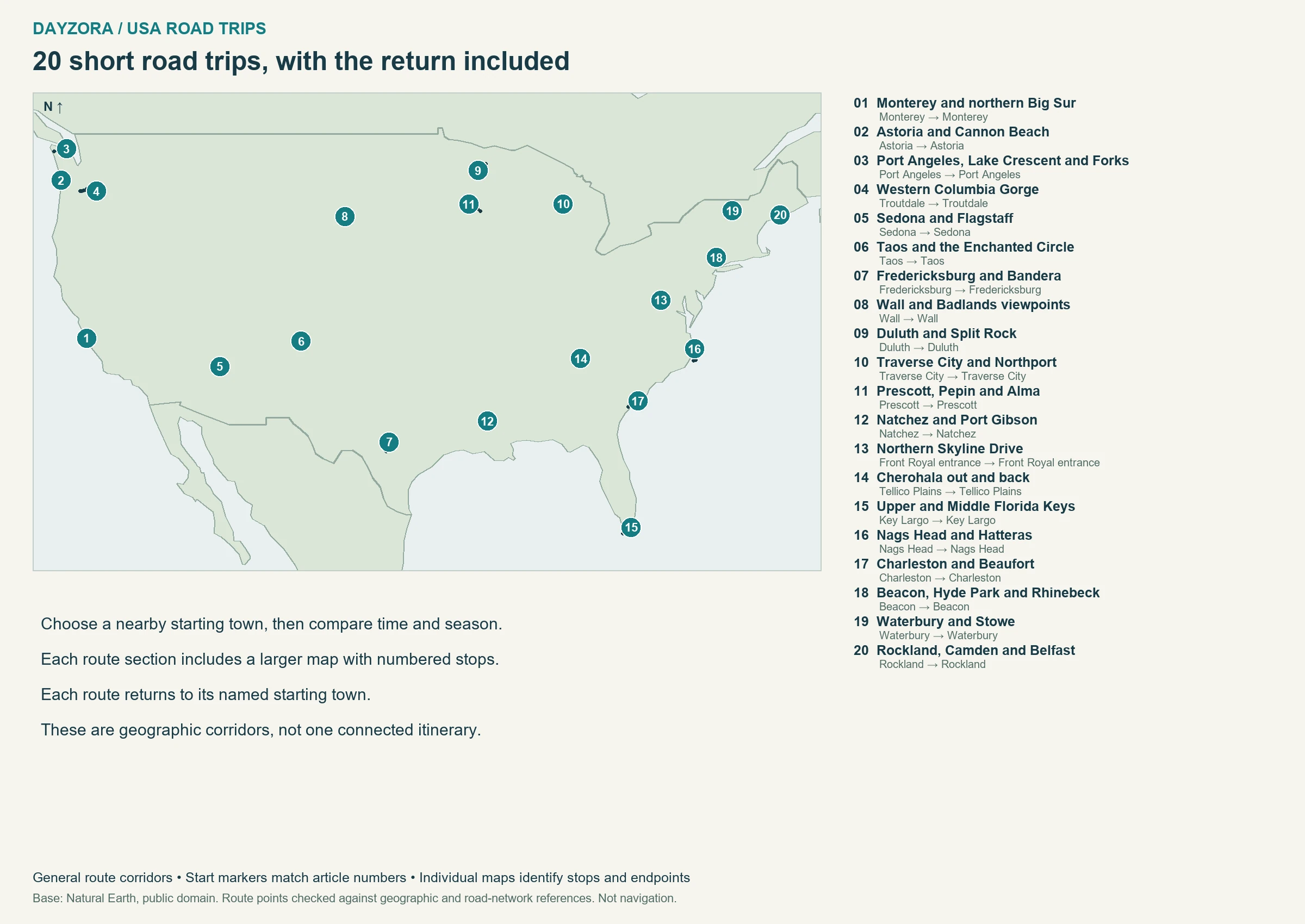
The best weekend road trips in the USA keep the return journey inside the plan. These 20 ideas use short regional routes that begin and end in the same gateway town, with roughly two or three days for sightseeing, meals and an overnight stay. They range from northern Big Sur and the Florida Keys to river towns, mountain crossings and New England villages.
Choose a starting point close enough to home that reaching it does not consume the weekend. The listed mileage includes returning to that town, but excludes your home-to-start drive and optional local outings. Each route has a comparison entry, a numbered map, an overnight suggestion and a simple plan for distributing the days. Driving estimates are baselines before traffic and stops; a short distance on a winding road can still deserve a full day. If you mainly want a hotel base with little driving, compare our weekend getaway destinations. For longer journeys, the U.S. road-trip pillar covers broader regional and cross-country routes.
Trip length: 2–3 days per route.
Distance range: about 24–142 main-route miles, including return.
Driving intensity: roughly 1–4 hours total baseline driving, spread across the trip.
Best for: local or regional travelers who can reach the named start easily.
Best season: route-specific; avoid treating high roads and warm coastal routes as interchangeable.
Coastal access check, September 26: NCDOT reported NC 12 closed at Pea Island. The northern Outer Banks plan below avoids that segment; do not extend toward Hatteras, and postpone coastal travel during active storm warnings.
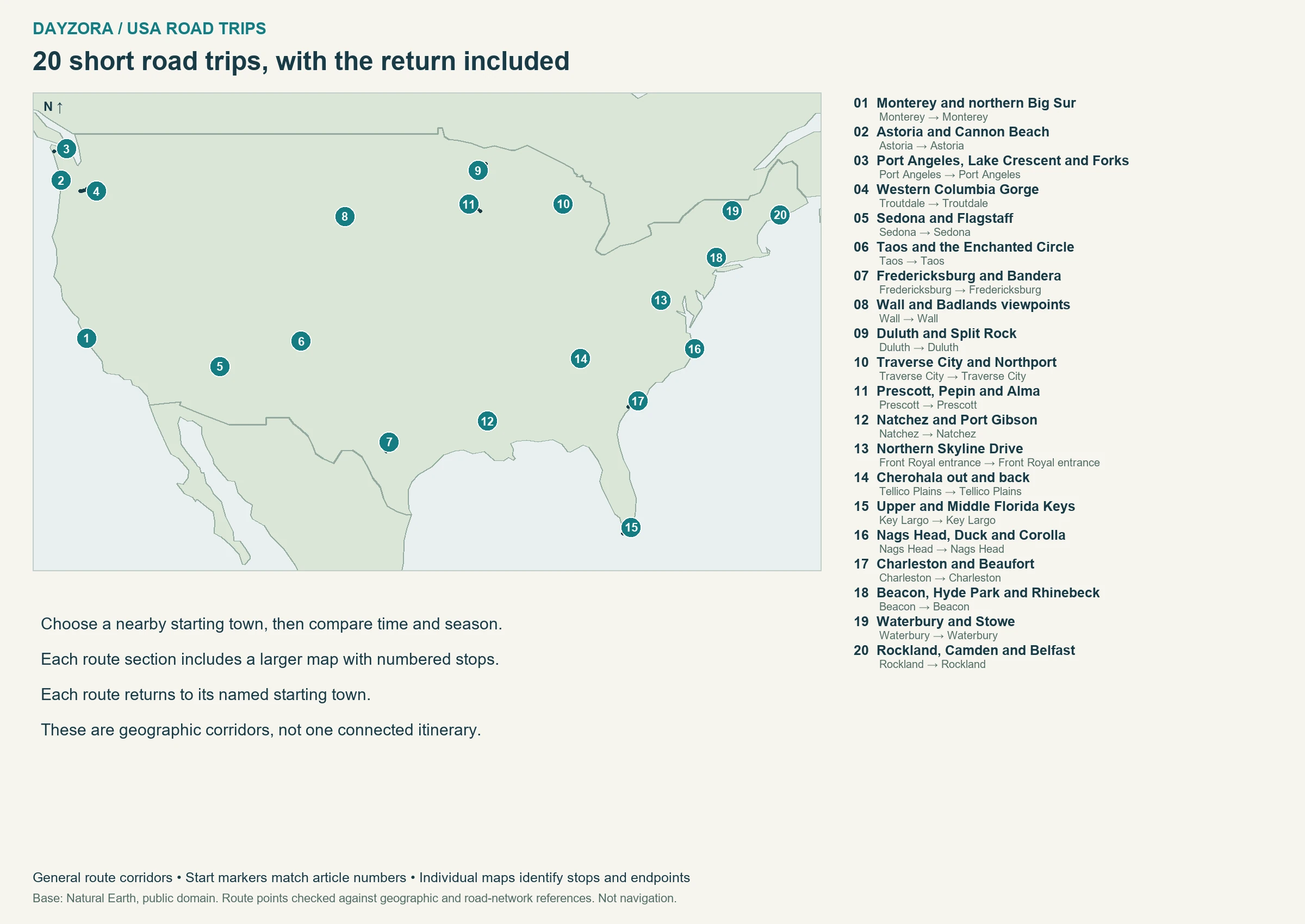
Swipe the comparison table sideways on a small screen.
| Road trip | Route | Approx. miles | Trip length | Best season | Best for |
|---|---|---|---|---|---|
| 1. Monterey and northern Big Sur | Monterey → Monterey | 60 | 2–3 days | May–October | Coastal scenery |
| 2. Astoria and Cannon Beach | Astoria → Astoria | 50 | 2–3 days | June–September | Beaches and small towns |
| 3. Port Angeles, Lake Crescent and Forks | Port Angeles → Port Angeles | 116 | 2–3 days | June–September | Forest and lake stops |
| 4. Western Columbia Gorge | Troutdale → Troutdale | 89 | 2–3 days | April–October | Waterfalls and river views |
| 5. Sedona and Flagstaff | Sedona → Sedona | 60 | 2–3 days | April–May; September–October | Red rocks to pine forest |
| 6. Taos and the Enchanted Circle | Taos → Taos | 93 | 2–3 days | June–September | Mountain culture |
| 7. Fredericksburg and Bandera | Fredericksburg → Fredericksburg | 100 | 2–3 days | March–April; October–November | Small towns and regional food |
| 8. Wall and Badlands viewpoints | Wall → Wall | 62 | 2–3 days | May–June; September | Prairie and eroded rock formations |
| 9. Duluth and Split Rock | Duluth → Duluth | 92 | 2–3 days | June–September | Lakes, waterfalls and harbors |
| 10. Traverse City and Northport | Traverse City → Traverse City | 58 | 2–3 days | June–October | Lakeshore villages |
| 11. Prescott, Pepin and Alma | Prescott → Prescott | 122 | 2–3 days | May–October | River bluffs and small towns |
| 12. Natchez and Port Gibson | Natchez → Natchez | 85 | 2–3 days | March–May; October–November | History and unhurried driving |
| 13. Northern Skyline Drive | Front Royal entrance → Front Royal entrance | 102 | 2–3 days | May–June; September–October | Blue Ridge overlooks |
| 14. Cherohala out and back | Tellico Plains → Tellico Plains | 102 | 2–3 days | May–October | Forested mountain ridges |
| 15. Upper and Middle Florida Keys | Key Largo → Key Largo | 100 | 2–3 days | December–April | Ocean views and island time |
| 16. Nags Head, Duck and Corolla | Nags Head → Nags Head | 68 | 2–3 days | May–June; September–October | Coastal villages and beaches |
| 17. Charleston and Beaufort | Charleston → Charleston | 142 | 2–3 days | March–May; October–November | Marshes and historic towns |
| 18. Beacon, Hyde Park and Rhinebeck | Beacon → Beacon | 65 | 2–3 days | May–June; September–October | Art, river towns and foliage |
| 19. Waterbury and Stowe | Waterbury → Waterbury | 24 | 2–3 days | June–October | Green Mountains and foliage |
| 20. Rockland, Camden and Belfast | Rockland → Rockland | 55 | 2–3 days | June–October | Harbors and coastal towns |
How to read distances and maps: Town-to-town distances and driving baselines were checked against OpenStreetMap-based OSRM routing on September 26, 2026, with official road mileage used where identified. They are approximate, exclude traffic and sightseeing, and can include town access or spurs; they are not always the same as a designated byway’s published length. Maps show geographic stop order, not exact road alignments or live closures. The return to the named starting town is included here; add home-to-start travel and optional side trips. Recommendations for days, bases and pacing are DayZora’s editorial planning choices, not claims of a personally tested drive.
Pass the weekend test before you book
Add three pieces of time: getting to the starting town, completing the selected route, and getting home. Then reserve time for sleep, meals and the activity you most want to do. If the total leaves only a few rushed hours outside the car, choose a closer route or take an additional day off. These are regional ideas, not invitations to fly across the country for a two-day drive.
A useful two-day pattern is one outward sightseeing day, one overnight and a relaxed return with a different stop. With three days, give the middle day to one place. For the shortest routes, a single base can be better than changing hotels. Compare the whole room price, parking and cancellation terms, using the budget weekend guide when cost is the main constraint.
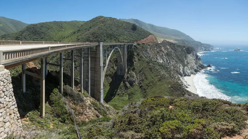
1. Monterey and northern Big Sur
Route: Monterey and northern Big Sur · California
Start: Monterey · End: Monterey
Approximate distance: 60 miles. Approximate driving time: 2 hours before stops or delays.
Recommended trip length: 2–3 days · Best season: May–October
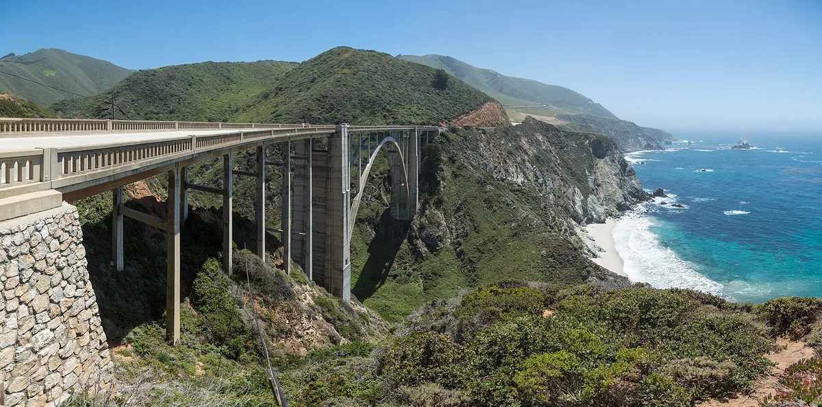
Major stops, in order: Monterey → Carmel → Bixby Bridge → Big Sur → Bixby Bridge → Carmel → Monterey
Road type: Coastal Highway 1 · Best for: Coastal scenery
Round trip to the named starting town; home-to-start travel and local outings additional.
Open the numbered Monterey and northern Big Sur route map
Your weekend plan: Keep Monterey as a two-night base and use northern Big Sur as one full outing. Day one belongs to Monterey and Carmel; day two follows Highway 1 to Bixby Bridge and the Big Sur area before returning. With a third day, add a local morning rather than extending to Cambria and rushing back.
Where to stay: Monterey or Carmel. Food and pacing: Eat in Monterey or Carmel before leaving, carry lunch and choose only legal coastal parking. This works because you return to the same room and do not need to pack between sightseeing days.
Route-specific tip: Caltrans listed Rocky Creek Bridge one-way traffic control on September 26. Check Highway 1 before the outing and shorten it if access changes; the 60-mile plan is not the full Big Sur coast. Official route or destination information.
2. Astoria and Cannon Beach
Route: Astoria and Cannon Beach · Oregon
Start: Astoria · End: Astoria
Approximate distance: 50 miles. Approximate driving time: 1.5 hours before stops or delays.
Recommended trip length: 2–3 days · Best season: June–September
Major stops, in order: Astoria → Cannon Beach → Astoria
Road type: US 101 · Best for: Beaches and small towns
Round trip to the named starting town; home-to-start travel and local outings additional.
Open the numbered Astoria and Cannon Beach route map
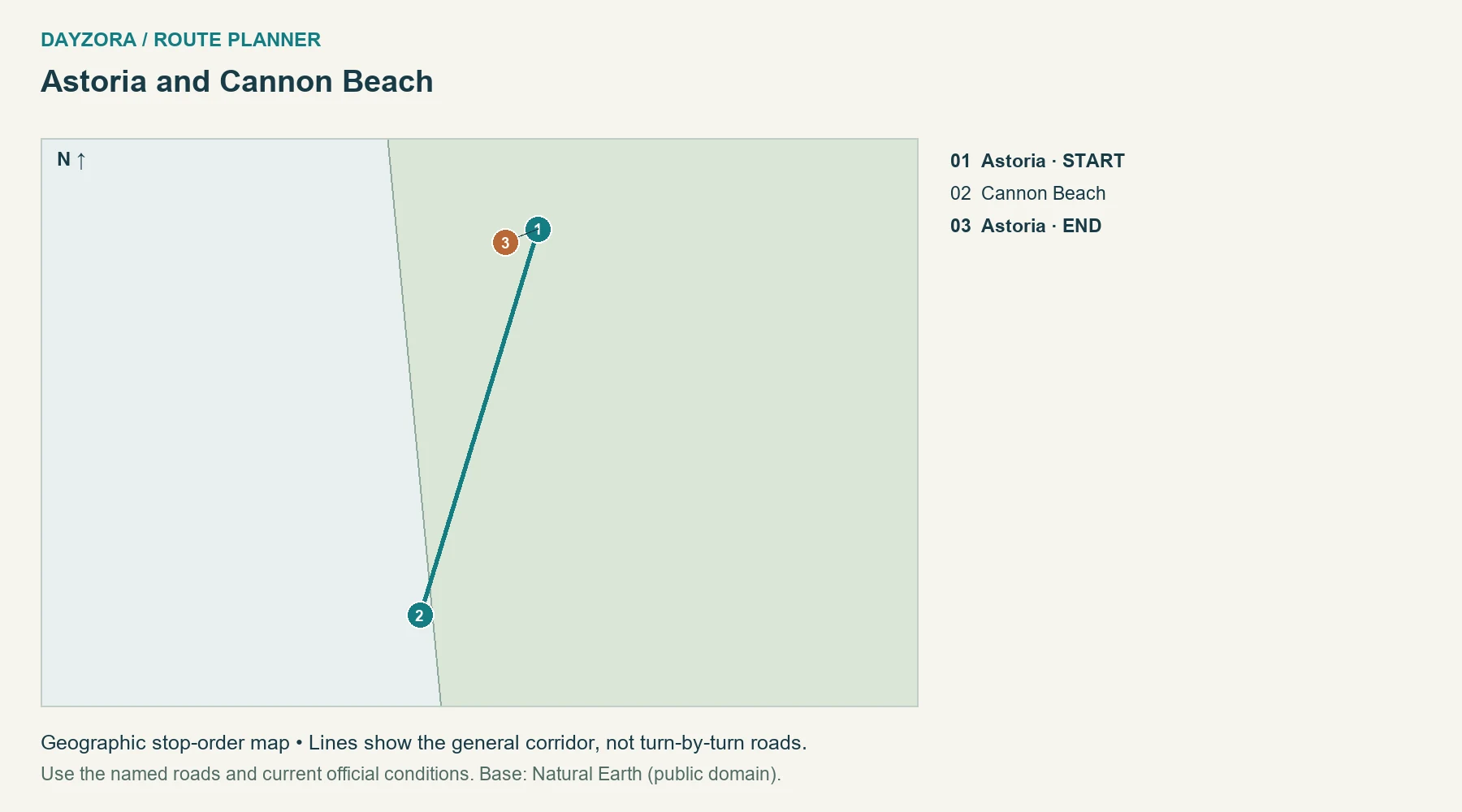
Your weekend plan: Spend day one in Astoria’s town and waterfront areas, then take day two south to Cannon Beach and return. A third day lets you repeat a beach walk in better weather rather than continuing far down US 101. The compact distance leaves most of the weekend available for walking and meals.
Where to stay: Astoria. Food and pacing: Use Astoria as the base, with a seafood or bakery lunch in either town. Pack layers and a picnic backup so fog or a busy restaurant does not determine the entire day’s schedule.
Route-specific tip: Check Oregon TripCheck for US 101. Beach conditions matter separately from road conditions: stay away from active surf and driftwood, and do not plan a shore walk solely from a sunny inland forecast. Official route or destination information.
3. Port Angeles, Lake Crescent and Forks
Route: Port Angeles, Lake Crescent and Forks · Washington
Start: Port Angeles · End: Port Angeles
Approximate distance: 116 miles. Approximate driving time: 3.5 hours before stops or delays.
Recommended trip length: 2–3 days · Best season: June–September
Major stops, in order: Port Angeles → Lake Crescent → Forks → Lake Crescent → Port Angeles
Road type: US 101 and paved access roads · Best for: Forest and lake stops
Round trip to the named starting town; home-to-start travel and local outings additional.
Open the numbered Port Angeles, Lake Crescent and Forks route map
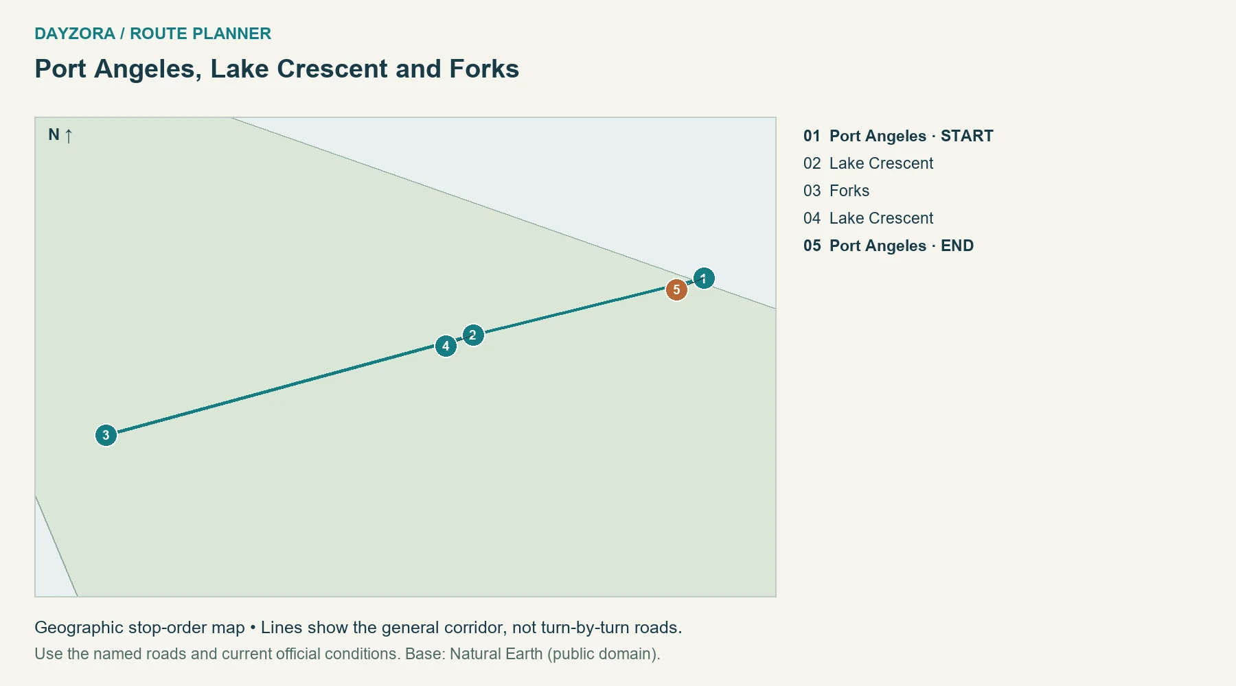
Your weekend plan: Leave Port Angeles with a selected Lake Crescent stop, continue to Forks for the night, then return the following day with a different short lake stop. Three days gives you a full unhurried day between the transfers. This is a focused northern-peninsula trip, not an attempt to see every part of Olympic National Park.
Where to stay: Forks, with Port Angeles before or after. Food and pacing: Eat and buy supplies in Port Angeles or Forks, carrying lunch for the lake. A Forks overnight reduces pressure to finish every stop before turning around.
Route-specific tip: Hurricane Ridge, the Hoh Rain Forest and ocean beaches are additional drives with separate access notices. The core US 101 route does not cross the Hoh River bridge; adding those excursions changes the mileage and timing. Official route or destination information.
4. Western Columbia Gorge
Route: Western Columbia Gorge · Oregon
Start: Troutdale · End: Troutdale
Approximate distance: 89 miles. Approximate driving time: 2.5 hours before stops or delays.
Recommended trip length: 2–3 days · Best season: April–October
Major stops, in order: Troutdale → Vista House → Multnomah Falls → Cascade Locks → Multnomah Falls → Vista House → Troutdale
Road type: Historic US 30 with I-84 connections · Best for: Waterfalls and river views
Round trip to the named starting town; home-to-start travel and local outings additional.
Open the numbered Western Columbia Gorge route map
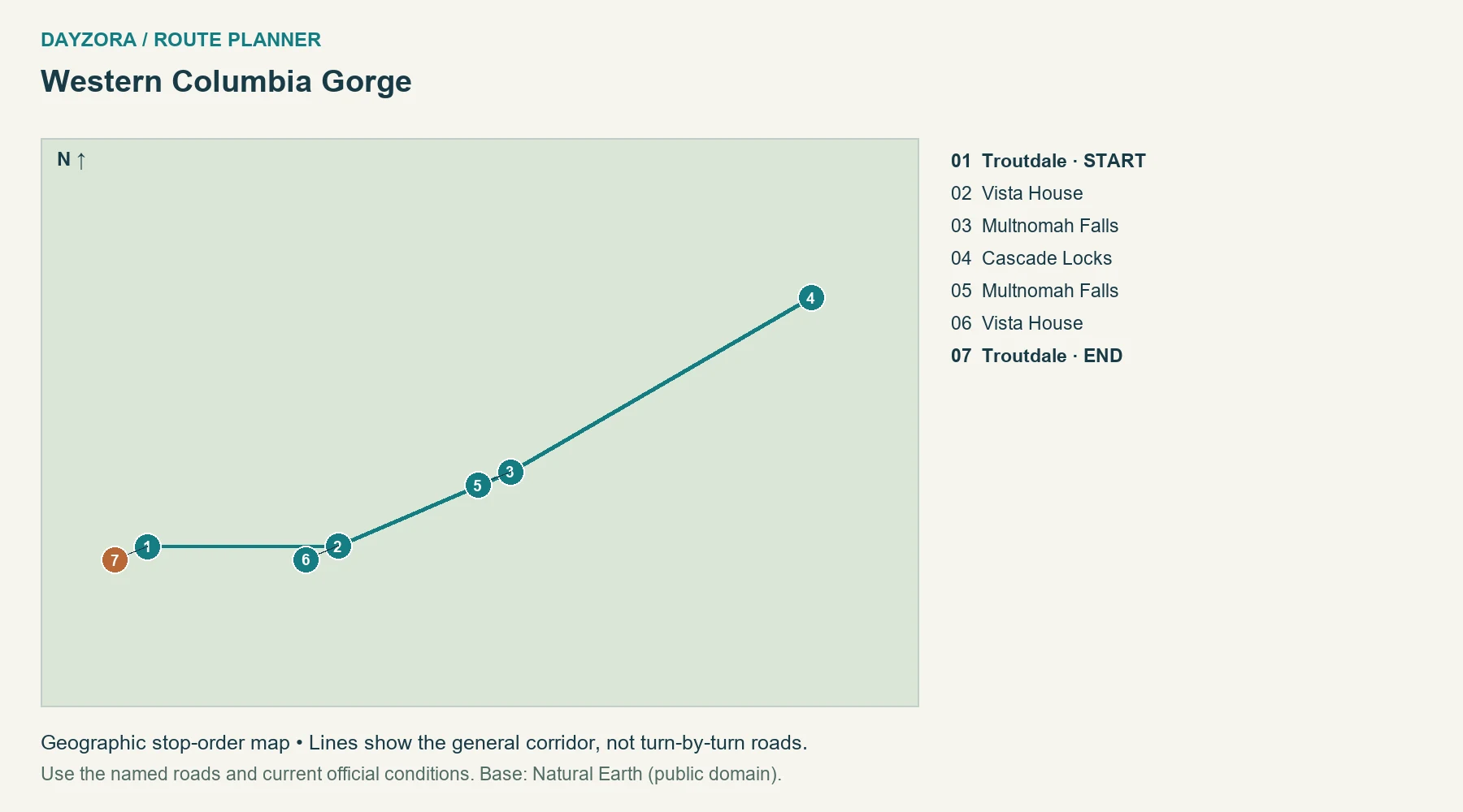
Your weekend plan: Base in Troutdale and divide the western Gorge across two days. On the first, visit Vista House and a selected waterfall stop; on the second, continue to Cascade Locks and return. A third day is useful for a longer walk, provided its current trail access is checked.
Where to stay: Troutdale. Food and pacing: Use Troutdale and Cascade Locks for meals and carry food for the viewpoint corridor. Keep the same room if possible, allowing you to adjust which day gets the clearest views.
Route-specific tip: Historic-road pieces connect through modern roads, and some old sections are vehicle-free. The 2026 I-84 Multnomah Falls timed-use season ended September 7; future dates need a fresh check. Do not add Hood River and The Dalles by default. Official route or destination information.
5. Sedona and Flagstaff
Route: Sedona and Flagstaff · Arizona
Start: Sedona · End: Sedona
Approximate distance: 60 miles. Approximate driving time: 2.5 hours before stops or delays.
Recommended trip length: 2–3 days · Best season: April–May; September–October
Major stops, in order: Sedona → Slide Rock → Oak Creek Vista → Flagstaff → Oak Creek Vista → Slide Rock → Sedona
Road type: AZ 89A through Oak Creek Canyon · Best for: Red rocks to pine forest
Round trip to the named starting town; home-to-start travel and local outings additional.
Open the numbered Sedona and Flagstaff route map
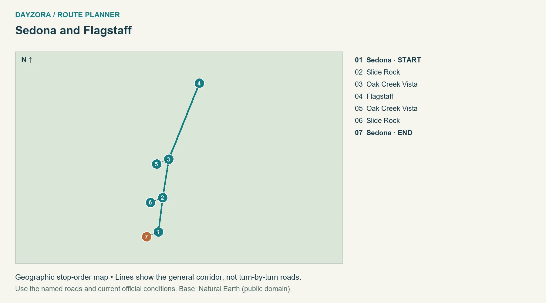
Your weekend plan: Start with a Sedona day, then drive through Oak Creek Canyon to Flagstaff for an overnight. Return the next day, choosing one canyon stop you did not visit on the way north. In a two-day version, keep the first afternoon simple so the short road never becomes an excuse for an overfilled activity list.
Where to stay: Flagstaff or Sedona. Food and pacing: Stay in Flagstaff for a change in setting, or keep a Sedona base and make the crossing an outing. Both towns provide meals; use a packed lunch when parking at a canyon site will shape your midday schedule.
Route-specific tip: Temperatures differ sharply between Sedona and Flagstaff. Check AZ 89A conditions and site-specific parking rules. A full lot is a reason to change stops, not to park on an unsafe shoulder. Official route or destination information.
6. Taos and the Enchanted Circle
Route: Taos and the Enchanted Circle · New Mexico
Start: Taos · End: Taos
Approximate distance: 93 miles. Approximate driving time: 3 hours before stops or delays.
Recommended trip length: 2–3 days · Best season: June–September
Major stops, in order: Taos → Questa → Red River → Eagle Nest → Angel Fire → Taos
Road type: NM 522/38 and US 64 · Best for: Mountain culture
Round trip to the named starting town; home-to-start travel and local outings additional.
Open the numbered Taos and the Enchanted Circle route map
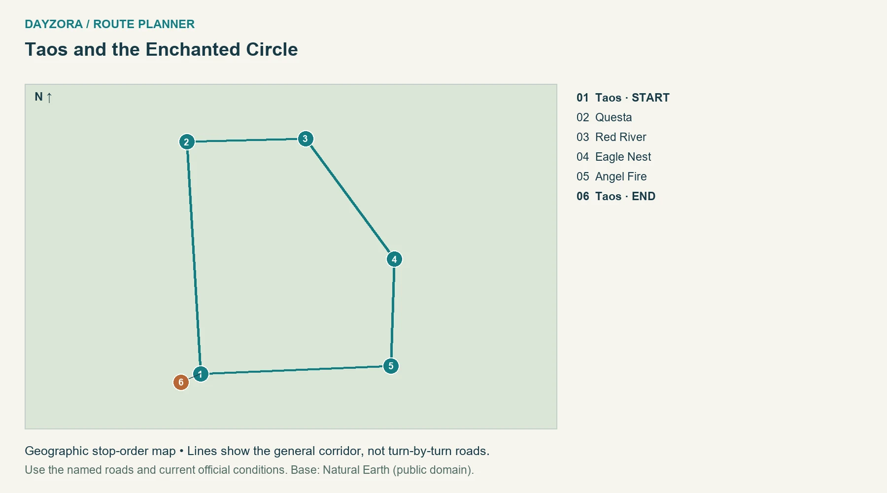
Your weekend plan: Use Taos for the first day, then drive the circle through Questa, Red River, Eagle Nest and the Angel Fire detour before returning. Split the circuit with a Red River night if you prefer two shorter road days. A third day belongs to Taos galleries or a separately arranged cultural visit.
Where to stay: Taos; optional Red River overnight. Food and pacing: New Mexican chile dishes and mountain-town cafés provide useful meal choices. Keep a picnic option and avoid arranging a fixed-time dinner that requires rushing the mountain section.
Route-specific tip: This checked 93-mile town route includes Angel Fire access and differs from the commonly quoted 84-mile scenic circle. Summer and early autumn suit a general touring trip; winter ski travel needs a different weather-aware plan. Official route or destination information.
7. Fredericksburg and Bandera
Route: Fredericksburg and Bandera · Texas
Start: Fredericksburg · End: Fredericksburg
Approximate distance: 100 miles. Approximate driving time: 2.5 hours before stops or delays.
Recommended trip length: 2–3 days · Best season: March–April; October–November
Major stops, in order: Fredericksburg → Kerrville → Bandera → Kerrville → Fredericksburg
Road type: US and state highways · Best for: Small towns and regional food
Round trip to the named starting town; home-to-start travel and local outings additional.
Open the numbered Fredericksburg and Bandera route map
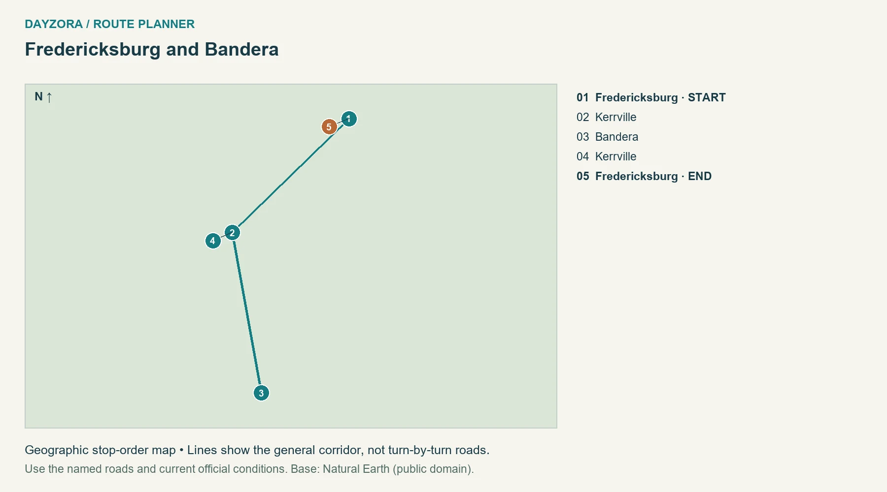
Your weekend plan: Start in Fredericksburg, travel through Kerrville to Bandera, and return the following day. Give the towns walking time rather than collecting a succession of brief roadside stops. A three-day version can use a full Fredericksburg day before the loop-like out-and-back journey begins.
Where to stay: Fredericksburg or Bandera. Food and pacing: Stay in Fredericksburg or Bandera depending on which town you want to enjoy after parking. Barbecue, Tex-Mex and local cafés work well; any winery visit needs a non-drinking driver and its own time allowance.
Route-specific tip: The 100-mile route excludes Austin and San Antonio approaches. Do not add both cities to a normal weekend. Check DriveTexas after heavy rain and never drive through water covering a low-water crossing. Official route or destination information.
8. Wall and Badlands viewpoints
Route: Wall and Badlands viewpoints · South Dakota
Start: Wall · End: Wall
Approximate distance: 62 miles. Approximate driving time: 2 hours before stops or delays.
Recommended trip length: 2–3 days · Best season: May–June; September
Major stops, in order: Wall → Pinnacles entrance → Yellow Mounds → Ben Reifel visitor center → Yellow Mounds → Pinnacles entrance → Wall
Road type: Paved SD 240 · Best for: Prairie and eroded rock formations
Round trip to the named starting town; home-to-start travel and local outings additional.
Open the numbered Wall and Badlands viewpoints route map
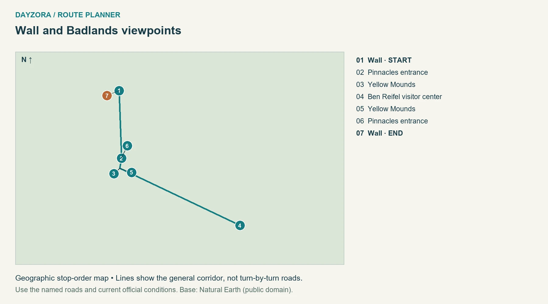
Your weekend plan: Sleep in Wall, enter through the Pinnacles side, then work east through Yellow Mounds toward Ben Reifel before returning. Split the viewpoints across two daylight outings or use one main park day and a relaxed arrival day. A third morning gives you a chance at different light without changing hotels.
Where to stay: Wall. Food and pacing: Buy groceries and water in Wall and take a picnic. The attraction is time in the landscape, so there is little value in replacing every viewpoint pause with another driving extension.
Route-specific tip: This is an out-and-back on the paved portion, not the entire park road system. Sage Creek’s unpaved road is excluded. Check park alerts and weather; summer heat can make a short walk more demanding than the driving distance suggests. Official route or destination information.
9. Duluth and Split Rock
Route: Duluth and Split Rock · Minnesota
Start: Duluth · End: Duluth
Approximate distance: 92 miles. Approximate driving time: 4 hours before stops or delays.
Recommended trip length: 2–3 days · Best season: June–September
Major stops, in order: Duluth → Two Harbors → Split Rock Lighthouse → Two Harbors → Duluth
Road type: MN 61 and old lakeshore sections · Best for: Lakes, waterfalls and harbors
Round trip to the named starting town; home-to-start travel and local outings additional.
Open the numbered Duluth and Split Rock route map
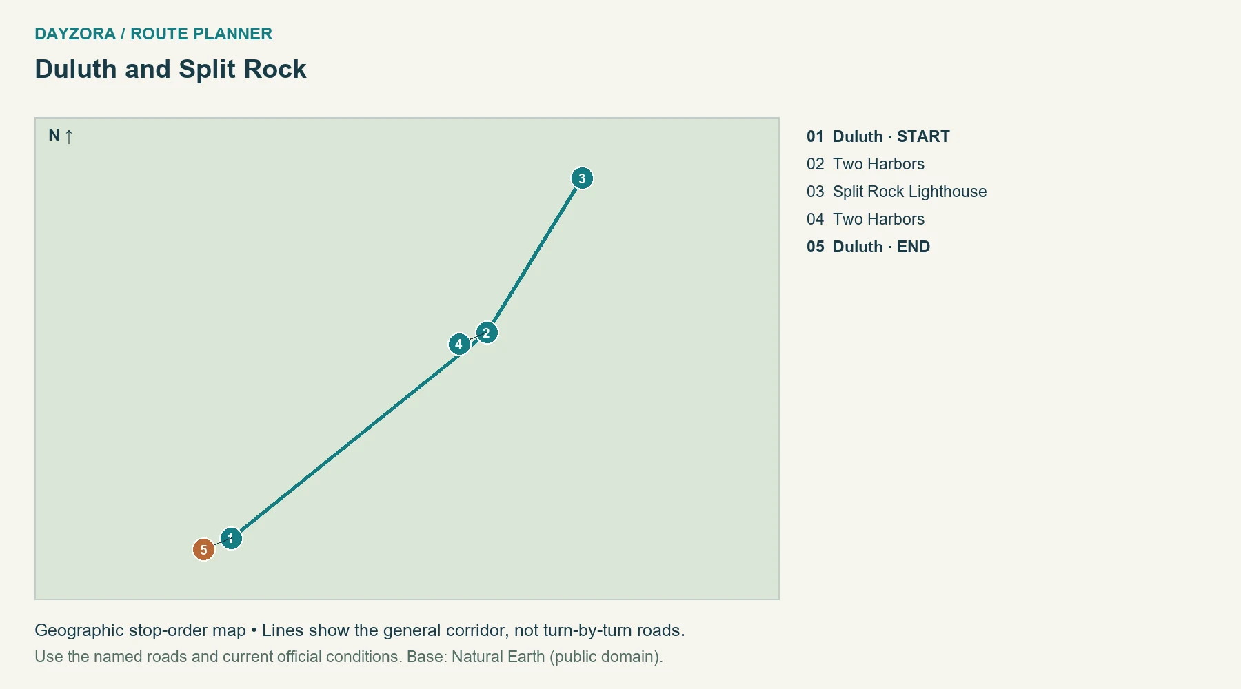
Your weekend plan: Use Duluth for arrival and town time, then follow the shore through Two Harbors to Split Rock and return. Overnight near Two Harbors if you want a slower second morning by the lake. Keep Grand Marais for a longer trip rather than adding it after the lighthouse.
Where to stay: Duluth or Two Harbors. Food and pacing: Plan around town bakeries, smoked fish and simple picnic food. Duluth and Two Harbors make practical meal and lodging anchors, leaving shore stops flexible.
Route-specific tip: Bring a warm layer even in summer and check the specific lighthouse and state-park admission arrangements. The short route still uses winding lakeshore sections, so the checked driving allowance is more useful than assuming interstate speed. Official route or destination information.
10. Traverse City and Northport
Route: Traverse City and Northport · Michigan
Start: Traverse City · End: Traverse City
Approximate distance: 58 miles. Approximate driving time: 2 hours before stops or delays.
Recommended trip length: 2–3 days · Best season: June–October
Major stops, in order: Traverse City → Suttons Bay → Northport → Suttons Bay → Traverse City
Road type: M-22 with town stops · Best for: Lakeshore villages
Round trip to the named starting town; home-to-start travel and local outings additional.
Open the numbered Traverse City and Northport route map
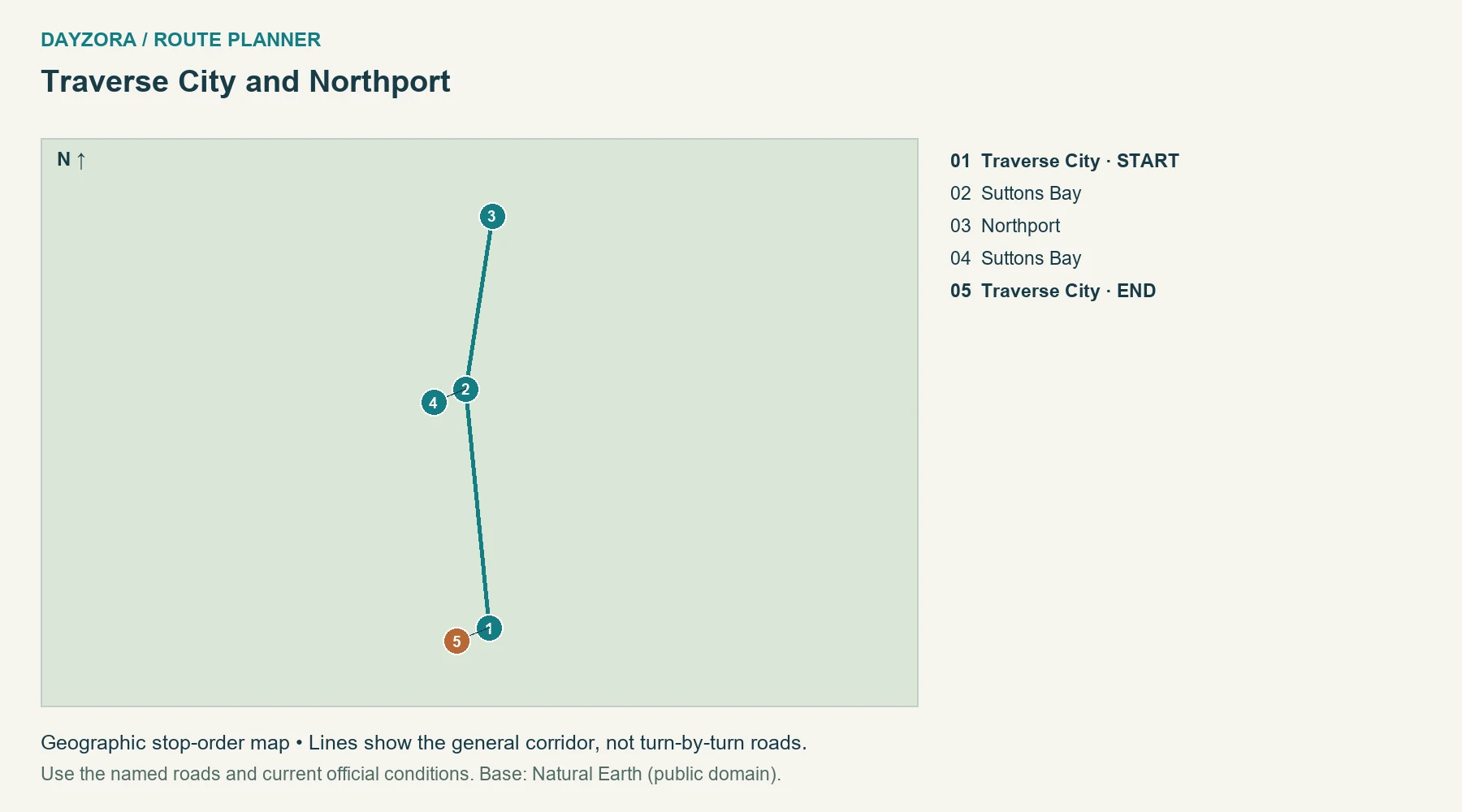
Your weekend plan: Drive from Traverse City through Suttons Bay to Northport, stay locally or return to the same base, and use the next day for village time and the trip back. The deliberately short northern-peninsula route suits travelers who would rather walk, eat and pause by the water than spend the weekend driving all of M-22.
Where to stay: Traverse City, Suttons Bay or Northport. Food and pacing: Choose Traverse City for broader services or a smaller Leelanau village for a quieter night. Bakeries, seasonal produce and casual meals provide flexible stops without crossing the peninsula repeatedly for reservations.
Route-specific tip: This 58-mile out-and-back is not the entire M-22 scenic drive and does not include Sleeping Bear Dunes. Book summer lodging early, and assign a non-drinking driver if adding wineries. Official route or destination information.
11. Prescott, Pepin and Alma
Route: Prescott, Pepin and Alma · Wisconsin
Start: Prescott · End: Prescott
Approximate distance: 122 miles. Approximate driving time: 3.5 hours before stops or delays.
Recommended trip length: 2–3 days · Best season: May–October
Major stops, in order: Prescott → Pepin → Alma → Pepin → Prescott
Road type: WI 35 river corridor · Best for: River bluffs and small towns
Round trip to the named starting town; home-to-start travel and local outings additional.
Open the numbered Prescott, Pepin and Alma route map
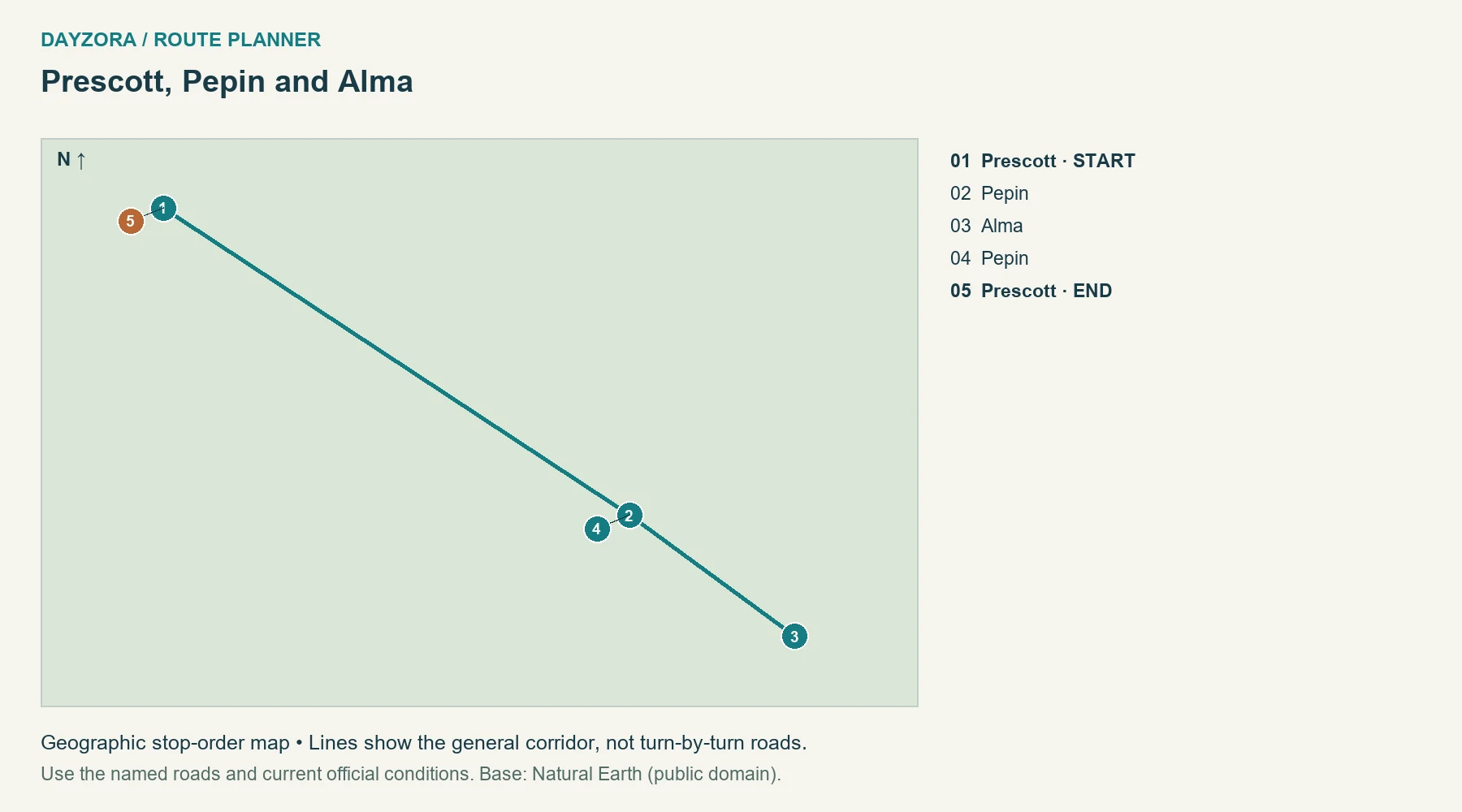
Your weekend plan: Start in Prescott, follow the Wisconsin river corridor through Pepin to Alma, and return after an overnight. Day one can emphasize the river towns; day two can leave time for one selected viewpoint before heading back. A third day allows a longer stay without pushing south to La Crosse.
Where to stay: Pepin or Alma. Food and pacing: Use Pepin or Alma for lodging and local dining, with Wisconsin cheese or bakery food for a picnic. Confirm small-business hours, especially outside summer weekends.
Route-specific tip: Remain on the Wisconsin bank unless you deliberately add a crossing. Bridges can turn a seemingly nearby stop into a much longer detour. The 122-mile total includes the return to Prescott but not travel from the Twin Cities. Official route or destination information.
12. Natchez and Port Gibson
Route: Natchez and Port Gibson · Mississippi
Start: Natchez · End: Natchez
Approximate distance: 85 miles. Approximate driving time: 2.5 hours before stops or delays.
Recommended trip length: 2–3 days · Best season: March–May; October–November
Major stops, in order: Natchez → Mount Locust → Port Gibson → Mount Locust → Natchez
Road type: US 61, parkway access and paved town roads · Best for: History and unhurried driving
Round trip to the named starting town; home-to-start travel and local outings additional. Includes Mount Locust access; not an all-parkway drive.
Open the numbered Natchez and Port Gibson route map
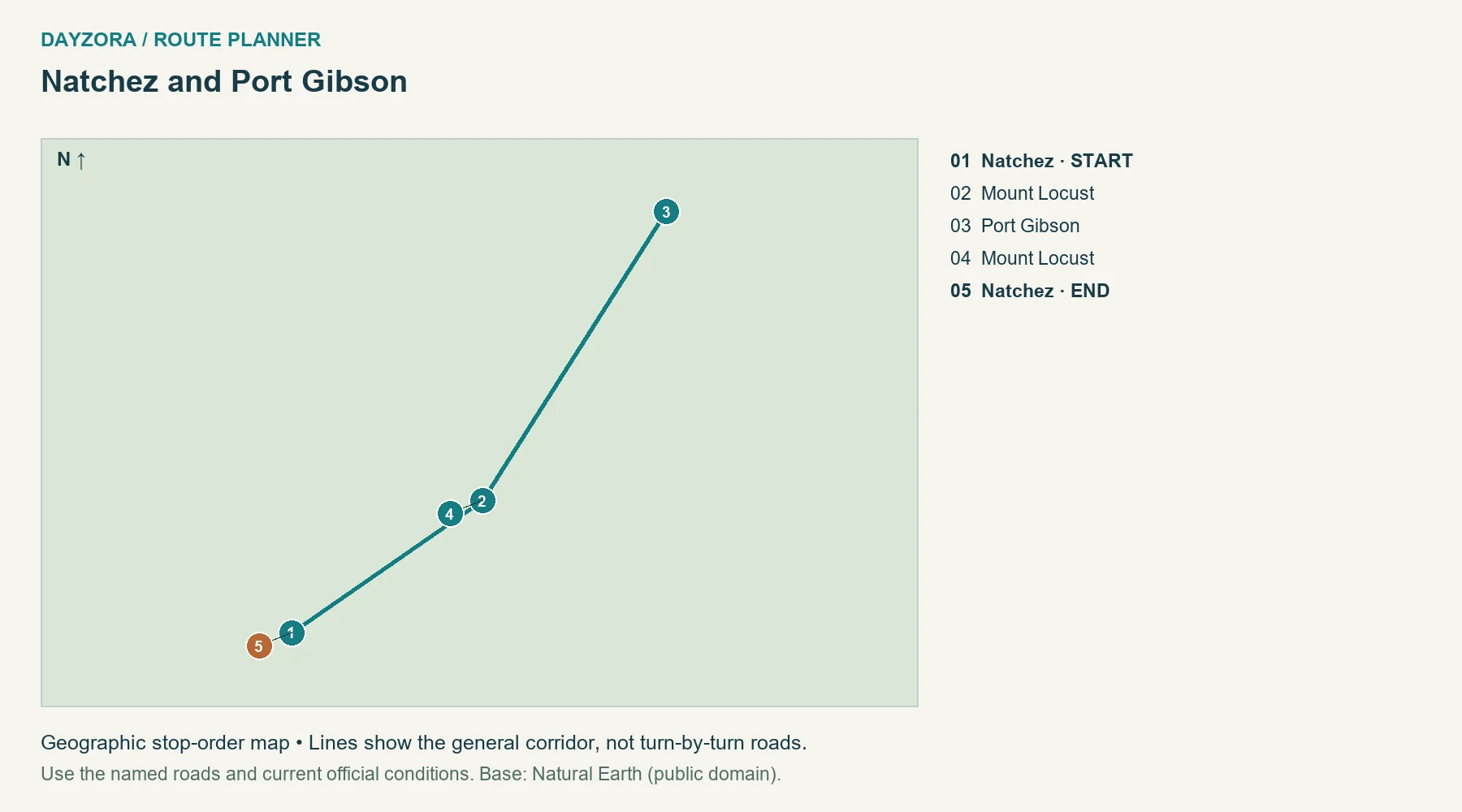
Your weekend plan: Give Natchez an arrival day, then visit Mount Locust’s grounds on the way toward Port Gibson and return. You can stay in Natchez both nights or use a local overnight to split the outing. The short route leaves space for interpretation of the region’s Indigenous history, commerce and slavery.
Where to stay: Natchez. Food and pacing: Eat in town and carry a picnic for the historic-site portion. Plan fuel and services around communities rather than assuming continuous facilities along a parkway segment.
Route-specific tip: Mount Locust’s inn interior is closed; the grounds and exterior are the intended stop. This 85-mile plan uses US 61 and paved access roads as well as parkway access, not an uninterrupted Natchez Trace drive. It stays south of the published milepost 135 closure. Official route or destination information.
13. Northern Skyline Drive
Route: Northern Skyline Drive · Virginia
Start: Front Royal entrance · End: Front Royal entrance
Approximate distance: 102 miles. Approximate driving time: 3.5 hours before stops or delays.
Recommended trip length: 2–3 days · Best season: May–June; September–October
Major stops, in order: Front Royal entrance → Thornton Gap → Big Meadows → Thornton Gap → Front Royal entrance
Road type: Mountain park road · Best for: Blue Ridge overlooks
Round trip to the named starting town; home-to-start travel and local outings additional.
Open the numbered Northern Skyline Drive route map
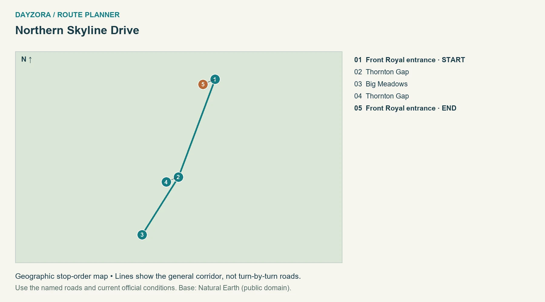
Your weekend plan: Enter Skyline Drive at Front Royal, continue through Thornton Gap toward Big Meadows, then return north over the weekend. An in-park night can split the drive if available; a gateway base adds approach mileage. Two days works for overlooks and short walks, while three suits a more substantial hike.
Where to stay: Big Meadows area if available, or a gateway town. Food and pacing: Pack a picnic and verify seasonal dining. Luray can be useful for accommodation, but it lies off the measured road and its access drive must be added.
Route-specific tip: This is about 102 miles out and back on the northern half, not the full 105-mile through-road. Fog, ice and storms can close sections. Check Shenandoah’s current road report before entering and keep an indoor gateway-town alternative. Official route or destination information.
14. Cherohala out and back
Route: Cherohala out and back · Tennessee and North Carolina
Start: Tellico Plains · End: Tellico Plains
Approximate distance: 102 miles. Approximate driving time: 3.5 hours before stops or delays.
Recommended trip length: 2–3 days · Best season: May–October
Major stops, in order: Tellico Plains → Cherohala Santeetlah overlook → Robbinsville → Cherohala Santeetlah overlook → Tellico Plains
Road type: TN 165 / NC 143 · Best for: Forested mountain ridges
Round trip to the named starting town; home-to-start travel and local outings additional.
Open the numbered Cherohala out and back route map
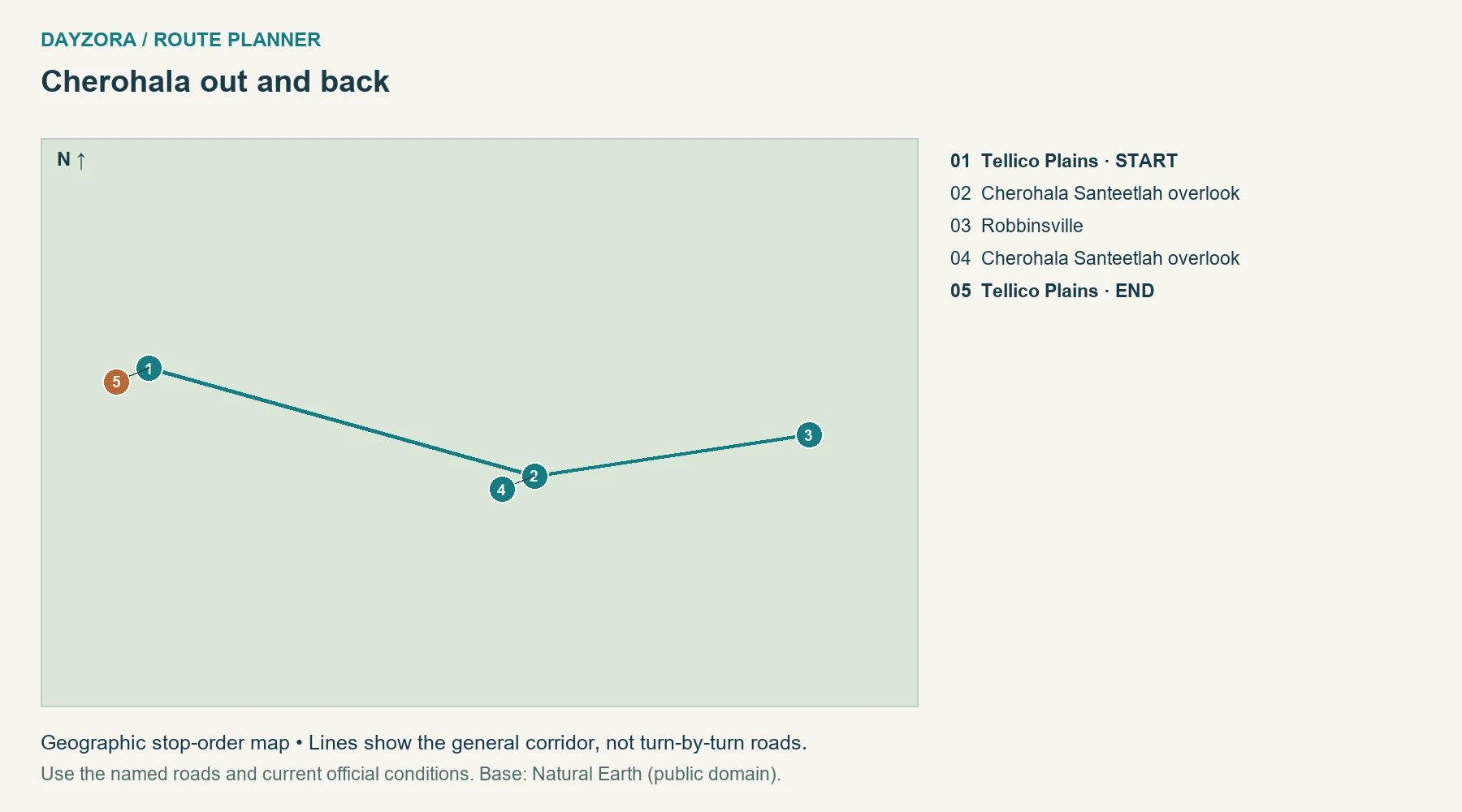
Your weekend plan: Cross from Tellico Plains to Robbinsville in daylight, stay at the eastern end, then return the next day. Stop at a few established overlooks rather than trying to photograph every bend. A third day gives weather flexibility or time for a separately researched local walk.
Where to stay: Robbinsville. Food and pacing: Eat in the gateway towns and carry lunch and water for the high section. Staying in Robbinsville avoids making both mountain crossings on the same day.
Route-specific tip: The approximately 102-mile round trip includes town access beyond the named scenic road. Check Tennessee SmartWay and North Carolina DriveNC. Fog and storms can change the high-road experience even when the valley forecast looks pleasant. Official route or destination information.
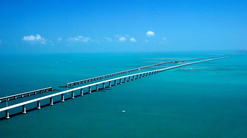
15. Upper and Middle Florida Keys
Route: Upper and Middle Florida Keys · Florida
Start: Key Largo · End: Key Largo
Approximate distance: 100 miles. Approximate driving time: 3 hours before stops or delays.
Recommended trip length: 2–3 days · Best season: December–April
Major stops, in order: Key Largo → Islamorada → Marathon → Islamorada → Key Largo
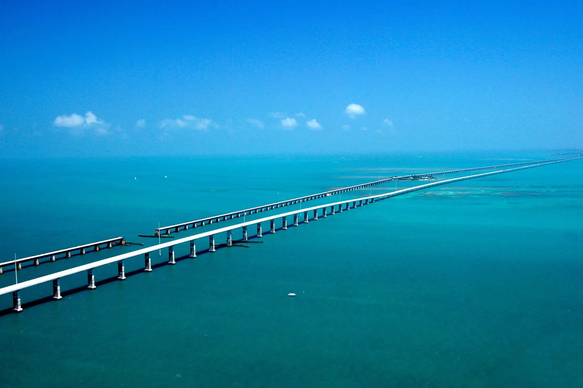
Road type: US 1 bridges and island roads · Best for: Ocean views and island time
Round trip to the named starting town; home-to-start travel and local outings additional.
Open the numbered Upper and Middle Florida Keys route map
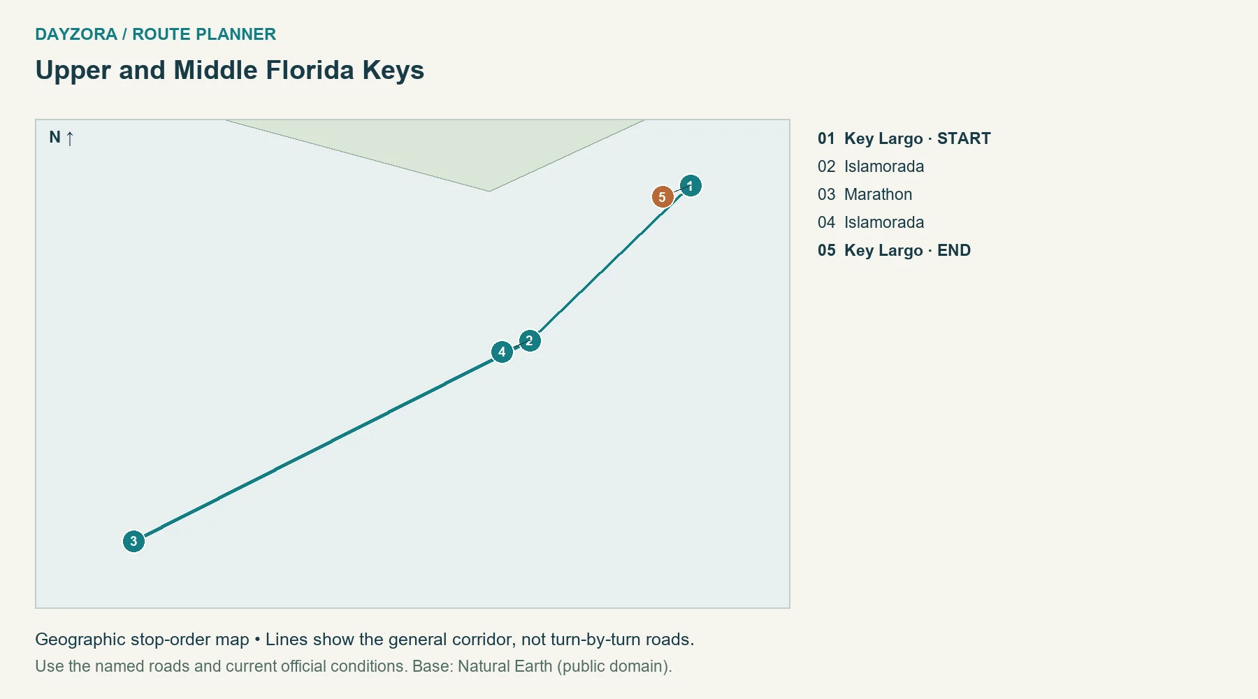
Your weekend plan: Start in Key Largo, pause around Islamorada, and sleep in Marathon before returning. Two days gives an island overnight; three allows a full day for a weather-dependent marine outing or time by the water. This plan intentionally stops before Key West to keep the weekend manageable.
Where to stay: Marathon or Islamorada. Food and pacing: Compare Marathon lodging with its parking and total fees included. Seafood, Cuban-influenced food and key lime desserts offer flexible town stops, while groceries help avoid an expensive meal every time you pause.
Route-specific tip: The 100-mile total begins and ends in Key Largo; Miami access is extra. Check Florida 511 and official weather advisories, particularly during hurricane season. Do not add a distant boat trip immediately before a fixed departure. Official route or destination information.
16. Nags Head, Duck and Corolla
Route: Nags Head, Duck and Corolla · North Carolina
Start: Nags Head · End: Nags Head
Approximate distance: 68 miles. Approximate driving time: 2.5 hours before stops or delays.
Recommended trip length: 2–3 days · Best season: May–June; September–October
Major stops, in order: Nags Head → Kitty Hawk → Duck → Corolla → Duck → Kitty Hawk → Nags Head
Road type: US 158, northern NC 12 and paved town access · Best for: Coastal villages and beaches
Round trip to Nags Head; excludes home access, Hatteras and the closed Pea Island section.
Open the numbered Nags Head, Duck and Corolla route map
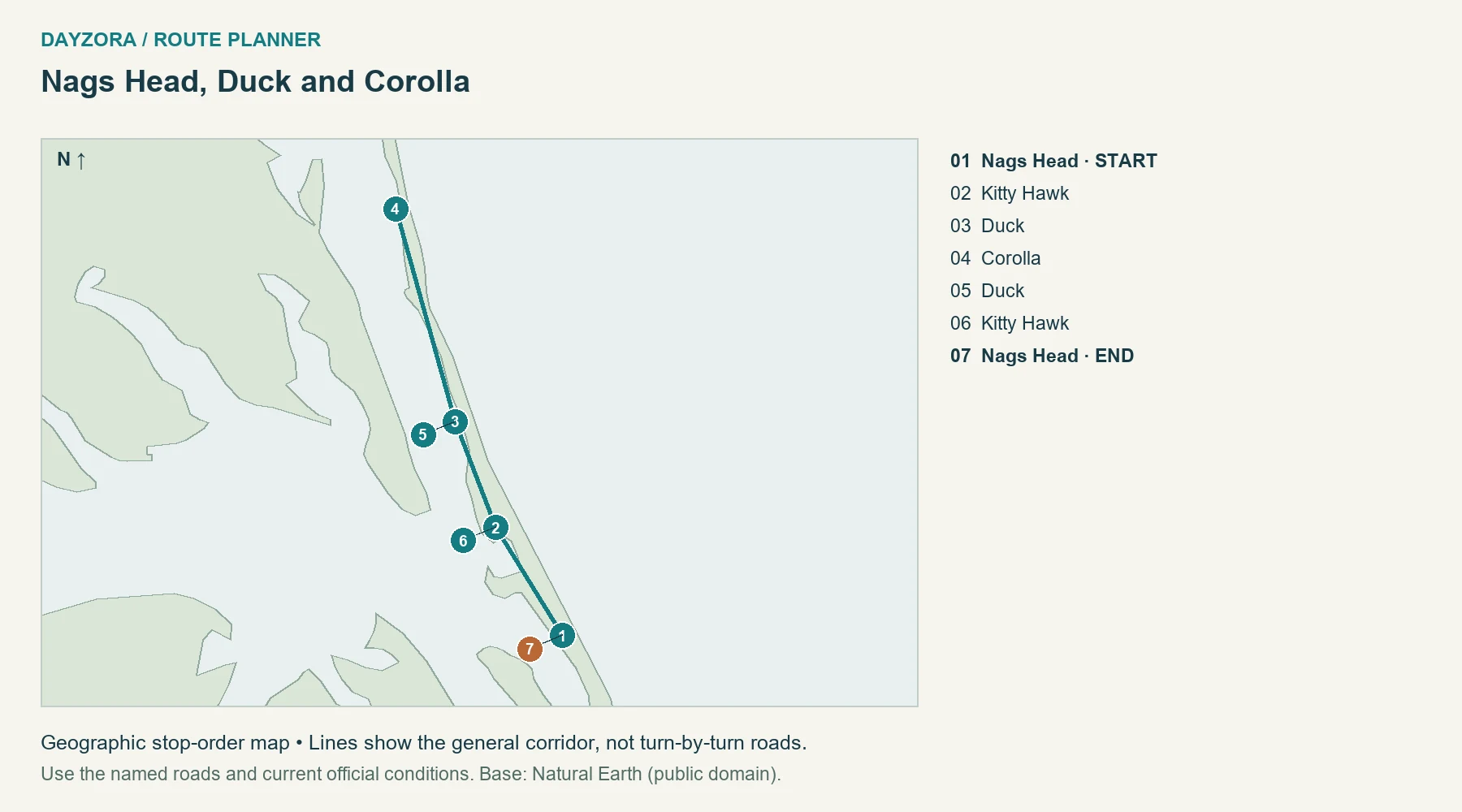
Your weekend plan: Spend the first day around Nags Head and Kitty Hawk, then continue north through Duck to Corolla. Stay in the northern villages or return to a Nags Head base, using day two or three for the return and a selected beach or village stop. This compact route stays north of Pea Island.
Where to stay: Nags Head, Duck or Corolla. Food and pacing: Use village seafood restaurants and groceries, with a picnic backup and a lodging base that does not require repeated long local transfers. The 68-mile round trip excludes home access and any beach-sand roads.
Route-specific tip: NCDOT reported NC 12 closed between the Marc Basnight Bridge and Rodanthe on September 24, with no reopening estimate. This itinerary avoids the closed section. Postpone coastal travel during active storm warnings, check DriveNC before departure, and do not extend south toward Hatteras until an official reopening. Official route or destination information.
17. Charleston and Beaufort
Route: Charleston and Beaufort · South Carolina
Start: Charleston · End: Charleston
Approximate distance: 142 miles. Approximate driving time: 3.5 hours before stops or delays.
Recommended trip length: 2–3 days · Best season: March–May; October–November
Major stops, in order: Charleston → Beaufort SC → Charleston
Road type: US 17 and paved local highways · Best for: Marshes and historic towns
Round trip to the named starting town; home-to-start travel and local outings additional.
Open the numbered Charleston and Beaufort route map
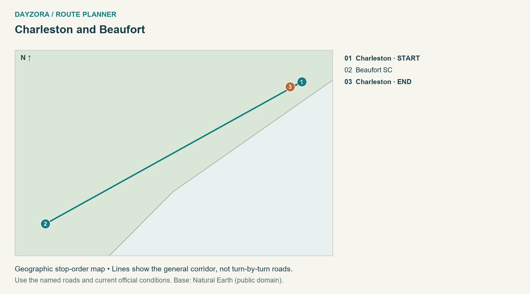
Your weekend plan: Leave Charleston for Beaufort, spend a night there, then return after a second morning of town time. A three-day plan can add a full Charleston day before the road portion. Keep Savannah for a longer itinerary instead of turning the weekend into three hurried historic districts.
Where to stay: Beaufort, South Carolina. Food and pacing: Choose lodging with practical parking, then explore on foot. Lowcountry seafood and rice dishes fit the region, with an indoor meal or museum option for very hot or rainy hours.
Route-specific tip: Include Gullah Geechee history and the experiences of enslaved people in your interpretation of the region. Check tropical-weather advisories and road conditions; the short distance does not protect an itinerary from a major storm. Official route or destination information.
18. Beacon, Hyde Park and Rhinebeck
Route: Beacon, Hyde Park and Rhinebeck · New York
Start: Beacon · End: Beacon
Approximate distance: 65 miles. Approximate driving time: 2 hours before stops or delays.
Recommended trip length: 2–3 days · Best season: May–June; September–October
Major stops, in order: Beacon → Hyde Park → Rhinebeck → Hyde Park → Beacon
Road type: US 9 and paved town access roads · Best for: Art, river towns and foliage
Round trip to the named starting town; home-to-start travel and local outings additional.
Open the numbered Beacon, Hyde Park and Rhinebeck route map
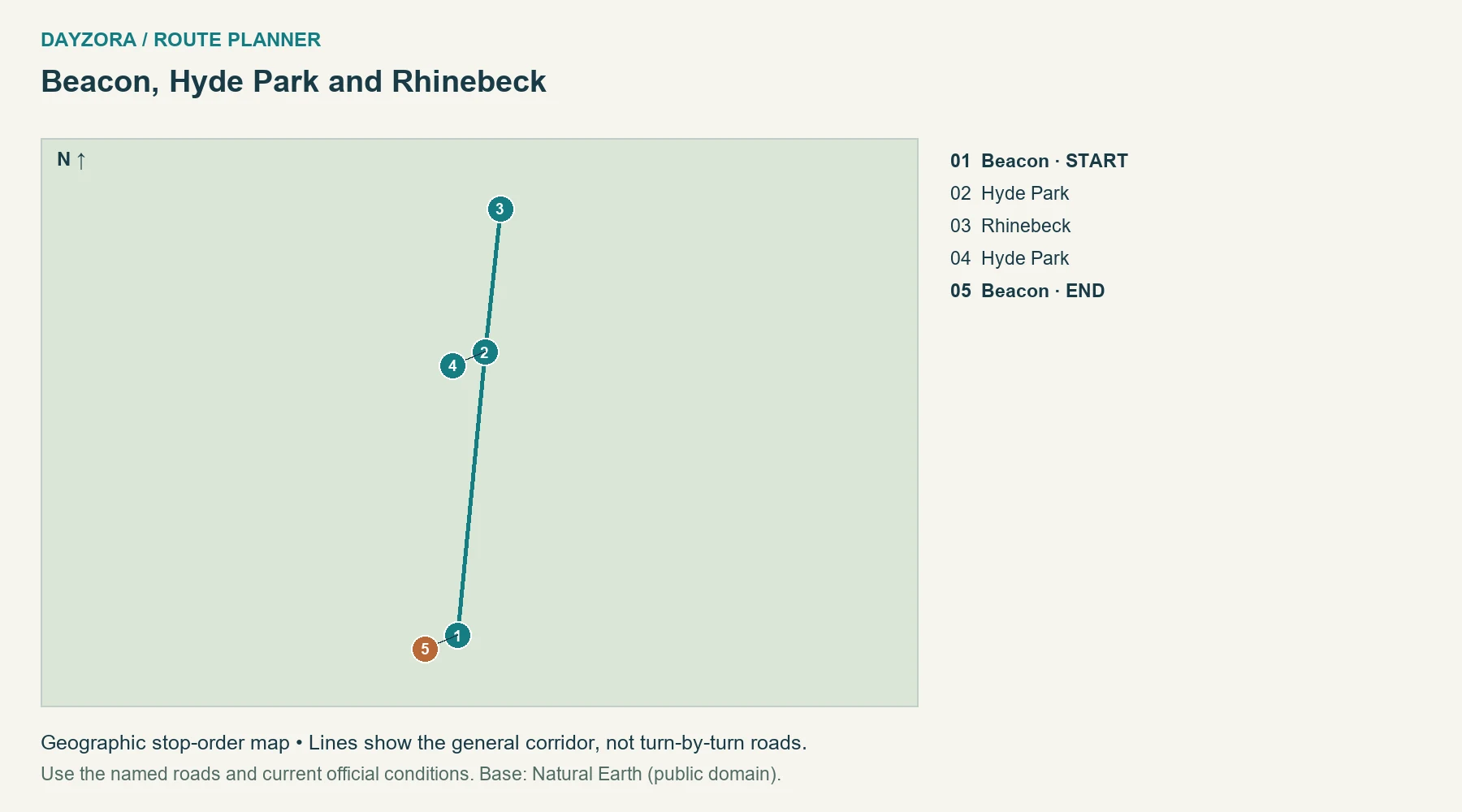
Your weekend plan: Begin in Beacon, choose a major Hyde Park visit, then spend the night around Rhinebeck before returning. With three days, reserve a separate day for Beacon’s cultural attractions. The route stays on one side of the Hudson corridor so you can spend time at sites instead of repeatedly crossing the river.
Where to stay: Rhinebeck or nearby lodging. Food and pacing: Use town centers for cafés and seasonal meals, booking only the meal that matters most. Keep the overnight near your chosen next-morning visit.
Route-specific tip: Museum hours and admission arrangements determine the useful order of the weekend. Check them before reserving a nonrefundable room. The 65-mile total excludes getting from New York City to Beacon and does not include every estate or museum driveway. Official route or destination information.
19. Waterbury and Stowe
Route: Waterbury and Stowe · Vermont
Start: Waterbury · End: Waterbury
Approximate distance: 24 miles. Approximate driving time: 1 hour before stops or delays.
Recommended trip length: 2–3 days · Best season: June–October
Major stops, in order: Waterbury → Stowe → Waterbury
Road type: VT 100 and short town connections · Best for: Green Mountains and foliage
Round trip to the named starting town; home-to-start travel and local outings additional.
Open the numbered Waterbury and Stowe route map
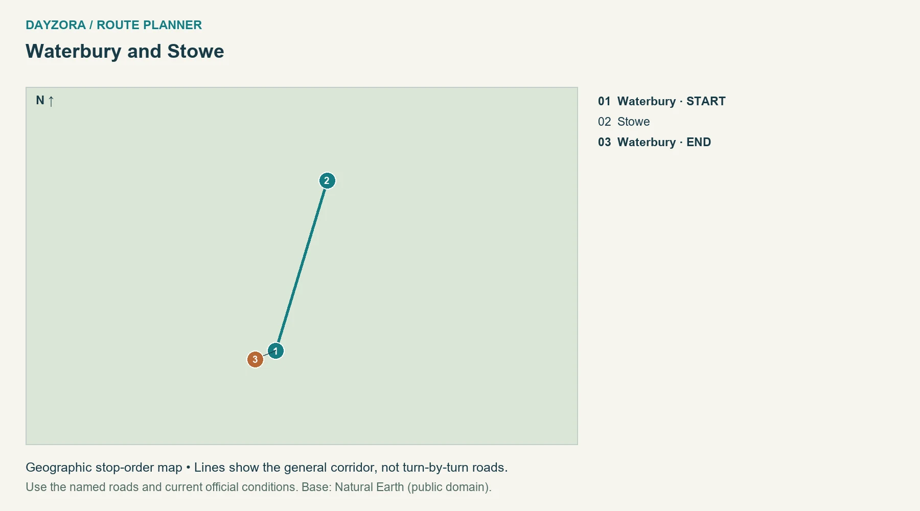
Your weekend plan: Use Waterbury and Stowe as two nearby bases for one regional weekend rather than a long foliage chase. Drive north on the first day, spend time in Stowe, then return on day two or three. Most of the trip should happen outside the car: village walks, a selected outdoor activity and relaxed meals.
Where to stay: Waterbury or Stowe. Food and pacing: Stay in either town and plan for maple products, local cheese or bakery stops. The short main drive gives you room to change the day’s activity when weather shifts.
Route-specific tip: The checked 24-mile return route follows the town corridor and excludes mountain toll roads, ski-area access and Smugglers’ Notch. Do not add a seasonal pass merely because it appears nearby on a map; it needs its own vehicle and opening check. Official route or destination information.
20. Rockland, Camden and Belfast
Route: Rockland, Camden and Belfast · Maine
Start: Rockland · End: Rockland
Approximate distance: 55 miles. Approximate driving time: 2 hours before stops or delays.
Recommended trip length: 2–3 days · Best season: June–October
Major stops, in order: Rockland → Camden → Belfast → Camden → Rockland
Road type: US 1 and harbor access roads · Best for: Harbors and coastal towns
Round trip to the named starting town; home-to-start travel and local outings additional.
Open the numbered Rockland, Camden and Belfast route map
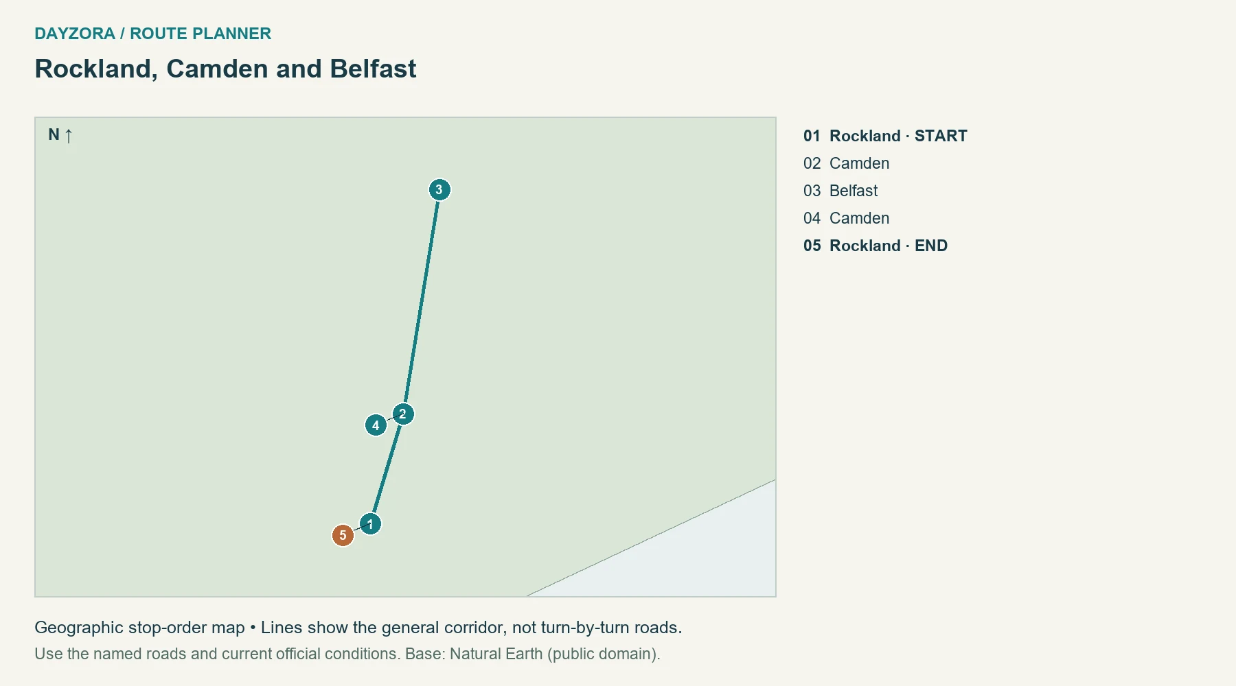
Your weekend plan: Base in Rockland or Camden, continue north to Belfast for a town outing, then return. Two days works for a compact harbor-focused break; three lets you give each town meaningful walking time. This is a midcoast weekend, not a compressed Portland-to-Acadia itinerary.
Where to stay: Rockland or Camden. Food and pacing: Use seafood restaurants, bakeries and groceries around the towns, checking seasonal hours. Staying centrally can let you park once for the evening instead of adding more local driving.
Route-specific tip: US 1 is not continuously oceanfront. The views come from deliberate harbor stops, whose parking and local access can add miles. Do not tack Bar Harbor onto the last afternoon; it changes the scale of the trip. Official route or destination information.
Keep the return day comfortable
Choose a departure time based on daylight, likely traffic and your energy, then work backward to the final activity. Do not put a long hike or a weather-sensitive boat excursion immediately before the drive home. A meal and a short walk can be a better final stop than one more distant attraction.
Download the route before leaving good coverage, save the accommodation address and keep a fallback stop if the first parking area is full. Check the official road report before departure and again before a mountain or barrier-island leg. For scenery as the main priority, compare the scenic drives guide; for a longer coast itinerary, use the California road-trip plans.
Estimate fuel and the whole-trip budget
Estimated fuel cost = total miles ÷ vehicle MPG × fuel price per gallon. For example, a hypothetical 600-mile trip in a vehicle achieving 30 MPG at an assumed $4 per gallon costs about $80 in fuel. The price is an illustration, not today’s local pump price. Include the return drive, local outings and a sensible detour allowance in total miles.
| Expense | Planning amount |
|---|---|
| Fuel or charging | Your route calculation; for EVs use expected kWh and actual charging tariffs. |
| Accommodation | Number of nights × quoted total nightly price, including applicable taxes and fees. |
| Food | Travelers × days × your own daily allowance; include groceries and planned restaurant meals. |
| Attractions and parks | Current admission, reservation and tour charges for the sites you will actually visit. |
| Parking and tolls | Hotel and city parking, toll roads, bridges and rental-company toll processing where applicable. |
| Miscellaneous | Rental costs if relevant, supplies and a contingency you can afford. |
A park pass does not automatically cover campground, tour or timed-entry charges. Check current NPS pass eligibility and prices, including residency-related differences. Use DayZora’s travel budget guide to compare the complete trip rather than only the room rate.
Before you leave: roads, vehicle and packing
Review the state transportation service and the relevant park’s alerts before booking a tightly timed route, again before departure, and each morning in mountain or storm-affected country. A route planner’s line does not establish that a road is open. Leave a comfortable arrival margin and stop when tired; a shorter itinerary is better than recovering lost time after dark.
For an EV, use the U.S. Department of Energy station locator and your vehicle or network planner to check connector compatibility, operating status, charging speed and an alternative stop. Do not infer charging access from a town’s size. Remote stretches need an energy reserve; charging time is additional to driving time.
- Documents: valid driver’s license, registration, insurance details and rental documents if applicable.
- Vehicle: tires and pressure, required fluids, lights, and a spare or repair solution appropriate to the vehicle; know how to request roadside assistance.
- Personal supplies: drinking water, snacks, medication, sun protection and layers suitable for elevation changes.
- Technology: car charger, charging cables, power bank and downloaded maps; share the route with someone if coverage will be limited.
- Emergency supplies: a practical vehicle kit and weather-appropriate equipment; follow local chain or traction requirements rather than improvising.
For the rest of your luggage, use the travel packing checklist. The broader travel tips guide covers booking and preparation decisions that apply before you collect the car.
Weekend road-trip FAQs
How far should I drive on a weekend?
Start with your available time and add both access and return travel. These routes keep the main regional drive short, but a distant starting town can still make the trip impractical.
Does the mileage include getting home?
It includes returning to the named starting town. Travel between your home and that town, plus local outings, is additional.
Are these all loops?
Most are out-and-back routes, with selected stops on each direction. The Enchanted Circle is a circuit. Returning along a familiar road can be simpler than forcing a longer loop.
Should I use one hotel or two?
Use one base when the drive is short and nearby activities are the priority. Stay at the far end when it avoids two demanding crossings in one day, as on the Cherohala trip.
What if the weather changes?
Shorten the route, choose a town activity or reschedule a weather-dependent outing. Follow official closures; a weekend booking is not a reason to improvise a risky detour.
Which trips work for a low budget?
The closest suitable route often wins because it reduces access travel. Compare actual lodging, parking, food and admission quotes instead of assuming one destination is always cheap.
Can I use these routes with children?
Choose short driving legs, reliable meal breaks and activities suited to your group. Reduce the stop list and keep flexibility for rest; the displayed driving baseline does not include those breaks.
Pingback: 25 Best Weekend Getaways in the USA for 2026