
Last route information reviewed: September 26, 2026. Updated September 26, 2026. Research-based planning guidance for DayZora.
The most rewarding scenic road trips in the USA give you time to notice how the landscape changes. This selection compares 15 drives chosen for coastline, alpine country, forests, desert formations, lakes and fall color. They range from a short Arizona canyon crossing to a week along a coast, so the right choice depends on both your available days and the season.
Use the map and comparison table to choose a landscape first, then read the route notes for the best viewing conditions, overnight bases and a realistic pace. Driving times describe movement between stops; they do not include walks, viewpoint parking, meals or weather delays. These are independent itineraries, and reaching the start or returning home takes additional time. Several routes also appear in our broader U.S. road-trip guide, but this guide’s emphasis is the scenery itself: what you see, when it is most compelling, and how to avoid spending the best part of the day rushing past it.
Trip length: 2–7 days per route.
Choose by landscape: coast, mountains, forest, desert, lakes or foliage.
Driving intensity: short daylight legs with time for safe, designated stops.
Best for: scenery-focused travelers who can keep plans flexible.

Swipe the comparison table sideways on a small screen.
| Road trip | Route | Approx. miles | Trip length | Best season | Best for |
|---|---|---|---|---|---|
| 1. Big Sur coast | Monterey → Cambria | 104 | 2–3 days | May–October | Coastal scenery |
| 2. Beartooth Highway | Red Lodge → Cooke City | 66 | 2 days | July–September, when open | Mountain viewpoints |
| 3. Utah Scenic Byway 12 | Panguitch → Torrey | 132 | 3–4 days | May–June; September–October | Canyons and plateaus |
| 4. Going-to-the-Sun Road | West Glacier → St Mary | 51 | 2–3 days | July–September, when open | Alpine scenery |
| 5. Oregon coast | Astoria → Brookings | 340 | 5–7 days | June–September | Beaches and small towns |
| 6. Northern Olympic Peninsula | Port Townsend → Forks | 106 | 3–4 days | June–September | Forest and lake stops |
| 7. Columbia River Gorge | Troutdale → The Dalles | 82 | 2–3 days | April–October | Waterfalls and river views |
| 8. Badlands Loop | Northeast entrance → Wall | 35 | 2 days | May–June; September | Prairie and eroded rock formations |
| 9. Lake Superior North Shore | Duluth → Grand Portage | 160 | 3–5 days | June–September | Lakes, waterfalls and harbors |
| 10. Michigan M-22 | Manistee → Traverse City | 124 | 3–4 days | June–October | Dunes and lakeshore villages |
| 11. Skyline Drive | Front Royal entrance → Rockfish Gap | 105 | 2–3 days | May–June; September–October | Blue Ridge overlooks |
| 12. Florida Keys Overseas Highway | Key Largo → Key West | 98 | 3–5 days | December–April | Ocean views and island time |
| 13. Sedona to Flagstaff | Sedona → Flagstaff | 30 | 2 days | April–May; September–October | Red rocks to pine forest |
| 14. Vermont Route 100 sampler | Wilmington → Stowe | 151 | 3–4 days | June–October | Green Mountains and foliage |
| 15. Maine coast to Acadia | Portland → Bar Harbor | 166 | 5–7 days | June–October | Harbors and coastal towns |
How to read distances and maps: Town-to-town distances and driving baselines were checked against OpenStreetMap-based OSRM routing on September 26, 2026, with official road mileage used where identified. They are approximate, exclude traffic and sightseeing, and can include town access or spurs; they are not always the same as a designated byway’s published length. Maps show geographic stop order, not exact road alignments or live closures. Add travel to the start, the return journey, and optional side trips. Recommendations for days, bases and pacing are DayZora’s editorial planning choices, not claims of a personally tested drive.
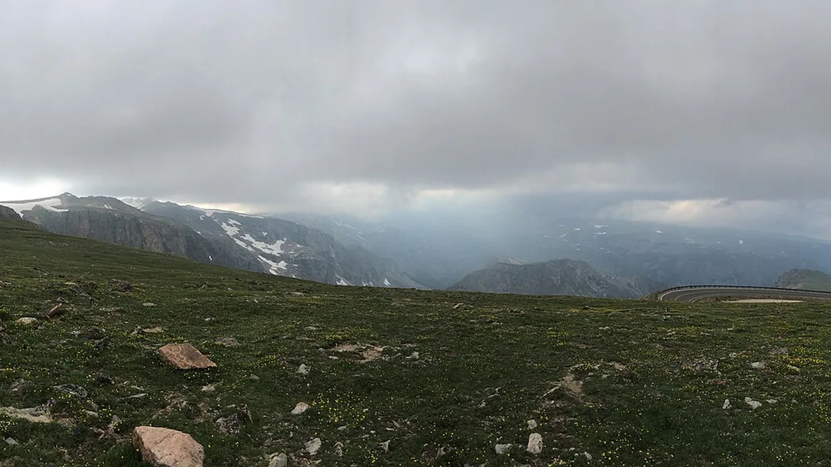
Match the landscape to the season
High alpine scenery is the least flexible choice: a trip only works if the road is open and visibility cooperates. For a fixed-date spring trip, consider lower-elevation canyon or coastal routes instead. For fall color, choose a region with several elevations and worthwhile towns so that a shifted foliage peak does not spoil the whole plan. Coastal travelers should allow room for fog rather than assuming every day will look like the featured photograph.
Plan one main walk and a small number of viewpoints per moving day. Morning light can suit one side of a valley while afternoon light suits another, but safety and access come first. Pull completely into designated parking, avoid blocking residents or driveways, and let the passenger handle photography while the vehicle moves.
1. Big Sur coast
Route: Big Sur coast · California
Start: Monterey · End: Cambria
Approximate distance: 104 miles. Approximate driving time: 3 hours before stops or delays.
Recommended trip length: 2–3 days · Best season: May–October
Major stops, in order: Monterey → Carmel → Bixby Bridge → Big Sur → Ragged Point → Cambria
Road type: Coastal Highway 1 · Best for: Coastal scenery
Open the numbered Big Sur coast route map
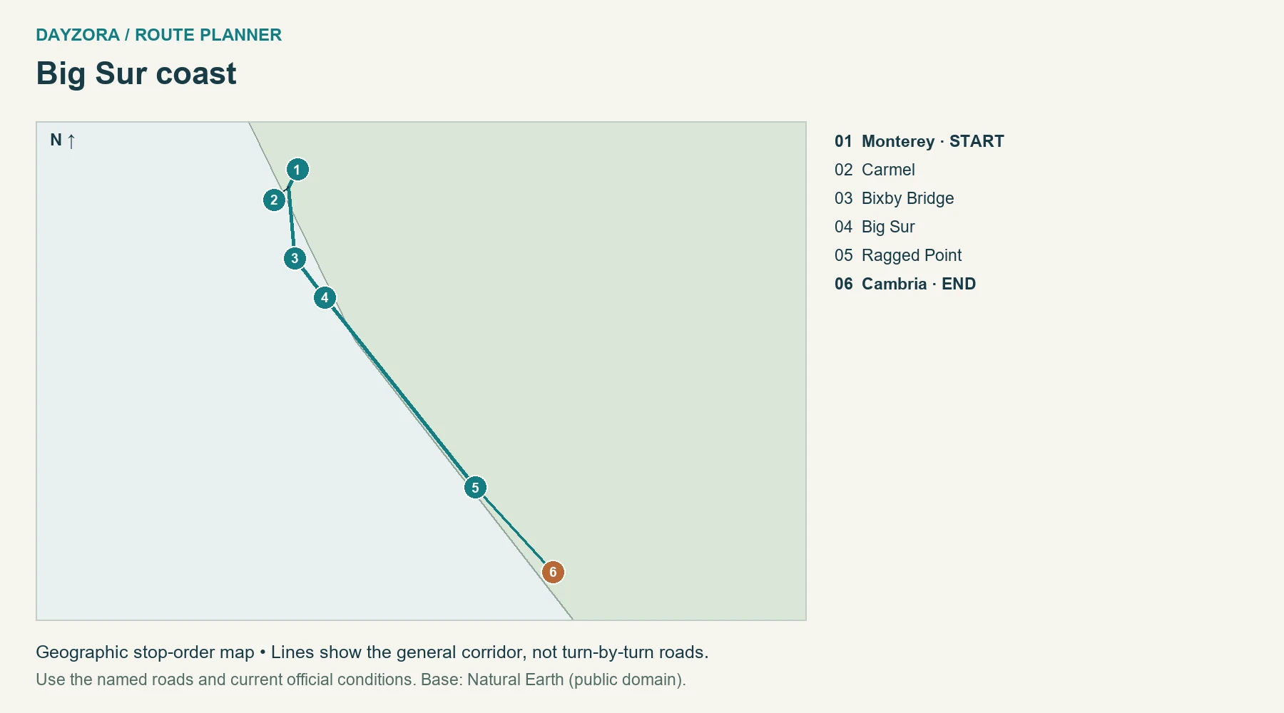
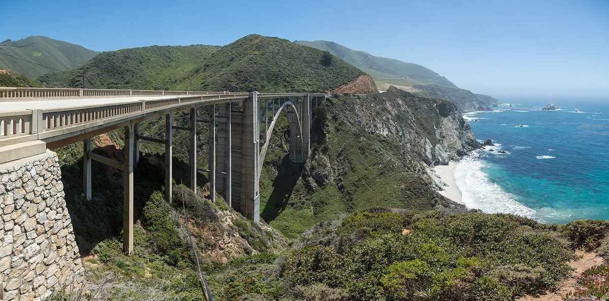
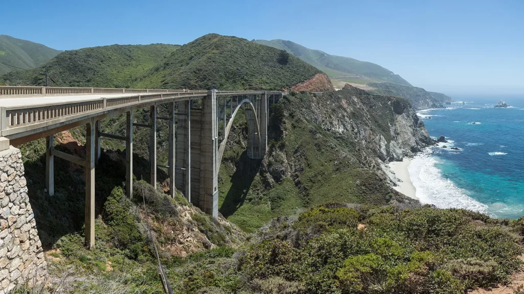
What you see and when: The strongest visual contrast is between steep coastal slopes and open water. Bixby Creek Bridge gives the landscape a recognizable structure, but the quieter headlands farther south are worth time too. Summer marine fog can turn a clear morning into a muted afternoon; a second coastal day gives you another chance at long views.
Scenic itinerary, stays and food: Spend day one around Monterey and Carmel, day two on the Big Sur crossing, and a final morning near Cambria. Select two or three legal pullouts and one short walk instead of stopping wherever another car has pulled over. Stay in Monterey/Carmel and Cambria; eat before the remote middle section and carry lunch.
Planning tip: The September 26 Caltrans report listed one-way traffic control at Rocky Creek Bridge. Check Highway 1 again before leaving. If a through closure returns, use a planned US 101 connection; local mountain tracks are not substitutes. Check official planning information.
2. Beartooth Highway
Route: Beartooth Highway · Montana and Wyoming
Start: Red Lodge · End: Cooke City
Approximate distance: 66 miles. Approximate driving time: 2.5 hours before stops or delays.
Recommended trip length: 2 days · Best season: July–September, when open
Major stops, in order: Red Lodge → Rock Creek Vista → Beartooth Pass → Cooke City
Road type: High alpine US 212 · Best for: Mountain viewpoints
Open the numbered Beartooth Highway route map
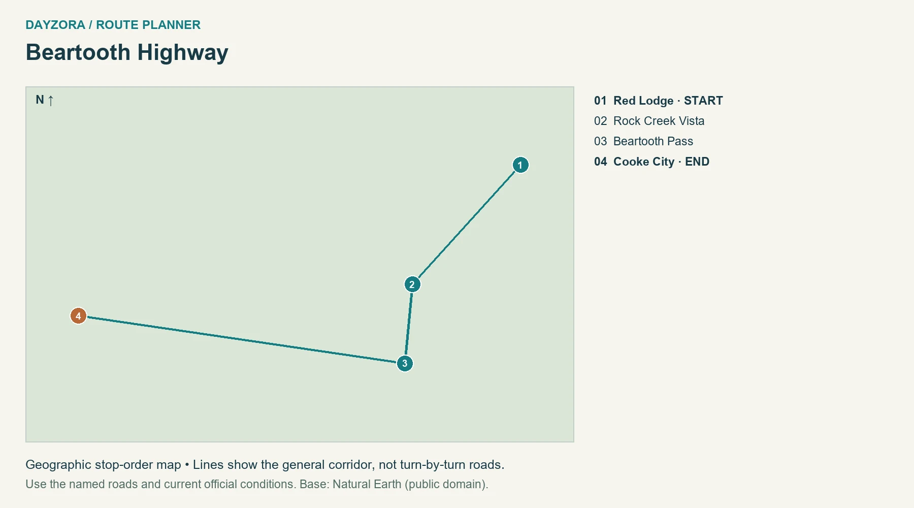
What you see and when: This is the choice for scenery above the tree line: exposed stone, distant peaks, alpine water and a road that makes the scale visible. The transition matters as much as the summit, so start at Red Lodge rather than judging the trip by one pass photograph. A clear summer day offers the broadest views; cloud can remove them entirely.
Scenic itinerary, stays and food: Sleep in Red Lodge, devote a daylight day to Rock Creek Vista, the high crossing and Cooke City, then stay at the western end. Pack food from town and bring warm layers even if Red Lodge feels hot. A second day is useful as weather flexibility, not an obligation to drive the road twice.
Planning tip: The nominal warm-season window is not an opening promise. Check Montana and Wyoming reports before committing to either end’s accommodation. Do not schedule a fixed-time Yellowstone activity immediately after the crossing. Check official planning information.
3. Utah Scenic Byway 12
Route: Utah Scenic Byway 12 · Utah
Start: Panguitch · End: Torrey
Approximate distance: 132 miles. Approximate driving time: 3.5 hours before stops or delays.
Recommended trip length: 3–4 days · Best season: May–June; September–October
Major stops, in order: Panguitch → Red Canyon Visitor Center → Tropic → Escalante → Boulder → Torrey
Road type: UT 12, paved high desert and mountain road · Best for: Canyons and plateaus
Open the numbered Utah Scenic Byway 12 route map
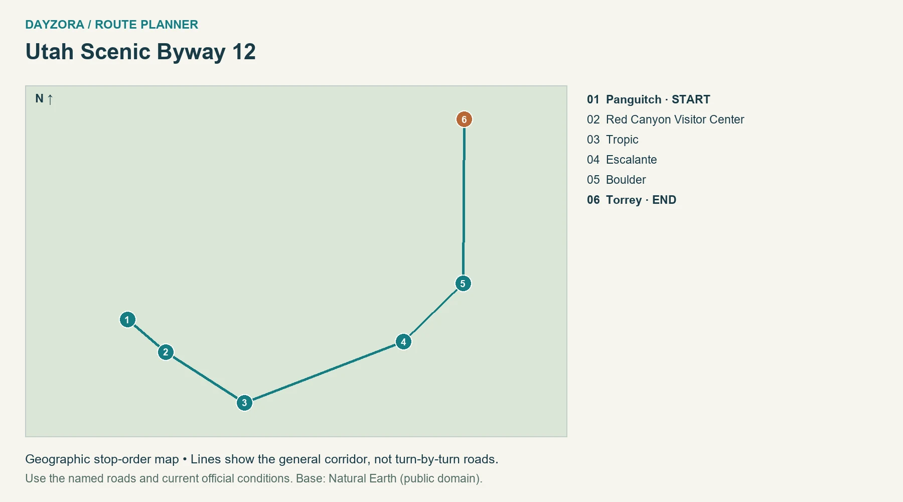
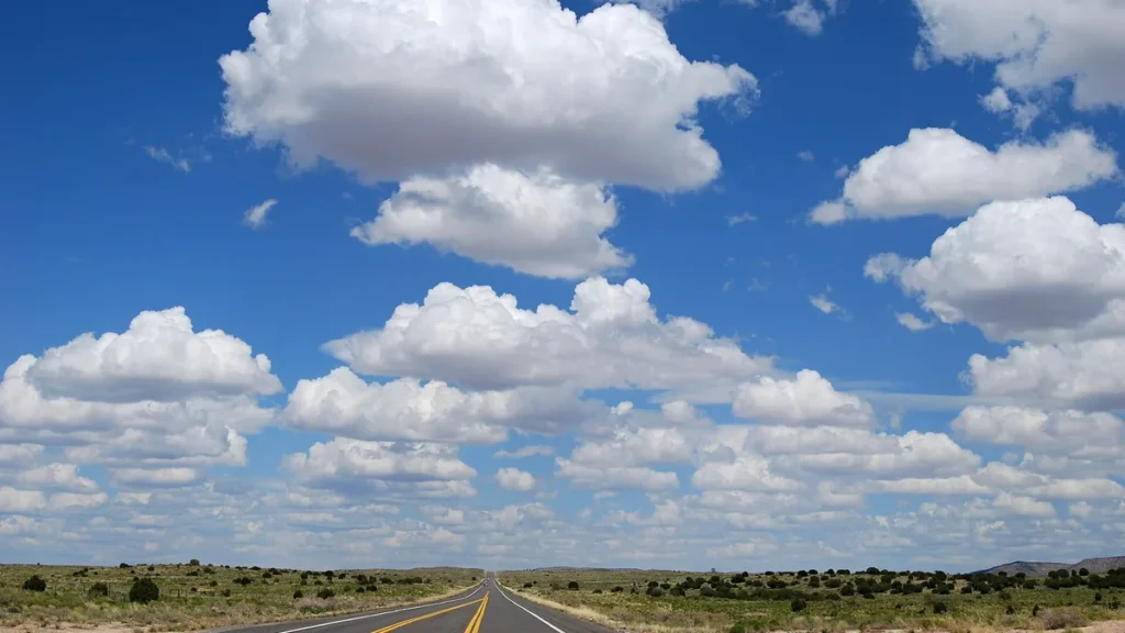
What you see and when: UT 12 has unusually strong landscape transitions: red rock near the western end, pale slickrock around Escalante, the exposed Hogback and the higher wooded slopes toward Torrey. Spring and autumn can offer comfortable low-elevation walking, while the mountain portion may still be cold. Choose this when variety matters more than a single famous viewpoint.
Scenic itinerary, stays and food: Divide the drive among Tropic, Escalante and Torrey, keeping the transfer days short enough for one chosen stop. Add separate days for Bryce Canyon or Capitol Reef; their internal driving and walks are not included in the highway mileage. Buy meals and groceries in the towns and carry water beyond them.
Planning tip: The paved highway is the recommendation. An enticing unpaved road is a separate trip with its own weather and vehicle requirements. Check UDOT for work zones and Boulder Mountain conditions, and avoid rushing the Hogback to reach a dinner booking. Check official planning information.
4. Going-to-the-Sun Road
Route: Going-to-the-Sun Road · Montana
Start: West Glacier · End: St Mary
Approximate distance: 51 miles. Approximate driving time: 2 hours before stops or delays.
Recommended trip length: 2–3 days · Best season: July–September, when open
Major stops, in order: West Glacier → Lake McDonald Lodge → Logan Pass → St Mary
Road type: Narrow alpine park road · Best for: Alpine scenery
Open the numbered Going-to-the-Sun Road route map
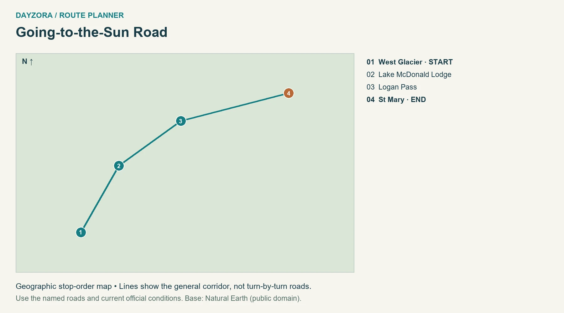
What you see and when: Going-to-the-Sun Road offers a continuous change from Lake McDonald and forest to alpine ledges and the Continental Divide. Choose the crossing for the full sequence, not only Logan Pass. Summer’s long days help, but parking pressure and rapidly changing mountain weather can determine which stops are realistic.
Scenic itinerary, stays and food: Use West Glacier as the first base and St. Mary as the second. Spend the intervening day crossing, taking a picnic and choosing a walk that fits the day’s weather and available parking. A third day makes a better buffer than attempting a long hike after every overlook. Gateway towns are the reliable meal-planning anchors.
Planning tip: For 2026, vehicle reservations are not required, while ticketed Logan Pass shuttle access is separate. Vehicles over 21 feet long or 8 feet wide, including mirrors, are prohibited on the restricted alpine section. Consult NPS for height cautions, road status and current shuttle details. Check official planning information.
5. Oregon coast
Route: Oregon coast · Oregon
Start: Astoria · End: Brookings
Approximate distance: 340 miles. Approximate driving time: 9 hours before stops or delays.
Recommended trip length: 5–7 days · Best season: June–September
Major stops, in order: Astoria → Cannon Beach → Tillamook → Newport → Florence → Bandon → Brookings
Road type: US 101 · Best for: Beaches and small towns
Open the numbered Oregon coast route map
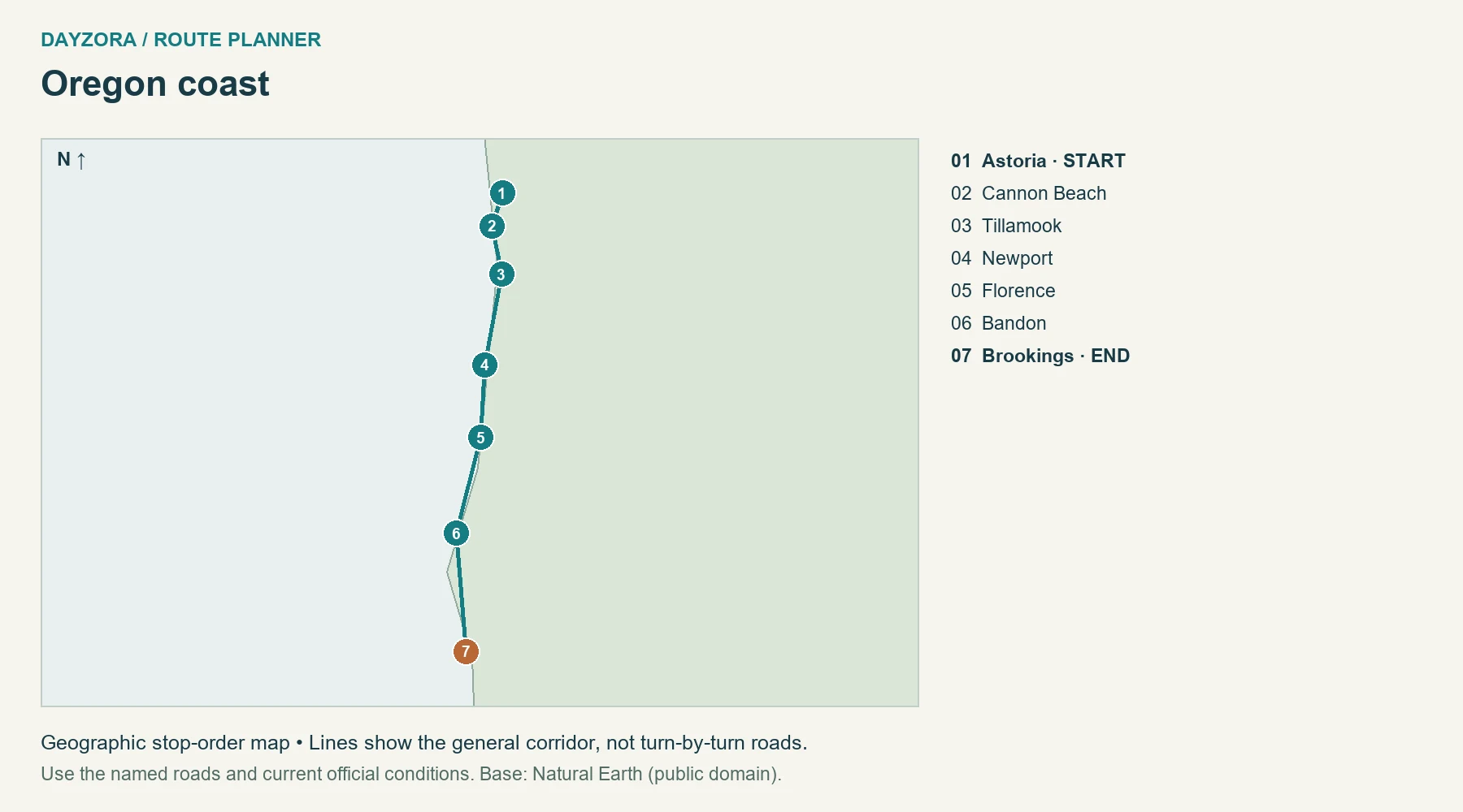
What you see and when: Oregon is the best fit here for changing coastal moods over several days. Northern beaches feel broad and open; central-coast harbors and the Florence dunes interrupt the journey; Bandon adds striking sea stacks farther south. US 101 also runs inland, which makes the return to the ocean more noticeable. Summer is practical, but fog is part of the experience.
Scenic itinerary, stays and food: Give Cannon Beach, Newport and Bandon overnight time, using Florence to break a longer middle section if needed. Walk one beach at each base rather than collecting many brief stops. Choose harbor seafood or bakery lunches in town, then carry a picnic for quieter stretches. Five to seven days makes the full route feel like a holiday.
Planning tip: Check tide and surf conditions before beach walking. Stay well back from active surf and driftwood; a photograph is not a reason to stand on exposed rocks. Use TripCheck for US 101 incidents and allow time for town traffic. Check official planning information.
6. Northern Olympic Peninsula
Route: Northern Olympic Peninsula · Washington
Start: Port Townsend · End: Forks
Approximate distance: 106 miles. Approximate driving time: 3 hours before stops or delays.
Recommended trip length: 3–4 days · Best season: June–September
Major stops, in order: Port Townsend → Sequim → Port Angeles → Lake Crescent → Forks
Road type: US 101 and paved access roads · Best for: Forest and lake stops
Open the numbered Northern Olympic Peninsula route map
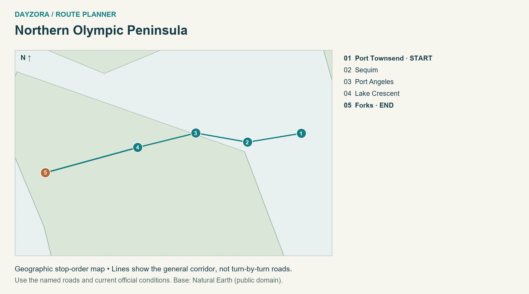
What you see and when: The northern Olympic Peninsula is a forest-and-water drive, with Lake Crescent as its scenic center. Port Townsend adds a waterfront town rather than wilderness, and the road gradually trades settled shores for denser forest toward Forks. Summer usually gives the most flexible daylight; wet-weather woodland can still be beautiful when mountain viewpoints disappear.
Scenic itinerary, stays and food: Spend the first day between Port Townsend and Port Angeles, then make Lake Crescent the focus of the second before continuing to Forks. Stay in Port Angeles and Forks, using the third day for a locally checked outing or return travel. Eat in the towns and pack lunch for the lake rather than relying on every seasonal service.
Planning tip: This is the northern corridor only. Hurricane Ridge, the Hoh Rain Forest and Pacific beaches require separate access-road checks and extra driving. The mapped route does not cross the Hoh River bridge, and it is not a complete peninsula loop. Check official planning information.
7. Columbia River Gorge
Route: Columbia River Gorge · Oregon
Start: Troutdale · End: The Dalles
Approximate distance: 82 miles. Approximate driving time: 2 hours before stops or delays.
Recommended trip length: 2–3 days · Best season: April–October
Major stops, in order: Troutdale → Vista House → Multnomah Falls → Cascade Locks → Hood River → Rowena Crest → The Dalles
Road type: Historic US 30 with I-84 connections · Best for: Waterfalls and river views
Open the numbered Columbia River Gorge route map
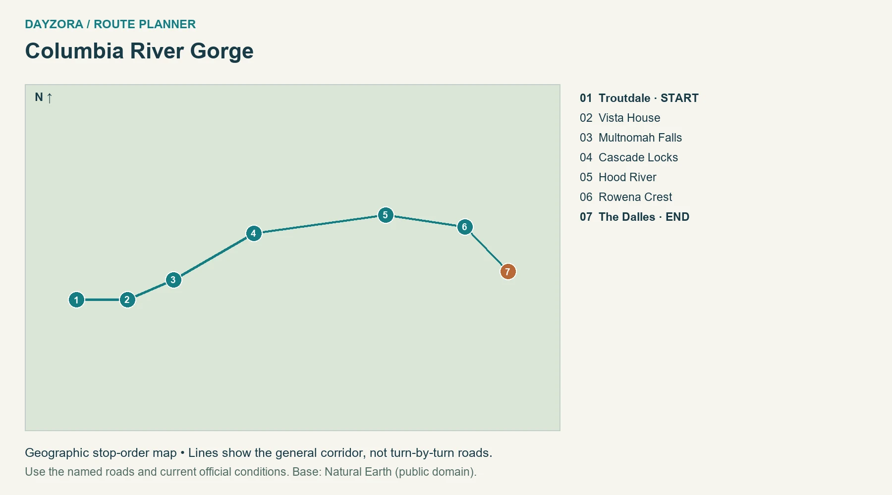
What you see and when: The Gorge is especially rewarding when you follow its change from damp waterfall country to open, drier slopes east of Hood River. Vista House provides the broad river perspective; the waterfall corridor supplies close detail; Rowena changes the scale again. Spring can emphasize green slopes and flowing water, while autumn adds color around the forested western end.
Scenic itinerary, stays and food: Use the first day for Troutdale, Vista House and a selected waterfall stop, then stay near Hood River. Continue to Rowena and The Dalles on day two, adding a third for walking. Hood River is a useful food base, with picnic supplies for the viewpoints. Keep a flexible stop list because parking can be the limiting factor.
Planning tip: Historic-road sections need modern connections, and some old sections are vehicle-free trails. The 2026 I-84 Multnomah Falls timed-use season ended September 7; check future dates separately. ODOT’s viaduct restoration finished in May 2026, but that does not remove other roadwork. Check official planning information.
8. Badlands Loop
Route: Badlands Loop · South Dakota
Start: Northeast entrance · End: Wall
Approximate distance: 35 miles. Approximate driving time: 1.5 hours before stops or delays.
Recommended trip length: 2 days · Best season: May–June; September
Major stops, in order: Northeast entrance → Ben Reifel visitor center → Yellow Mounds → Pinnacles entrance → Wall
Road type: Paved SD 240 · Best for: Prairie and eroded rock formations
Open the numbered Badlands Loop route map
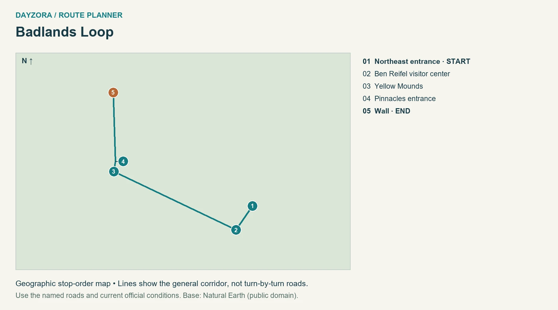
What you see and when: The Badlands offer a different visual rhythm: open prairie suddenly breaks into deeply eroded ridges, pale layers and rounded mounds. Low-angle light gives these surfaces more definition than a hurried midday drive. Spring and early autumn are useful planning windows; in summer, make walking plans around heat rather than only the desired photograph.
Scenic itinerary, stays and food: Enter from the northeast, visit Ben Reifel, then work west toward Yellow Mounds and the Pinnacles entrance before sleeping in Wall. Return to a selected viewpoint the next morning if the conditions justify it. Pack water and food before entering; Wall provides the practical meal and supply stop. Two days lets you see changing light without a long route.
Planning tip: Stay on paved SD 240 for this itinerary. Sage Creek Rim Road is an optional unpaved route with different conditions. Use established viewpoints, respect wildlife space and alter walks when storms or heat make them unsuitable. Check official planning information.
9. Lake Superior North Shore
Route: Lake Superior North Shore · Minnesota
Start: Duluth · End: Grand Portage
Approximate distance: 160 miles. Approximate driving time: 5.5 hours before stops or delays.
Recommended trip length: 3–5 days · Best season: June–September
Major stops, in order: Duluth → Two Harbors → Split Rock Lighthouse → Grand Marais → Grand Portage
Road type: MN 61 and old lakeshore sections · Best for: Lakes, waterfalls and harbors
Open the numbered Lake Superior North Shore route map
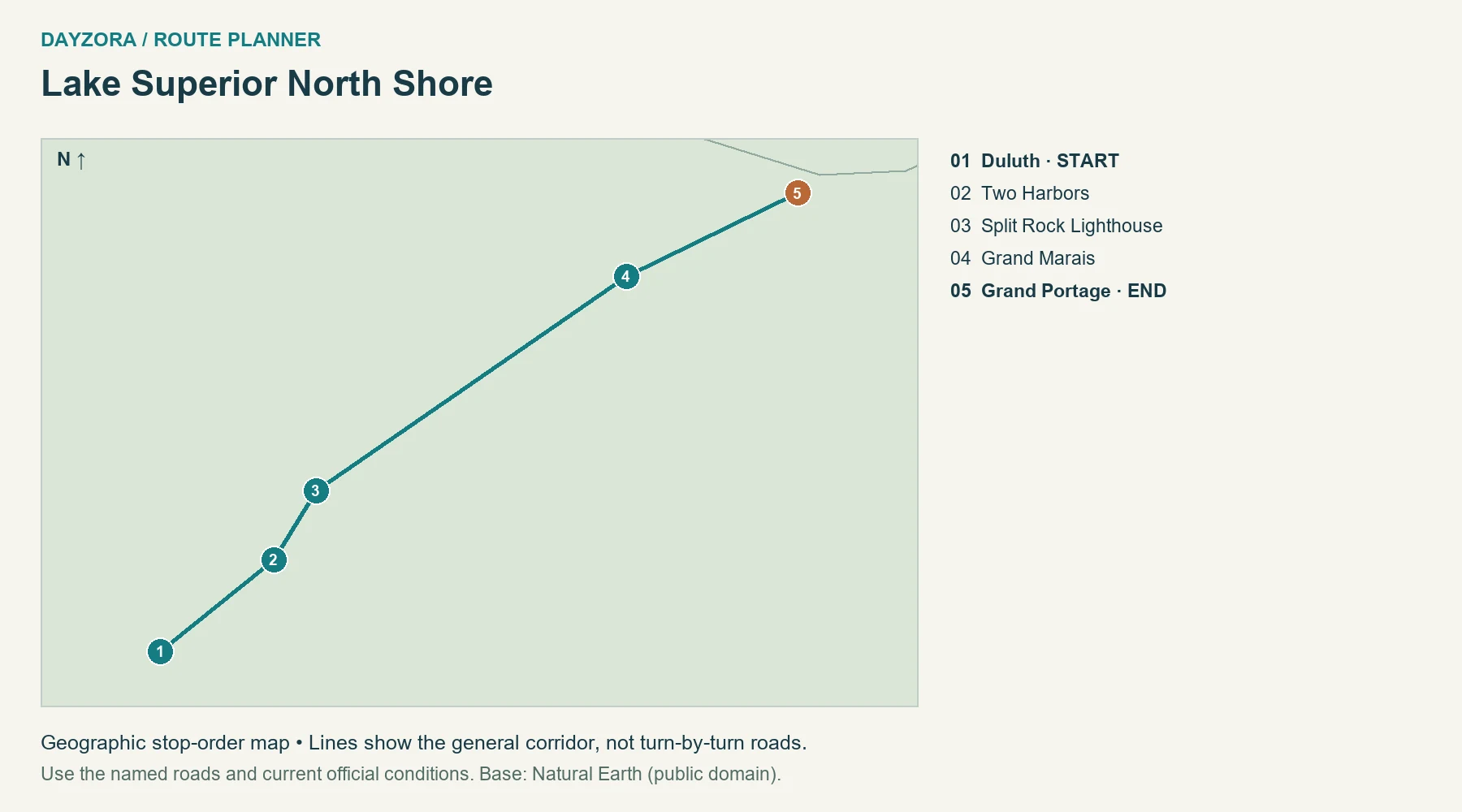
What you see and when: Lake Superior supplies a horizon that can feel coastal, with rocky shore, wooded slopes and harbor towns making the drive varied. Split Rock adds a distinctive historic structure to the lake setting, while the farther north you travel, the more useful it becomes to stay several nights. Summer gives long evenings; early autumn may add color inland.
Scenic itinerary, stays and food: Begin in Duluth, spend time around Two Harbors and Split Rock, then base two nights around Grand Marais before reaching Grand Portage. Three days is a compact version; five leaves more time for selected waterfalls and shore walks. Use town bakeries, smoked-fish stops and harbor dining, and check seasonal hours.
Planning tip: The lake moderates temperatures: bring a warm layer even when inland weather sounds summery. Lighthouse admission and state-park entry are separate arrangements. The mapped mileage includes an access stop and is not simply the official highway’s end-to-end length. Check official planning information.
10. Michigan M-22
Route: Michigan M-22 · Michigan
Start: Manistee · End: Traverse City
Approximate distance: 124 miles. Approximate driving time: 3.5 hours before stops or delays.
Recommended trip length: 3–4 days · Best season: June–October
Major stops, in order: Manistee → Onekama → Frankfort → Empire → Glen Arbor → Leland → Northport → Suttons Bay → Traverse City
Road type: M-22 with town stops · Best for: Dunes and lakeshore villages
Open the numbered Michigan M-22 route map
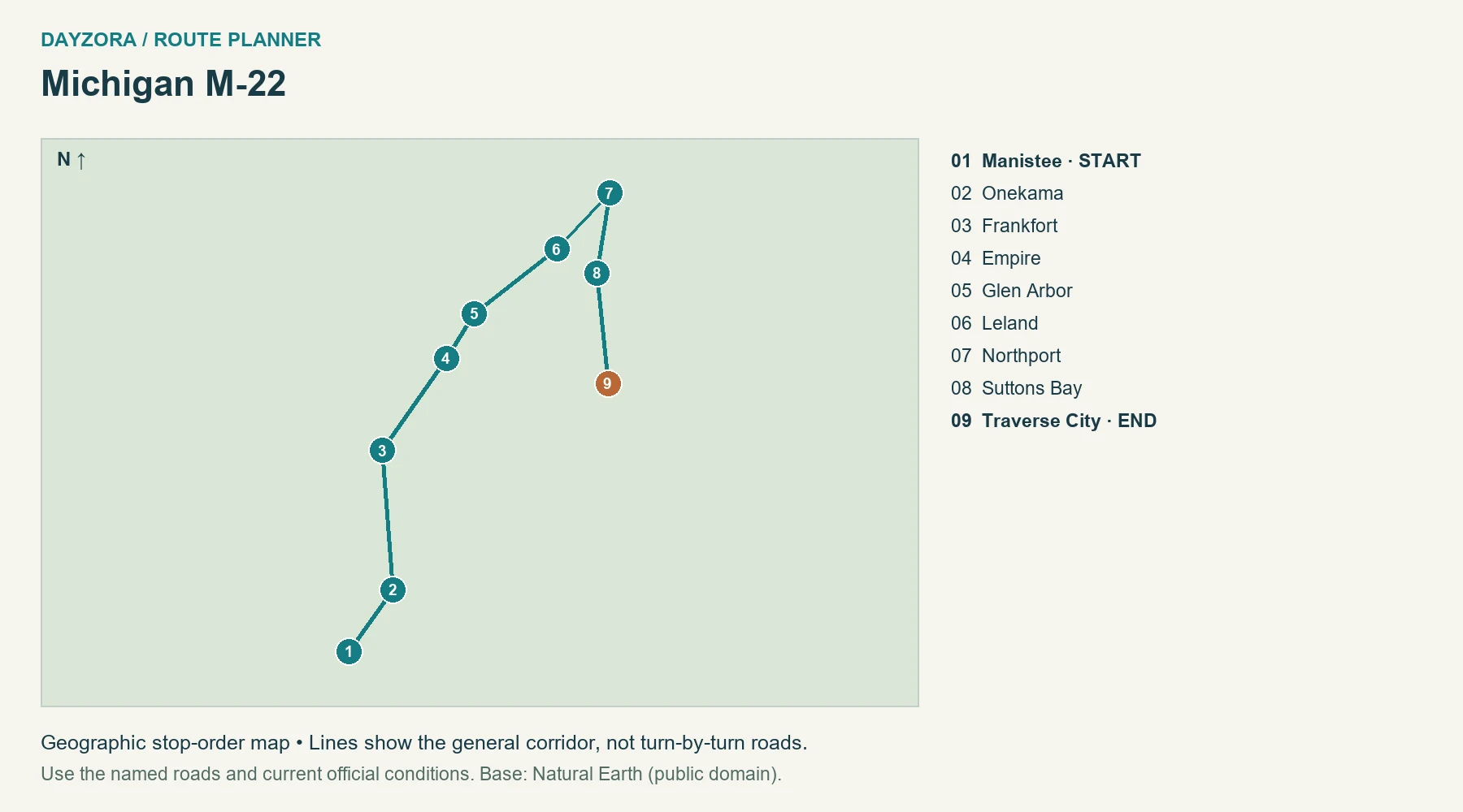
What you see and when: M-22 is about the relationship between water, dunes and lived-in villages. The Leelanau Peninsula adds orchards and farm country between shoreline views, while the turn around Northport eventually faces Grand Traverse Bay. Summer suits swimming and longer days; autumn adds color and harvest-season food without guaranteeing warm beach weather.
Scenic itinerary, stays and food: Break the journey in Frankfort, then Glen Arbor, before continuing through Leland and Northport to Traverse City. Give Sleeping Bear Dunes a substantial block of time rather than treating it as an extra overlook. Stay three nights if possible, and use village cafés, cherry products and farm stands as part of the route.
Planning tip: The route includes town-center access beyond the bare highway mileage. Check NPS fees and alerts for Sleeping Bear stops. Avoid committing to a dune descent without understanding the return climb, particularly in heat. Check official planning information.
11. Skyline Drive
Route: Skyline Drive · Virginia
Start: Front Royal entrance · End: Rockfish Gap
Approximate distance: 105 miles. Approximate driving time: 3 hours before stops or delays.
Recommended trip length: 2–3 days · Best season: May–June; September–October
Major stops, in order: Front Royal entrance → Thornton Gap → Big Meadows → Swift Run Gap → Rockfish Gap
Road type: Mountain park road · Best for: Blue Ridge overlooks
Official through-road mileage; access to lodging additional
Open the numbered Skyline Drive route map
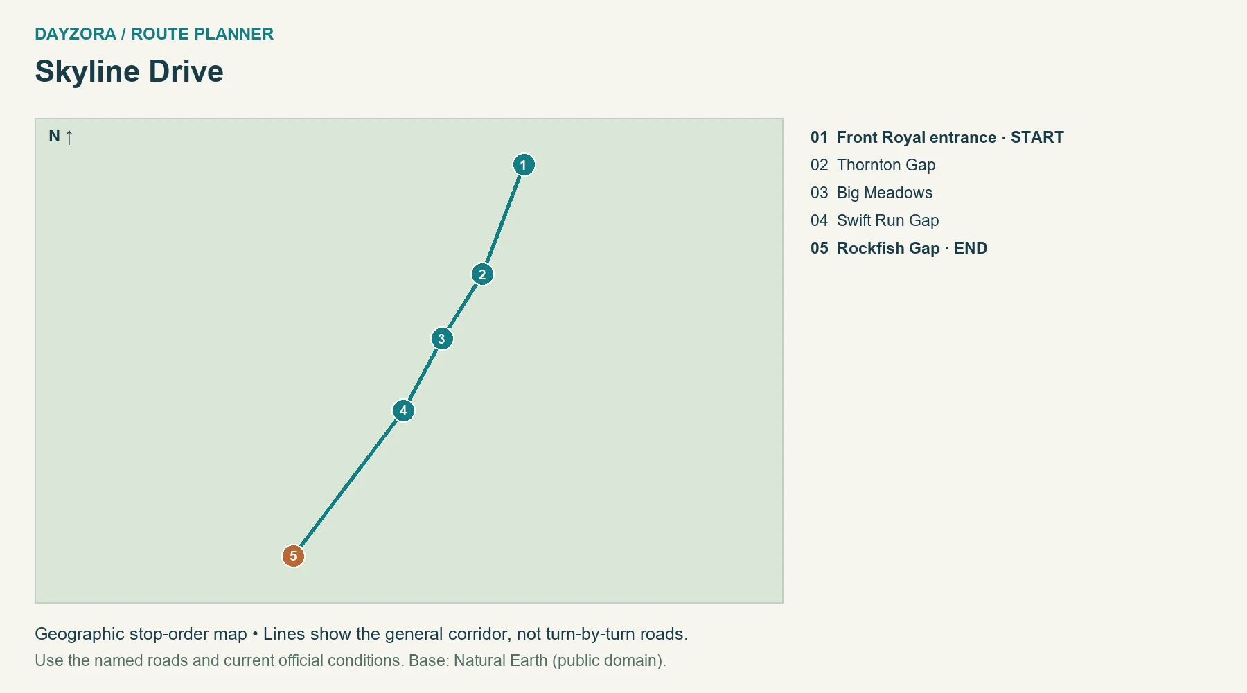
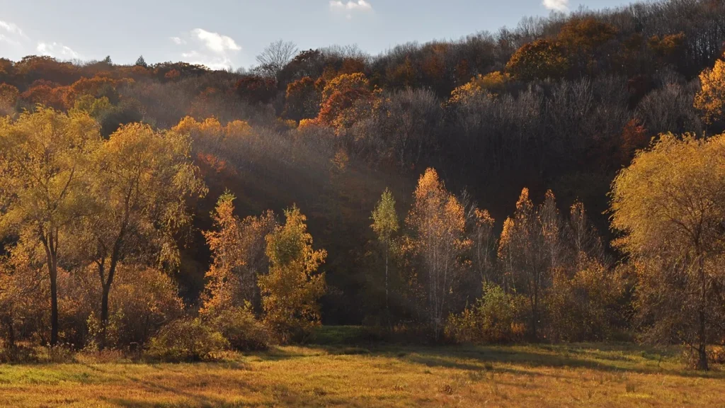
What you see and when: Skyline Drive favors repeated long views across the Blue Ridge and Shenandoah Valley, with forest close to the road between overlooks. It is a particularly good choice when you want to alternate driving with established walks. Autumn color draws crowds; late spring can give green views with fewer expectations about a single peak-foliage date.
Scenic itinerary, stays and food: Split the north-to-south drive around the central district, using two daylight days rather than one long string of pullouts. Luray is a useful gateway base; in-park lodging can reduce exit driving if available. Carry lunch and verify seasonal dining. Three days lets you add a longer walk while keeping the road itself unhurried.
Planning tip: The official 105-mile drive takes about three hours without substantial stops. Fog, snow and ice can close sections. Skyline Drive and the Blue Ridge Parkway are separate roads; do not extend south without checking the Parkway’s own closure map. Check official planning information.
12. Florida Keys Overseas Highway
Route: Florida Keys Overseas Highway · Florida
Start: Key Largo · End: Key West
Approximate distance: 98 miles. Approximate driving time: 3 hours before stops or delays.
Recommended trip length: 3–5 days · Best season: December–April
Major stops, in order: Key Largo → Islamorada → Marathon → Bahia Honda → Key West
Road type: US 1 bridges and island roads · Best for: Ocean views and island time
Open the numbered Florida Keys Overseas Highway route map
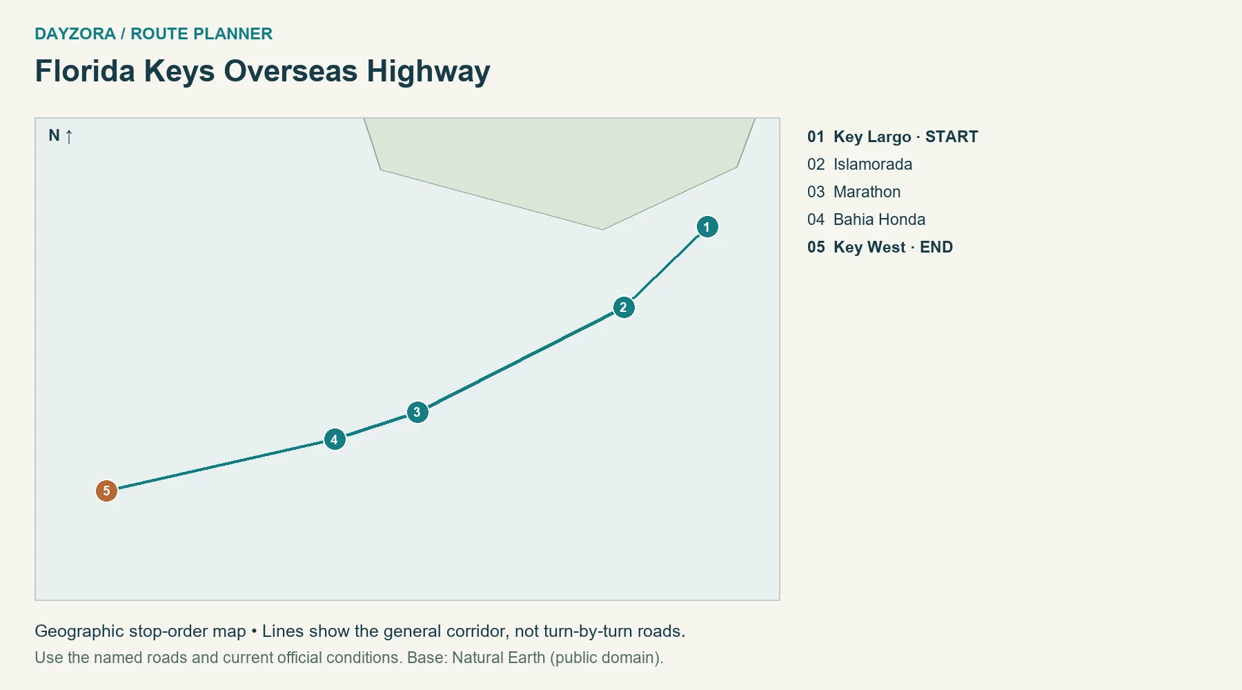
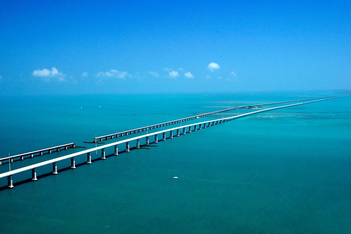
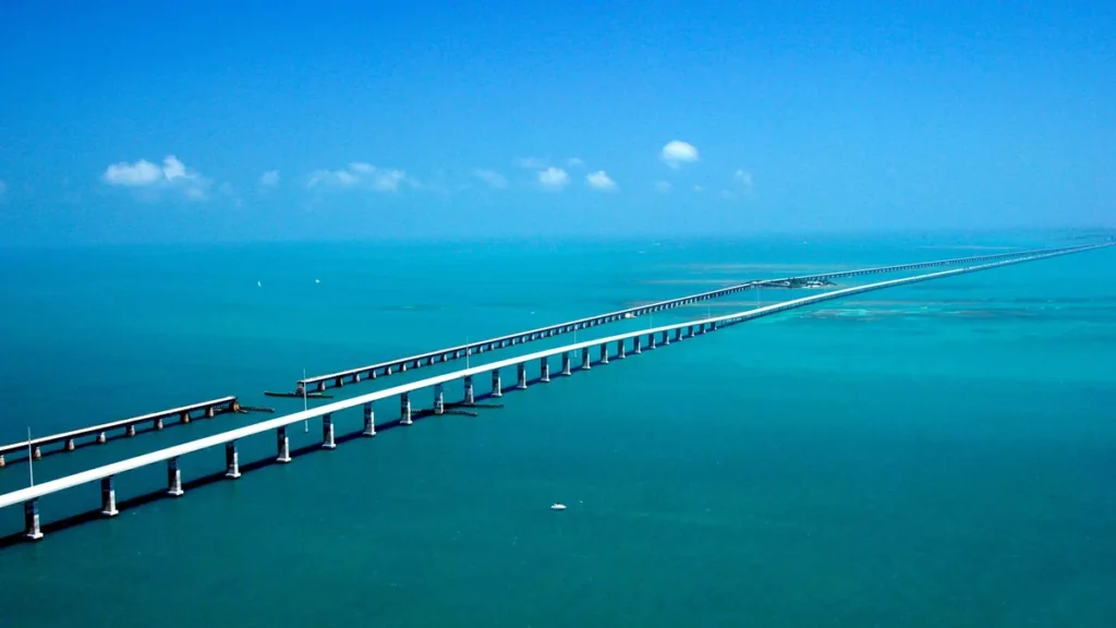
What you see and when: The Keys are the water-and-sky alternative to mountain drama. Long bridge approaches open the view, while island stretches bring mangroves, marinas and neighborhoods back into the foreground. The most memorable scenery may be from a legal waterfront stop or a boat outing, not something you can safely examine while driving across a bridge.
Scenic itinerary, stays and food: Travel from Key Largo through Islamorada and Marathon, pausing near Bahia Honda before staying in Key West. Three to five days leaves time for an upper-Keys night and two nights at the end. Plan seafood or Cuban-influenced meals in the towns, and compare hotel parking costs as well as room rates.
Planning tip: December through April is a useful weather-planning window, although busy dates require early lodging decisions. Hurricane-season trips need flexible plans and attention to official advisories. The mileage excludes Miami and the return drive; bridges are not roadside photo parking. Check official planning information.
13. Sedona to Flagstaff
Route: Sedona to Flagstaff · Arizona
Start: Sedona · End: Flagstaff
Approximate distance: 30 miles. Approximate driving time: 1.5 hours before stops or delays.
Recommended trip length: 2 days · Best season: April–May; September–October
Major stops, in order: Sedona → Slide Rock → Oak Creek Vista → Flagstaff
Road type: AZ 89A through Oak Creek Canyon · Best for: Red rocks to pine forest
Open the numbered Sedona to Flagstaff route map
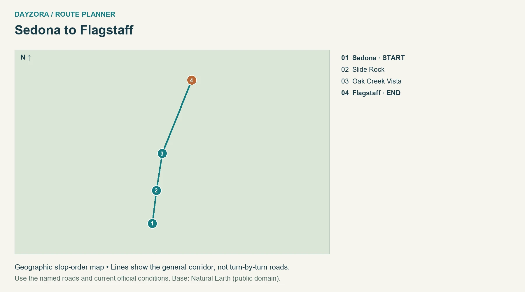
What you see and when: Oak Creek Canyon provides a remarkably compact change from Sedona’s red-rock setting to canyon shade, switchbacks and Flagstaff’s pine country. It suits travelers who want a full scenic day without a very long road. Spring and autumn are appealing at lower elevations, but conditions in Flagstaff can be much colder than in Sedona.
Scenic itinerary, stays and food: Stay in Sedona before the northbound drive, choose one canyon stop such as the Slide Rock area, then continue past Oak Creek Vista toward Flagstaff. Spend the next morning around the northern base or return with a different stop. Both towns offer plenty of meals; take lunch if a busy canyon parking area will occupy the middle of the day.
Planning tip: Use designated parking and check the fee or pass for the actual site you select. A short distance does not mean unlimited stopping capacity. Do not make an unsafe turn because a viewpoint lot is full. Check official planning information.
14. Vermont Route 100 sampler
Route: Vermont Route 100 sampler · Vermont
Start: Wilmington · End: Stowe
Approximate distance: 151 miles. Approximate driving time: 5 hours before stops or delays.
Recommended trip length: 3–4 days · Best season: June–October
Major stops, in order: Wilmington → Weston → Ludlow → Killington junction → Rochester → Waitsfield → Waterbury → Stowe
Road type: VT 100 and short town connections · Best for: Green Mountains and foliage
Open the numbered Vermont Route 100 sampler route map
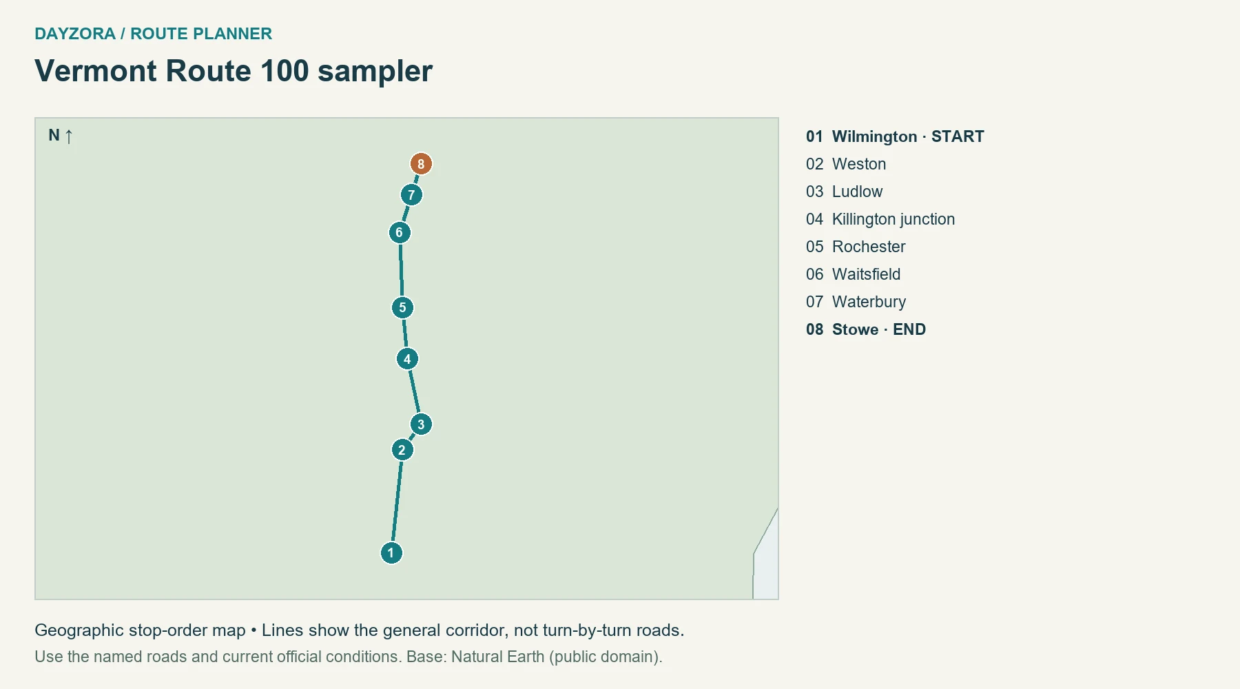
What you see and when: Route 100 offers layers of wooded hills, village greens and farm valleys. The scenery is less about one exposed overlook than the gradual rhythm of settled valleys and forested slopes. Autumn is the obvious attraction, but summer is a strong alternative when you prefer longer daylight and less pressure to find a perfect foliage weekend.
Scenic itinerary, stays and food: Divide Wilmington to Stowe across three or four days, stopping near Ludlow or Killington and again around Waitsfield. Spend time in Rochester and Waterbury rather than merely driving through. Village bakeries, maple products and local cheese make simple food stops; overnight bases should keep the next morning’s drive short.
Planning tip: Foliage changes with elevation and weather, so reserve a region you will enjoy even if the brightest color arrives earlier or later. Stay on suitable paved roads, especially after rain. This is a selected section with town connections, not the entire length of VT 100. Check official planning information.
15. Maine coast to Acadia
Route: Maine coast to Acadia · Maine
Start: Portland · End: Bar Harbor
Approximate distance: 166 miles. Approximate driving time: 4.5 hours before stops or delays.
Recommended trip length: 5–7 days · Best season: June–October
Major stops, in order: Portland → Bath → Wiscasset → Rockland → Camden → Belfast → Ellsworth → Bar Harbor
Road type: US 1 and ME 3 · Best for: Harbors and coastal towns
Open the numbered Maine coast to Acadia route map
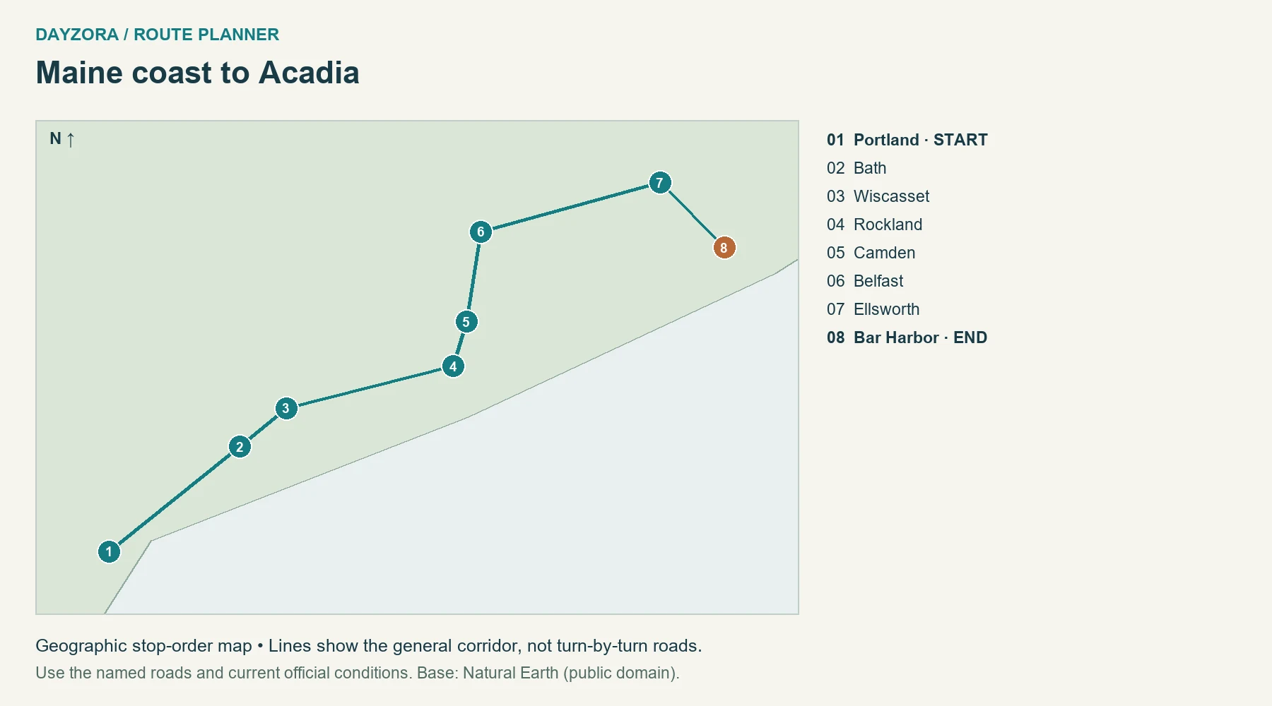
What you see and when: Maine rewards travelers willing to leave the car in harbor towns. Much of US 1 is inland from the immediate shore, so the scenic experience comes from deliberate stops in places such as Bath, Rockland and Camden, followed by Mount Desert Island. Summer brings the fullest service season; early autumn can be appealing with changing hours.
Scenic itinerary, stays and food: Use five to seven days: Portland first, a midcoast base around Rockland or Camden, then Bar Harbor for Acadia. Choose one peninsula detour rather than assuming every coastal village lies directly along the highway. Seafood lunches and working waterfronts fit naturally, but check seasonal restaurant openings before relying on a late arrival.
Planning tip: The driving figure stops at Bar Harbor and excludes Acadia’s internal roads. Cadillac Summit Road needs a vehicle reservation May 20–October 25, 2026, separate from park entry. Check road and weather alerts before committing to a summit view. Check official planning information.
For a longer park-focused journey linking Utah’s canyon scenery, use our 12-day national parks road trip itinerary and map. If season is your main decision, compare our fall national parks guide before booking mountain or desert stays.
Build a weather backup that still feels like a holiday
Book at least one base with a worthwhile town or indoor option. If fog hides a ridge, spend time in the gateway community and reassess conditions before attempting the high section. If storms close a coastal road, move to your documented inland alternative rather than asking a navigation app to improvise a shortcut. Never make a prepaid activity the reason to continue into a closure.
A shorter scenic segment can also be a better weekend than the full drive. Choose nearby start and finish points, include the return distance, and compare the weekend getaway guide if a relaxing base matters more than changing hotels.
Estimate fuel and the whole-trip budget
Estimated fuel cost = total miles ÷ vehicle MPG × fuel price per gallon. For example, a hypothetical 600-mile trip in a vehicle achieving 30 MPG at an assumed $4 per gallon costs about $80 in fuel. The price is an illustration, not today’s local pump price. Include the return drive, local outings and a sensible detour allowance in total miles.
| Expense | Planning amount |
|---|---|
| Fuel or charging | Your route calculation; for EVs use expected kWh and actual charging tariffs. |
| Accommodation | Number of nights × quoted total nightly price, including applicable taxes and fees. |
| Food | Travelers × days × your own daily allowance; include groceries and planned restaurant meals. |
| Attractions and parks | Current admission, reservation and tour charges for the sites you will actually visit. |
| Parking and tolls | Hotel and city parking, toll roads, bridges and rental-company toll processing where applicable. |
| Miscellaneous | Rental costs if relevant, supplies and a contingency you can afford. |
A park pass does not automatically cover campground, tour or timed-entry charges. Check current NPS pass eligibility and prices, including residency-related differences. Use DayZora’s travel budget guide to compare the complete trip rather than only the room rate.
Before you leave: roads, vehicle and packing
Review the state transportation service and the relevant park’s alerts before booking a tightly timed route, again before departure, and each morning in mountain or storm-affected country. A route planner’s line does not establish that a road is open. Leave a comfortable arrival margin and stop when tired; a shorter itinerary is better than recovering lost time after dark.
For an EV, use the U.S. Department of Energy station locator and your vehicle or network planner to check connector compatibility, operating status, charging speed and an alternative stop. Do not infer charging access from a town’s size. Remote stretches need an energy reserve; charging time is additional to driving time.
- Documents: valid driver’s license, registration, insurance details and rental documents if applicable.
- Vehicle: tires and pressure, required fluids, lights, and a spare or repair solution appropriate to the vehicle; know how to request roadside assistance.
- Personal supplies: drinking water, snacks, medication, sun protection and layers suitable for elevation changes.
- Technology: car charger, charging cables, power bank and downloaded maps; share the route with someone if coverage will be limited.
- Emergency supplies: a practical vehicle kit and weather-appropriate equipment; follow local chain or traction requirements rather than improvising.
For the rest of your luggage, use the travel packing checklist. The broader travel tips guide covers booking and preparation decisions that apply before you collect the car.
Scenic-drive FAQs
Which scenic drive is best for a first trip?
Sedona to Flagstaff offers a compact change in scenery with services at both ends. Choose a route that matches your comfort with curves and elevation, and keep the first day’s sightseeing modest.
What is the best month for scenic road trips?
There is no single national answer. Alpine roads favor their open summer season, desert routes are often more comfortable in spring or fall, and the Keys can work well in winter.
Can I take an RV on these roads?
Check the specific road and vehicle dimensions. Glacier has strict alpine-section limits, and narrow mountain roads may be unsuitable even where a vehicle is legally permitted.
Do I need a full week?
Not for the shorter routes. Two days can work for Oak Creek Canyon or the Badlands, while Oregon’s full coast deserves more time. Include access and the trip home in your actual leave allowance.
Are the maps suitable for navigation?
They show stop order and general geography. Use current navigation and official road reports for turns and closures; the map lines are not exact highway alignments.
How should I plan for photos?
Allow flexible time at a few legal viewpoints. Changing light is useful, but no photograph justifies stopping in a traffic lane, entering a closed area or walking beyond a safe viewing point.
To turn the coast into a full itinerary, use our California route plans for 7, 10 or 14 days. For a shorter break, the weekend road-trip guide includes compact routes and the drive back to the starting town.
Pingback: California Road Trip: 7, 10 & 14-Day Routes and Maps
Pingback: 25 Best Road Trips in the USA: Routes & Maps for 2026