A blue ridge parkway road trip is America’s favorite drive for a reason: 469 miles of ridgetop road connecting Shenandoah National Park in Virginia to Great Smoky Mountains National Park in North Carolina, with no stoplights, no billboards, no commercial traffic — just overlooks every few miles, tunnels through the mountains, and some of the finest fall color on the planet. The National Park Service calls it the most visited unit in the entire park system, and unlike the interstates it was designed to replace, every mile was engineered for the pleasure of the drive itself. This guide covers the full route milepost by milepost, the best overlooks and hikes, where to stay, when to go for peak foliage, how many days you need, and what to do when the weather turns.
Quick orientation: the Blue Ridge Parkway runs 469 miles from Milepost 0 at Rockfish Gap, Virginia (where it meets Skyline Drive and Shenandoah National Park) to Milepost 469 at Cherokee, North Carolina (the entrance to Great Smoky Mountains National Park). The speed limit is 45 mph max and 25 in developed areas — this is a road that punishes hurry, and that is entirely the point. A blue ridge parkway road trip is measured in overlooks, not miles.
How Many Days Do You Need for a Blue Ridge Parkway Road Trip?
You could drive the entire parkway in two long days, but the road’s whole philosophy is anti-hurry. Realistic pacing:
| Trip length | Coverage | Daily mileage |
|---|---|---|
| 2 days | Full 469 miles, highlights only, dawn-to-dusk driving | ~235 miles |
| 3 days | Full route with the top 15 stops and one real hike | ~155 miles |
| 4 days | Full route comfortably, 2–3 hikes, Asheville evening | ~117 miles |
| 5–6 days | Full route plus Shenandoah and Great Smoky Mountains bookends | ~80–95 miles |
| Weekend (2 days) | One section: Virginia half or Asheville-to-Cherokee | ~120 miles |
For a first blue ridge parkway road trip, four days is the sweet spot: three nights, roughly 115–120 miles of driving per day, time for hikes, and an evening in Asheville — the mountain city that anchors the parkway’s southern half. If you only have a weekend, drive the highest, most dramatic section: Asheville (MP 384) to Cherokee (MP 469), which packs the Linn Cove Viaduct, Mount Mitchell, and the Balsam Gap into 85 miles.
Driving the Blue Ridge Parkway: Rules of the Road
The parkway is a National Park Service road, not a highway, and it behaves like one. Commercial vehicles are banned. The speed limit is 45 mph, strictly enforced by rangers with radar — this is the single most common ticket on the parkway, so set the cruise control. There are no gas stations on the parkway itself (fuel up in gateway towns), no streetlights, and long stretches without cell service. In fall, the road can be bumper-to-bumper at popular overlooks on October weekends; go on weekdays or at sunrise if you can.
Weather deserves respect. The parkway’s elevation ranges from 649 feet to 6,047 feet at Richland Balsam, and conditions change fast. Fog is common in the mornings — drive with headlights on and never stop in the travel lane for a photo. In winter, sections close due to ice and snow; the parkway does not plow or salt like an interstate, and closures can last weeks. Always check the NPS road closure map before you go. Spring brings wildflowers, summer brings cool mountain air (a genuine relief when the lowlands are sweltering), and fall brings the crowds.
Blue Ridge Parkway Road Trip: Milepost-by-Milepost Guide
Milepost 0–60: Rockfish Gap to Buena Vista (Shenandoah foothills)
Begin at Rockfish Gap, where the parkway meets Skyline Drive. The first 60 miles roll through the northern Virginia highlands — gentler terrain than what is ahead, but lovely. Key stops:
- Humpback Rocks (MP 6): a short but steep 1-mile round-trip hike to a rocky outcrop with valley views, plus a reconstructed 1890s mountain farmstead at the trailhead.
- Raven’s Roost Overlook (MP 10.7): one of the finest cliff-edge views in Virginia — sheer drop, sweeping valley, and spectacular at sunset.
- Sherando Lake (MP 16, detour): a few miles off the parkway, a mountain lake with swimming beach — perfect summer stop.
- Whetstone Ridge (MP 29.4): picnic area and honest mountain views without the crowds.
Milepost 60–120: Buena Vista to Roanoke (Peaks of Otter country)
This section climbs into the first real high country. The centerpiece is the Peaks of Otter area around MP 86:
- Peaks of Otter Lodge (MP 86): the parkway’s most famous lodge, sitting on Abbott Lake with Sharp Top mountain reflected in the water. Even if you do not stay, stop for the view and the restaurant’s blackberry cobbler.
- Sharp Top hike: 3.3 miles round trip, strenuous, 1,300 feet of climbing — and a 360-degree summit view that justifies every step.
- Roanoke Valley Overlook (MP 109): the city of Roanoke spread out below, best at dusk when the lights come on.
- Mill Mountain Star detour: hop off at Roanoke to see the 88-foot illuminated star, the city’s symbol since 1949.
Milepost 120–200: Roanoke to Fancy Gap (the rolling middle)
The middle section is the parkway’s quiet stretch — fewer famous landmarks, but some of its prettiest pastoral scenery and the excellent Mabry Mill:
- Smart View Overlook (MP 154.5): classic layered-ridge view, especially fine in morning mist.
- Rocky Knob (MP 167–169): campground, picnic area, and the 10.8-mile Rock Castle Gorge trail for serious hikers.
- Mabry Mill (MP 176.2): the most photographed spot on the entire parkway — a 1910 gristmill with a blacksmith shop and working waterwheel. Rangers give demonstrations in season. Go early to beat the tour buses.
- Blue Ridge Music Center (MP 213): free midday concerts of old-time mountain music in summer, plus exhibits on the region’s musical heritage.
Milepost 200–305: Fancy Gap to Blowing Rock (Grandfather Mountain highlands)
Crossing into North Carolina, the parkway climbs toward its most dramatic engineering and scenery:
- Doughton Park (MP 238–244): the parkway’s largest recreation area — 6,000 acres of meadows, the 1880s Brinegar Cabin, and trailheads into backcountry most visitors never see.
- Blowing Rock (MP 291.8): the charming mountain town just off the parkway, with the famous Blowing Rock attraction (a cliff where legend says the wind blows upward) and a walkable downtown of shops and restaurants.
- Grandfather Mountain (MP 305, detour): the Mile High Swinging Bridge, wildlife habitats, and some of the most rugged hiking in the East. Admission fee applies; allow half a day.
- Linn Cove Viaduct (MP 304): the parkway’s engineering marvel — a 1,243-foot concrete segmental bridge that snakes around the side of Grandfather Mountain. The view from the Yonahlossee Overlook below it is the shot you have seen in every brochure.
Milepost 305–384: Blowing Rock to Asheville (the high crest)
This is the highest, wildest, most beloved section of any blue ridge parkway road trip — and the one to prioritize if time is short:
- Craggy Gardens (MP 364): rhododendron tunnels in June, 360-degree views from Craggy Pinnacle (a 1.4-mile round-trip hike), and twisted, wind-sculpted trees.
- Mount Mitchell State Park (MP 355.4, detour): at 6,684 feet, the highest peak east of the Mississippi. The observation deck view on a clear day stretches for 85 miles. Go early — clouds often close in by afternoon.
- Folk Art Center (MP 382): the Southern Highland Craft Guild’s flagship, with working studios and the best mountain-craft shopping on the route.
- Asheville (MP 384): the parkway’s urban anchor — Biltmore Estate (America’s largest home, allow a full day), a nationally famous food and craft-beer scene, and live music every night. Plan at least one overnight here.
Milepost 384–469: Asheville to Cherokee (the grand finale)
The southernmost 85 miles pack the parkway’s highest elevations and its most remote feel:
- Graveyard Fields (MP 418.8): the name is grim, the place is gorgeous — a high valley of waterfalls (Second Falls is a short hike), wild blueberries in August, and brilliant fall color.
- Devil’s Courthouse (MP 422.4): a short, steep half-mile hike to a bare rock summit with a genuinely thrilling exposed view.
- Richland Balsam (MP 431.4): at 6,047 feet, the highest point on the parkway. A short self-guided nature trail loops through a spruce-fir forest that feels like Canada.
- Waterrock Knob (MP 451.2): the last great overlook — a 0.6-mile climb to 6,292 feet with views in every direction. Sunset here, on your final evening, is the perfect end to a blue ridge parkway road trip.
- Oconaluftee Valley (MP 469): the parkway ends at the Great Smoky Mountains entrance, where elk graze in the fields at dawn and dusk and the Mountain Farm Museum preserves 19th-century Appalachian life.
The 20 Best Overlooks on the Blue Ridge Parkway
With nearly 200 overlooks, choice paralysis is real. If you can only stop at twenty, make them these (north to south):
| Milepost | Overlook | Best time |
|---|---|---|
| 6 | Humpback Rocks | Morning |
| 10.7 | Raven’s Roost | Sunset |
| 86 | Peaks of Otter / Abbott Lake | Morning (reflections) |
| 109 | Roanoke Valley | Dusk |
| 154.5 | Smart View | Morning mist |
| 176.2 | Mabry Mill | Early morning |
| 238.5 | Brinegar Cabin meadows | Golden hour |
| 291.8 | Thunder Hill | Any |
| 304 | Linn Cove Viaduct | Morning light |
| 308.3 | Flat Rock | Sunset |
| 339.5 | Chestoa View | Afternoon |
| 355.4 | Mount Mitchell summit | Early morning |
| 364.1 | Craggy Pinnacle | Sunrise |
| 382 | Folk Art Center grounds | Midday |
| 393.7 | French Broad River | Afternoon |
| 404.5 | Pisgah Inn views | Sunset dinner |
| 418.8 | Graveyard Fields valley | Fall midday |
| 422.4 | Devil’s Courthouse | Clear afternoon |
| 431.4 | Richland Balsam | Morning |
| 451.2 | Waterrock Knob | Sunset |
Best Hikes on a Blue Ridge Parkway Road Trip
The parkway is lined with trailheads, and the best ones reward modest effort hugely:
- Sharp Top (MP 86): 3.3 miles round trip, strenuous — the classic summit hike.
- Craggy Pinnacle (MP 364): 1.4 miles round trip, easy-moderate — maximum view per step on the parkway.
- Graveyard Fields Loop (MP 418.8): 3.2-mile loop past two waterfalls — the best short waterfall hike on the route.
- Devil’s Courthouse (MP 422.4): 1 mile round trip, steep — exposed summit thrill.
- Rough Ridge (MP 302.8): 1.2 miles round trip on boardwalks over ancient boulders, with the Linn Cove Viaduct in view.
- Crabtree Falls (MP 339.5): 2.5-mile loop to a 70-foot waterfall in a lush amphitheater.
- Flat Top (MP 86 area): 4.4 miles round trip — quieter alternative to Sharp Top with equal views.
- Waterrock Knob (MP 451.2): 1.2 miles round trip — sunset summit to end your trip.
When to Go: Fall Foliage Timing on the Blue Ridge Parkway
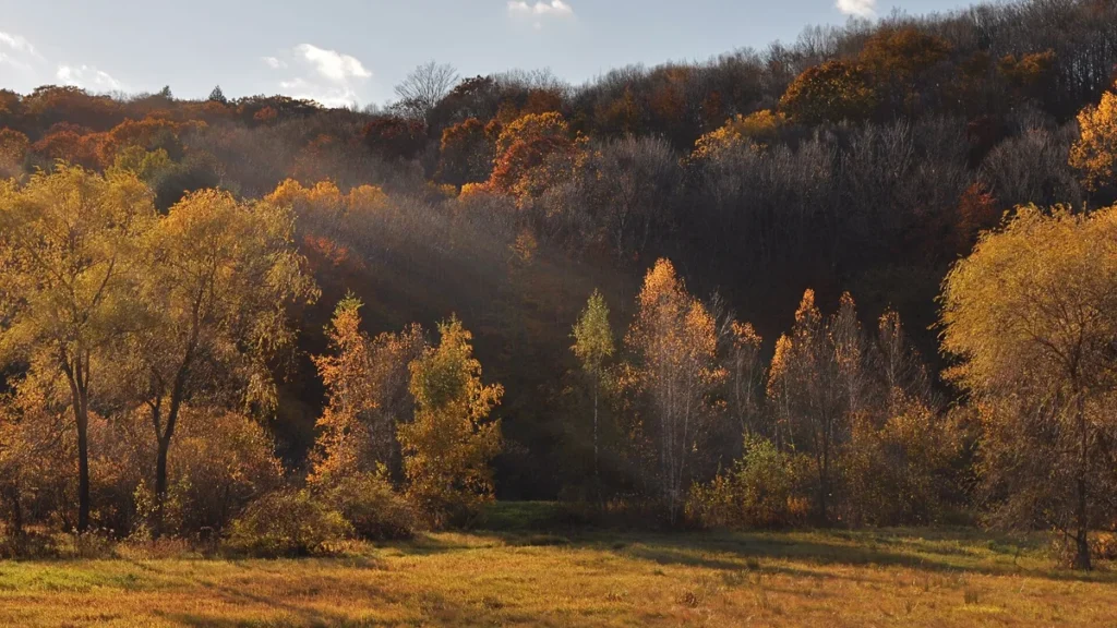
A huge share of blue ridge parkway road trip traffic comes for one thing: fall color. The timing varies by elevation, and getting it right is the difference between peak brilliance and brown leaves:
| Elevation | Section | Typical peak color |
|---|---|---|
| 5,000–6,000 ft | Mount Mitchell, Craggy Gardens, Graveyard Fields, Waterrock Knob | Early to mid-October |
| 3,500–5,000 ft | Linn Cove, Blowing Rock, Pisgah | Mid to late October |
| 2,000–3,500 ft | Peaks of Otter, Doughton Park, Asheville area | Late October |
| Below 2,000 ft | Rockfish Gap, Roanoke Valley, Cherokee lowlands | Late October to early November |
The practical strategy: in mid-October, stay high; in late October, work the middle elevations; in early November, the lowlands still glow. Check the NPS fall color reports and the various Blue Ridge fall-color trackers starting in late September. And book fall lodging 4–6 months ahead — October weekends in Asheville, Blowing Rock, and the Peaks of Otter area sell out completely.
Where to Stay on the Blue Ridge Parkway
There are only two lodges actually on the parkway, so most travelers base in gateway towns:
| Base | Milepost area | Why stay here |
|---|---|---|
| Waynesboro / Charlottesville, VA | MP 0–30 | Start of the route; Charlottesville has great food |
| Bedford / Peaks of Otter Lodge | MP 86 | The on-parkway lodge experience; book far ahead |
| Roanoke, VA | MP 110–120 | Real city with hotels at every price, Mill Mountain Star |
| Floyd, VA | MP 165–175 | Music town — Friday Night Jamboree at the country store |
| Blowing Rock / Boone, NC | MP 290–305 | Charming towns, Grandfather Mountain access |
| Asheville, NC | MP 382–384 | Biltmore, food scene, breweries — plan 1–2 nights |
| Pisgah Inn (on parkway) | MP 408 | The only other on-parkway lodge; sunset views, no TVs |
| Cherokee / Bryson City, NC | MP 460–469 | End of the route; Smokies access, elk viewing |
Camping is plentiful and cheap: eight NPS campgrounds line the parkway (Otter Creek, Peaks of Otter, Roanoke Mountain, Rocky Knob, Doughton Park, Julian Price, Linville Falls, Mount Pisgah, Crabtree Falls — most open May through October, first-come or reservable depending on the site). Backcountry camping requires no permit on most parkway-adjacent national forest land, but check current rules.
What to Eat: Mountain Food Along the Parkway
Parkway dining is part of the experience. Do not miss: the restaurant at Peaks of Otter Lodge (trout and blackberry cobbler with the lake view), Mabry Mill’s restaurant for buckwheat pancakes in season, the Pisgah Inn dining room at sunset (reservations essential — the view tables go first), and any roadside stand selling boiled peanuts, apple butter, or fresh cider in fall. In Asheville, the food scene punches absurdly above the city’s weight: farm-to-table restaurants, legendary barbecue, and more breweries per capita than almost anywhere in America. In the small towns, look for “meat and three” diners — the definitive Southern mountain lunch.
Blue Ridge Parkway Road Trip Budget
One of the parkway’s great virtues: it is free. No entrance fee, no tolls. A 4-day blue ridge parkway road trip for two typically costs:
| Category | Budget (per person) | Mid-range (per person) |
|---|---|---|
| Lodging (3 nights, shared) | $75 (camping) | $300–$450 |
| Food (4 days) | $120 (groceries + diners) | $200–$300 |
| Gas (~600 miles total) | $70–$100 | |
| Attractions (Biltmore, Grandfather Mtn) | $0–$30 | $90–$150 |
| 4-day total per person | ~$265–$325 | ~$660–$1,000 |
The parkway is one of the cheapest great American road trips precisely because the main attraction — the road itself — costs nothing. Splurge selectively: one dinner at the Pisgah Inn, one night at Peaks of Otter Lodge, and the Biltmore if architecture and gardens are your thing.
Extending Your Blue Ridge Parkway Road Trip
- Skyline Drive + Shenandoah National Park (north end): 105 miles of ridgetop driving through Shenandoah; combine for a 574-mile continuous mountain drive.
- Great Smoky Mountains National Park (south end): America’s most visited national park begins where the parkway ends — Cades Cove, Clingmans Dome, and the elk of Oconaluftee.
- The Tail of the Dragon (near Cherokee): US-129’s 318 curves in 11 miles — a pilgrimage for motorcycle and sports-car enthusiasts.
- Biltmore Estate (Asheville): allow a full day; the house, gardens, and winery justify the ticket price.
- Great Smoky Mountains Railroad (Bryson City): scenic rail excursions through the Nantahala Gorge.
Frequently Asked Questions About a Blue Ridge Parkway Road Trip
How long does it take to drive the whole Blue Ridge Parkway?
The 469 miles take about 10–12 hours of pure driving at parkway speeds, but plan 3–4 days minimum to actually experience it. Most first-timers spend 4 days with overnights in the Peaks of Otter/Roanoke area, Blowing Rock, and Asheville.
When is the best time for a blue ridge parkway road trip?
Mid-to-late October for fall foliage (book lodging months ahead), May–June for wildflowers and rhododendron blooms, and September for the best weather-to-crowd ratio. Winter brings closures; check the NPS closure map. Summer offers cool mountain air but afternoon thunderstorms at high elevations.
Is the Blue Ridge Parkway free?
Yes — there is no entrance fee or toll. It is the rare great American road trip where the main attraction costs nothing. Budget instead for lodging, food, gas, and optional attractions like Biltmore and Grandfather Mountain.
Are there gas stations on the Blue Ridge Parkway?
No. There are no gas stations, and no food or lodging except the two lodges, on the parkway itself. Fill up in gateway towns (Waynesboro, Roanoke, Blowing Rock, Asheville, Cherokee) and never let the tank drop below half in the remote southern sections.
Can I drive the parkway in an RV?
Yes, with caveats: 25 tunnels, some with low clearance (the lowest is around 10’6″ at certain tunnels — check the NPS tunnel height list against your rig), and many overlooks cannot fit large vehicles. Vehicles over 30 feet will find the southern high-elevation sections stressful. Most RVers do fine but plan fuel and parking carefully.
What is the speed limit on the Blue Ridge Parkway?
45 mph maximum, 25 mph in developed areas, strictly enforced by NPS rangers. The limit is part of the design — the road was engineered for slow scenic driving, and the curves genuinely require it.
Where should I stay overnight on the parkway?
The two on-parkway lodges (Peaks of Otter Lodge at MP 86 and Pisgah Inn at MP 408) book out far in advance. Most travelers stay in gateway towns: Roanoke, Blowing Rock/Boone, Asheville (1–2 nights), and Cherokee. NPS campgrounds are plentiful May–October.
Is the parkway open in winter?
Partially. The NPS closes sections due to ice and snow and does not plow like an interstate — closures can last weeks, especially at high elevations. The low-elevation Virginia sections stay open most often. Always check the current NPS road closure map before a winter trip.
How does the Blue Ridge Parkway compare to Skyline Drive?
They connect end-to-end and are often driven together. Skyline Drive (105 miles through Shenandoah) charges an entrance fee and feels more like a national park road; the parkway is free, longer, more varied, and passes through real mountain towns. Do both if you can — the combined drive is 574 miles of continuous Appalachian ridgetop.
What wildlife will I see?
White-tailed deer are ubiquitous (drive carefully at dawn and dusk). Black bears are common in the southern sections — never feed them and store food properly when camping. Elk graze at Oconaluftee near the Cherokee end, especially mornings and evenings. Wild turkeys, hawks, and in spring, a riot of songbirds.
For more mountain driving, see our 15 best scenic road trips in the USA, and if fall color is your thing, our best fall road trips in the USA covers 15 more routes. Planning a bigger loop? Our 25 best road trips in the USA has the full bucket list.