

Searching for hiking trails near me is how most great hikes begin — but the difference between a magical morning on a perfect trail and a frustrating bushwhack to nowhere comes down to knowing where to look and how to read what you find. Google Maps will show you green blobs; this guide shows you how to turn those blobs into actual adventures. You’ll learn the best apps and websites for discovering trails (and how their filters actually work), how to decode trail ratings, reviews, and elevation profiles like a pro, where locals find the hidden gems that never make the top-10 lists, and the safety checks to run before you lace up. By the end, you’ll be able to find a great hike within an hour of anywhere in America.
The 7 Best Ways to Find Hiking Trails Near You
1. AllTrails (Best Overall Trail Finder)
AllTrails is the dominant trail database for a reason: millions of user-submitted trails with GPS tracks, photos, reviews, and difficulty ratings, searchable by location. Type your city or use your phone’s GPS, then filter by distance, elevation gain, difficulty, dog-friendliness, wheelchair accessibility, waterfalls, and more. The killer feature is recent reviews — sort by newest to learn about current conditions (mud, closures, bugs, crowds) that no static guide can give you. The free tier is genuinely useful; the paid tier adds offline maps and wrong-turn alerts. Always cross-check a trail’s stats against a second source before committing to a long or remote hike.
2. Hiking Project (Best Free Maps, by REI)
REI’s Hiking Project offers meticulously curated trail data with excellent topographic detail and is completely free. Its trail pages tend to be more accurate than crowd-sourced alternatives for route descriptions, and the “featured hikes” for each area are a great shortcut to the local classics. Pair it with AllTrails — where AllTrails has breadth and fresh reviews, Hiking Project has editorial quality.
3. Gaia GPS (Best for Backcountry Navigation)
When your ambitions grow beyond well-marked day hikes, Gaia GPS is the tool serious hikers swear by: professional-grade topo maps, slope-angle shading, public-land boundaries, and reliable offline downloads. It’s overkill for a city nature loop and essential for wilderness routes. The free version handles basics; the premium unlocks the full map catalog.
4. Google Maps (Fastest Quick Check)
Don’t dismiss it: searching “hiking trails near me” in Google Maps surfaces parks, trailheads, photos, hours, and reviews in seconds, and it’s unbeatable for logistics — driving time, parking situations, and whether the “trail” is actually a paved greenway. Use it for discovery and directions, then verify trail details in a dedicated hiking app.
5. Your State/County Parks Website (Most Authoritative)
For trails in public parks, the managing agency’s website is the ground truth: official trail maps, closure alerts, permit requirements, and hunting-season notices that apps sometimes miss. Many state park systems now have excellent interactive trail maps. Bookmark your state’s parks site — and browse our roundup of the best state parks in the USA for destination-worthy trail systems worth a road trip.
6. Local Hiking Clubs and Meetup Groups (Best Hidden Gems)
The trails locals love rarely top app leaderboards. Hiking clubs, Meetup groups, and regional Facebook groups are goldmines for the unmarked waterfall spur, the wildflower meadow at peak bloom, and the “don’t go on weekends” beta that saves trips. Many clubs welcome newcomers on group hikes — the fastest way to learn an area’s trail network from people who’ve walked all of it.
7. The NPS App and Visitor Centers (Best for National Parks)
Inside national parks, the official NPS app (with downloadable park content for offline use) plus the paper map from the visitor center beats any third-party app for accuracy. Rangers will also tell you which popular trails to skip and which quiet alternatives deliver the same views — ask them; it’s literally their job and they love it.
How to Read a Trail Listing Like a Pro
Finding trails is step one; evaluating them is the skill. Here’s how to decode the numbers:
| Metric | What It Tells You | Beginner Sweet Spot |
|---|---|---|
| Distance (round-trip?) | Check whether the listed distance is one-way or total — apps differ. “Out & back” doubles; “loop” and “point to point” don’t. | 2–5 miles total |
| Elevation gain | Total climbing, the real difficulty driver. 500 ft over 3 miles is gentle; 2,000 ft over 3 miles is brutal. | Under 800 ft |
| Difficulty rating | Crowd-sourced and inconsistent — “moderate” in Colorado ≠ “moderate” in Florida. Use it as a rough filter only. | Easy to moderate |
| Route type | Loop (no backtracking), out & back (see it twice), point-to-point (needs shuttle) | Loop or out & back |
| Elevation profile | The graph of the hike — look for where the climbing concentrates. A flat-then-wall profile hikes very differently from steady grade. | Steady, no spikes |
| Recent reviews | Current conditions: mud, snow, blowdowns, closures, crowds, bugs. Sort newest-first; ignore anything over a year old for conditions. | No red flags in last 30 days |
| Photos | Reality check on scenery and trail character — but note the season they were taken | Matches your expectations |
The Elevation-Gain Rule of Thumb
A useful heuristic: every 1,000 feet of elevation gain hikes roughly like an extra 1.5–2 miles of flat distance in effort. So a “4-mile” hike with 2,000 feet of gain will feel like 7–8 miles to a beginner. This single insight prevents more miserable hikes than any other — a short, steep trail can humble fitter hikers than a long, flat one.
Matching Trails to Your Fitness and Experience
- True beginners: 1–3 miles, under 500 ft gain, well-marked trails in parks with facilities. Rail-trails and nature-center loops are perfect.
- Building up: 3–6 miles, 500–1,200 ft gain. Start adding elevation deliberately — it’s the variable that matters most.
- Comfortable day hikers: 6–10 miles, 1,500–2,500 ft gain. You’re ready for most “classic” day hikes in the national parks.
- Ambitious: 10+ miles or 3,000+ ft gain, possible scrambling or exposure. Build up over a season, not a weekend.
Be honest about your current level, not your aspirational one. There’s no shame in a 2-mile waterfall walk — the hikers having the most fun are the ones on trails matched to their ability. And remember that altitude, heat, and pack weight all tax you more than expected; a sea-level hiker’s first 8,000-foot trail will feel dramatically harder than the numbers suggest.
Finding Hidden Gems the Apps Don’t Surface
The most-reviewed trails are often the most crowded. To find the quiet ones:
- Zoom out on the map view. In AllTrails or Gaia, browse the map instead of the ranked list — unnamed or lightly-reviewed trails near famous ones are often equally good and empty.
- Ask at local outdoor shops. Gear-shop staff hike constantly and love sharing beta. Buy some socks; get a trail tip worth ten times the price.
- Check land-trust and conservancy websites. Local land trusts protect thousands of small preserves with lovely trails that never appear in national databases.
- Hike on weekdays or at sunrise. The same trail can feel like a wilderness at 7 AM Tuesday and a theme park at 11 AM Saturday. Timing is a trail-finding strategy.
- Explore the “second” trailhead. Popular destinations often have alternate trailheads or longer approaches that 90% of visitors skip — same summit, fraction of the people.
Pre-Hike Safety Checks (5 Minutes That Prevent Rescues)
Most hiking emergencies are preventable with a quick routine before you leave the trailhead:
- Check the weather for the trail’s elevation — mountain forecasts differ wildly from town forecasts; afternoon thunderstorms are clockwork in the Rockies and Southwest in summer.
- Tell someone your plan — trail name, expected return time, and what to do if you’re overdue. A text takes 30 seconds and is the single highest-value safety action.
- Download offline maps — assume zero cell signal, because on many trails that’s exactly what you’ll get.
- Scan recent reviews for closures and hazards — washed-out bridges, aggressive wildlife, and hunting seasons all show up in reviews before they show up anywhere official.
- Pack the ten essentials — navigation, sun protection, insulation, illumination, first aid, fire, repair, nutrition, hydration, emergency shelter. Even for “just a short loop.”
- Know sunset time — and turn around at the halfway point of your daylight, not the halfway point of the trail.
Trail Etiquette: The Unwritten Rules
- Uphill hikers have the right of way. Step aside for those climbing — they’re working harder than you.
- Leave No Trace: pack out everything (yes, including tissues and fruit peels), stay on trail, and don’t stack rocks or carve trees.
- Yield to horses, and be predictable around mountain bikers on multi-use trails.
- Keep dogs leashed where required — and even where not, recall must be rock-solid around wildlife, livestock, and other hikers.
- Quiet down at viewpoints and around wildlife. Everyone came for the same peace you’re enjoying; don’t narrate it at full volume.
- Don’t geotag fragile spots. Viral locations get loved to death — share the experience, protect the place.
What to Bring on Your First Few Hikes
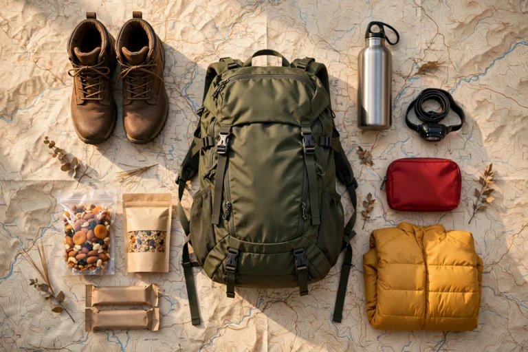
You don’t need expedition gear for local trails, but don’t go empty-handed either. The starter kit: comfortable broken-in shoes with grip (not fashion sneakers), 1–2 liters of water, snacks, sun protection, a charged phone with the trail map downloaded, a small first-aid kit with blister care, and a layer for weather changes. Toss in a headlamp once your hikes exceed two hours — “quick” hikes run long more often than anyone admits. As your ambitions grow toward bigger destinations, our best hiking trails in the USA roundup showcases the classic trails worth training for.
Frequently Asked Questions
What is the best app for finding hiking trails near me?
AllTrails has the largest trail database and most useful review system for most hikers. Hiking Project (by REI) offers excellent free maps with more curated accuracy, and Gaia GPS is the choice for backcountry navigation. Use AllTrails for discovery and cross-check details in a second source.
How do I find easy hiking trails near me as a beginner?
In AllTrails, filter by “easy” difficulty, set max distance to 3–5 miles, and cap elevation gain under 500–800 feet. Then sort by recent reviews to confirm current conditions. Local nature centers and rail-trails are also reliably beginner-friendly and rarely appear challenging in any database.
Are the difficulty ratings on hiking apps accurate?
Only roughly. Ratings are crowd-sourced and regional — a “moderate” in the Rockies may be harder than a “hard” in the Midwest. Ignore the label and read the actual numbers: distance plus elevation gain, plus the elevation profile graph, tells the true story.
How can I find dog-friendly hiking trails near me?
AllTrails has a dedicated dog-friendly filter, and it’s the fastest way to search. Always verify leash rules on the managing agency’s site, since rules change and app data lags — national parks, in particular, heavily restrict dogs on trails.
What should I do if a trail is harder than expected?
Turn around — there’s no shame in it, and it’s the mark of an experienced hiker, not a failed one. The mountain will be there next time. Note what surprised you (elevation? exposure? distance?) and use it to calibrate your next choice.
Can I trust GPS tracks from other hikers?
Mostly, but verify. Downloaded tracks occasionally include wrong turns, bushwhacks, or outdated reroutes. Compare the track against the official park map, and if they disagree significantly, trust the official map and recent reviews over a stranger’s GPS file.
How do I find hiking trails near me without cell service?
Download offline maps and trail data over WiFi before you leave (AllTrails+, Gaia GPS, and the NPS app all support this). Your phone’s GPS works without cell signal, so pre-downloaded maps keep you navigated deep in the backcountry.
When is the best time of day to hike local trails?
Early morning wins on every axis: cooler temperatures, better wildlife, softer light for photos, and far fewer people. For popular trails, a 7 AM start can mean having a famous viewpoint to yourself that would be packed by 10.
More Trail-Finding Questions, Answered
How do I find wheelchair-accessible hiking trails near me?
AllTrails has an accessibility filter, and many state and county park websites now mark ADA-accessible trails explicitly. Look for keywords like “paved,” “boardwalk,” “accessible,” and “barrier-free” in trail descriptions. The best accessible trails are often around park visitor centers and lakes — call the park to confirm current surface conditions, since “accessible” on paper sometimes meets reality imperfectly after storms.
Where can I find trails for trail running vs. hiking?
Most hiking apps work for runners too — filter for smoother, less-technical routes with moderate grades. Local running clubs and Strava’s segment explorer reveal the routes runners actually use, which often differ from hikers’ favorites. Rail-trails and park multi-use paths are ideal starting points before you graduate to technical singletrack.
How do I find trails that allow off-leash dogs?
Search AllTrails with the dog-friendly filter, then look for “off-leash” in reviews — but always verify against the managing agency’s current rules, which change frequently. Dedicated off-leash trail systems are rare; more commonly you’ll find voice-control areas within larger parks. When in doubt, leash up — it’s the default expectation on shared trails.
What is the best way to find waterfall hikes near me?
Use the waterfall filter in AllTrails or Hiking Project, then check recent reviews and photos for current flow — waterfalls are seasonal, and a “stunning cascade” in April can be a damp cliff in August. Local tourism sites often maintain waterfall trail roundups with seasonal flow guidance that’s more current than app data.
How can I find less-crowded alternatives to famous trails?
Look at the map view around any famous trailhead: nearby lesser-known trails with few reviews are often just as scenic. Hiking the famous trail on a weekday or at sunrise achieves the same uncrowded effect. Local hiking clubs and gear shops are the best source of “like X, but empty” recommendations.
Should I pay for AllTrails+ or a similar premium tier?
If you hike more than once a month, yes — offline maps alone justify it the first time you lose signal mid-hike. Wrong-turn alerts and downloadable layers for weather and air quality are genuinely useful. If you’re an occasional park-loop walker, the free tier plus a paper park map is plenty.
How do I check if a trail is closed before I go?
Check three sources in order: the managing agency’s website or social media (most current), recent app reviews (crowd-sourced ground truth), and a phone call to the ranger station for remote or high-stakes hikes. Closures from fires, floods, and trail work often appear on agency sites days before they propagate to apps.
Can I find good hiking trails near me in a flat state?
Absolutely — flat states hide excellent hiking in river valleys, coastal dunes, prairie preserves, and forested ravines. Adjust your filters toward distance and scenery rather than elevation gain, and look for state natural areas and wildlife refuges, which often have the best trail networks in flat regions. A 6-mile prairie hike at golden hour rivals any mountain view.