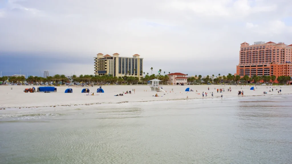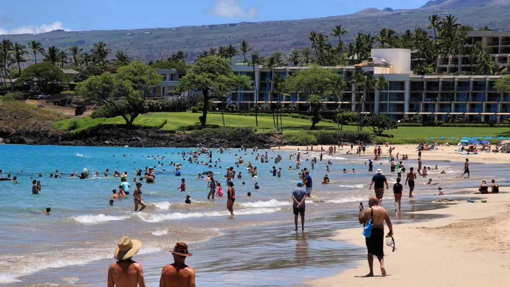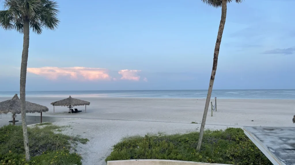
Research reviewed September 26, 2026. Conditions and access can change; recheck the linked local authorities before travel.
The best beaches in California include busy Southern California strands, smaller Orange County coves, broad Central Coast shores and rugged northern beaches where a walk is often the main attraction. Treating all of them as warm-water swimming destinations makes planning harder. Even a sunny day can bring cool Pacific water, afternoon wind, fog, strong surf or a water-quality advisory.
This guide selects 20 beaches from San Diego County to Humboldt County, balancing recognizable first-visit options with places suited to nature walks, tide-pool observation and coastal scenery. Each profile explains the setting, access, facilities, accommodation base and a practical limitation. The comparison table follows the same order as the numbered map, making it easier to build a regional stay without turning the whole state into one rushed drive. Use the suggested seasons as broad planning context, then check local weather, surf, tide and closure notices. A scenic shoreline can be an excellent trip choice even when entering the water is inappropriate.
Beach comparison at a glance
Swipe the table sideways on mobile. Numbers match the map and profiles.
| Beach / map number | Best for | Best time | Water / suitability |
|---|---|---|---|
| 1. Coronado Central Beach San Diego County |
Broad sand and a town base | Late spring to early autumn | Cool Pacific water; check county water-quality notices |
| 2. La Jolla Shores San Diego County |
An urban sand beach with organized water activities | Summer or early autumn | Separate swimming, surf and boat zones; conditions vary |
| 3. Torrey Pines State Beach San Diego County |
Sand beneath coastal bluffs | Spring or autumn for mixed walking | Cold water and surf; avoid cliff bases and hazardous sections |
| 4. Moonlight State Beach Encinitas, San Diego County |
Convenient town beach and facilities | Summer or early autumn | Surf conditions vary; consult patrol |
| 5. South Carlsbad State Beach Carlsbad, San Diego County |
Bluff-top camping and coast time | Late spring to early autumn | Cold water, surf and changing sand levels |
| 6. Crystal Cove State Park Orange County |
Coves, tide pools and historic beach cottages | Spring or autumn; tide-aware | Surf and rocky areas; conditions vary |
| 7. Main Beach, Laguna Beach Orange County |
Beach beside a compact arts town | Summer or early autumn | Ask lifeguards about current zones and surf |
| 8. Huntington City Beach Orange County |
Surf culture and a pier district | Summer or early autumn | Breaking waves; use designated areas and local advice |
| 9. Manhattan Beach Los Angeles County |
Town, pier and beach walking | Summer or early autumn | Open Pacific surf; check local conditions |
| 10. Santa Monica State Beach Los Angeles area |
Beach, pier and car-light city time | Summer or early autumn | Surf and water-quality notices govern swimming |
| 11. Zuma Beach Malibu, Los Angeles County |
A broad open beach day | Summer or early autumn | Strong surf and rip currents can occur |
| 12. Leo Carrillo State Park Beach Western Malibu coast |
Coves and tide-pool observation | Spring or autumn; low-tide planning | Rocky areas and surf; no casual cave access in rising water |
| 13. Carpinteria State Beach Santa Barbara County |
Town-adjacent camping and beach days | Summer or early autumn | Conditions vary; no beach has guaranteed safe water |
| 14. Pismo State Beach Grover Beach/Oceano, Central Coast |
Long shore walks and coastal camping | Spring or autumn for walks | Cold water and exposed surf; assess locally |
| 15. Morro Rock Beach Morro Bay, Central Coast |
Landmark scenery and surf watching | Spring or autumn | Exposed surf; do not treat harbor water as a swimming shortcut |
| 16. Carmel Beach Carmel-by-the-Sea, Central Coast |
Scenic walking and a compact town | Spring or autumn; layers year-round | Cold water and hazardous waves; scenery-focused |
| 17. Asilomar State Beach Pacific Grove, Monterey Peninsula |
Coastal trails, dunes and rocky views | Spring or autumn | Cold exposed water; primarily a walking visit |
| 18. Baker Beach San Francisco, Bay Area |
Golden Gate views from the sand | Spring or autumn; fog-dependent | Not recommended for swimming: rip currents, cold water and shorebreak |
| 19. Limantour Beach Point Reyes, Northern California |
Long walks, dunes and birding | Spring or autumn | Very cold water; conditions vary despite a more sheltered aspect |
| 20. Trinidad State Beach Humboldt County, Northern California |
Forest-to-coast walking and sea stacks | Summer or early autumn | Swimming not advised; cold water and sneaker waves |
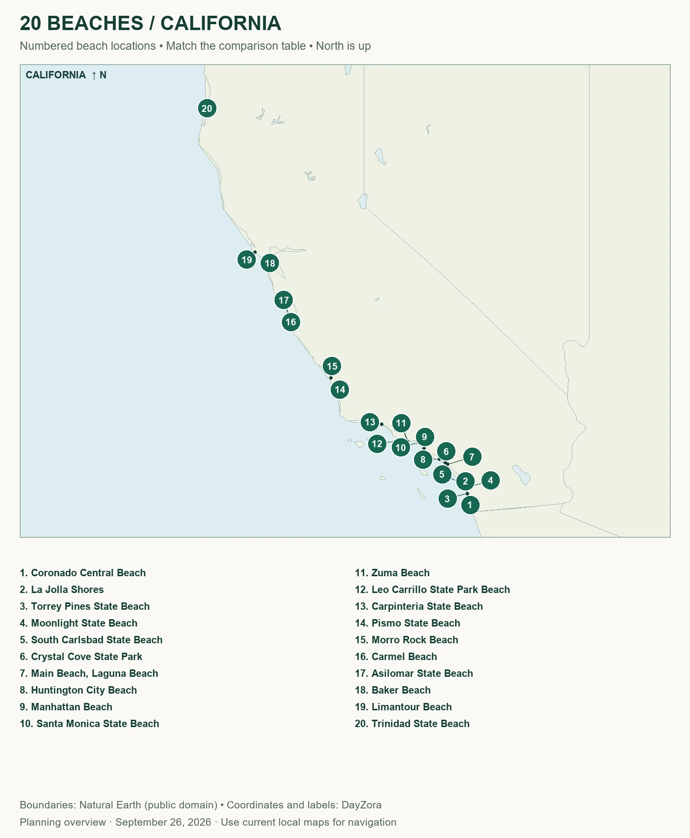
Where the beaches are
Swipe within the map or open the full-size map. Numbers match the main list; markers show approximate beach locations, not entrances or routes.
20 beaches to consider
1. Coronado Central Beach
- Location: San Diego County
- Best for: Broad sand and a town base
- Suggested trip: Half to one day; 2–4 nights in the area
- Best time: Late spring to early autumn
- Swimming: Cool Pacific water; check county water-quality notices
- Lifeguards: City year-round service; confirm staffed zone
- Getting there / access: Use signed Ocean Boulevard access and legal parking
- Facilities: Restrooms and showers; village food nearby
- Budget: Moderate–high lodging
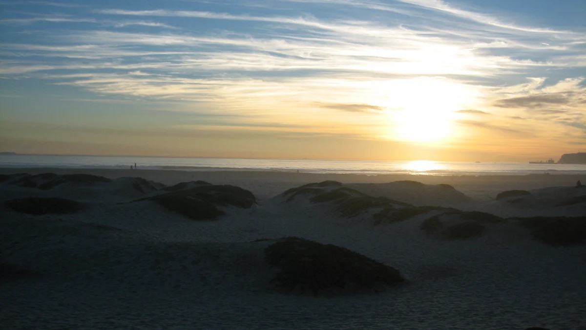
Why visit: Coronado is a practical choice when a beach stay must also support museums, the zoo and restaurants. Its broad sand provides a different experience from San Diego’s small coves.
Beach experience: The developed shoreline combines open sand with a residential and hotel backdrop. A pleasant town walk can be part of the same day.
Best things to do: Build sandcastles, walk the beach or explore the village. Put mainland attractions on another day so the bridge journey does not dominate a short visit.
When to go: Late spring through early autumn suits longer beach days, with possible coastal cloud. Winter is useful for walks; sunshine alone does not establish comfortable swimming temperatures.
Where to stay: Central Coronado for walking to meals; San Diego for a wider city itinerary and a separate beach journey.
Planning tip: Check both surf and water-quality notices immediately before visiting. A staffed lifeguard station does not override a water-contact advisory or closure.
Check current details: Coronado Central Beach visitor information.
2. La Jolla Shores
- Location: San Diego County
- Best for: An urban sand beach with organized water activities
- Suggested trip: Half to one day; 2–4 nights in the area
- Best time: Summer or early autumn
- Swimming: Separate swimming, surf and boat zones; conditions vary
- Lifeguards: Permanent city station; confirm daily patrol area
- Getting there / access: Public streets and Shores parking; arrive early on busy days
- Facilities: Restrooms, showers and adjacent park facilities
- Budget: Moderate
Why visit: La Jolla Shores offers a broad sandy alternative to the rocky La Jolla Cove area. It is useful for a beach morning supported by nearby neighborhood food and organized activities.
Beach experience: A gently curving sand beach sits beside Kellogg Park. This is a busy recreation shoreline with multiple users, not a private-feeling hideaway.
Best things to do: Walk, picnic or book a guided kayak or surf session with an operator who assesses conditions. A paid activity should replace part of the beach day rather than fill every remaining hour.
When to go: Summer and early autumn are practical for longer visits. Morning marine cloud can be part of the experience; winter swells may change the activity choice entirely.
Where to stay: La Jolla Shores for a short walk to the sand; other San Diego neighborhoods for a broader city base.
Planning tip: The Shores and the Cove are different places. Do not use a Cove photograph, parking plan or wildlife-viewing description as though it belongs to this beach.
Check current details: La Jolla Shores visitor information.
3. Torrey Pines State Beach
- Location: San Diego County
- Best for: Sand beneath coastal bluffs
- Suggested trip: Half to one day; 2–4 nights in the area
- Best time: Spring or autumn for mixed walking
- Swimming: Cold water and surf; avoid cliff bases and hazardous sections
- Lifeguards: State lifeguard service; verify staffed area
- Getting there / access: Use designated north/south beach parking; day-use charges vary
- Facilities: Parking and restrooms at developed access areas
- Budget: Low–moderate day costs
Why visit: Torrey Pines is for travelers who want the relationship between beach and bluffs to be the main attraction. A reserve walk can complement the shore if trails and conditions permit.
Beach experience: Sand lies below eroding coastal cliffs, with a more exposed feel than a sheltered urban park. Space on the beach can shrink with the tide.
Best things to do: Take a beach walk or choose a marked reserve trail. These are separate access decisions: do not scramble up the bluff as a shortcut.
When to go: Spring and autumn favor walking. Low tide can provide more room, but swell and cliff instability still matter; winter storms can alter access.
Where to stay: Del Mar, La Jolla or northern San Diego, depending on the rest of the trip.
Planning tip: Do not sit directly beneath unstable cliffs or assume you can round a headland on the return walk. Check tide timing and park warnings before setting off.
Check current details: Torrey Pines State Beach visitor information.
4. Moonlight State Beach
- Location: Encinitas, San Diego County
- Best for: Convenient town beach and facilities
- Suggested trip: Half to one day; 2–4 nights in the area
- Best time: Summer or early autumn
- Swimming: Surf conditions vary; consult patrol
- Lifeguards: Verify city staffing and current hours
- Getting there / access: Signed beach parking and surrounding town access
- Facilities: Restrooms, showers, playground and picnic/sport facilities
- Budget: Low–moderate day costs
Why visit: Moonlight suits a short, uncomplicated beach visit with food and town services nearby. It is a stronger default for a mixed-age group than a secluded access with a steep stair descent.
Beach experience: A sandy pocket at the end of town has a sociable recreation-park atmosphere. Peak weekends can feel busy even when the wider coast looks spacious.
Best things to do: Spend time on the sand, use the playground or explore Encinitas on foot. Arrange surf instruction separately and let the instructor choose suitable conditions.
When to go: Summer and early autumn suit extended visits, though marine-layer mornings remain possible. Cooler months can be good for a town-and-beach walk.
Where to stay: Central Encinitas for walking convenience; another North County town if your itinerary includes several coastal stops.
Planning tip: Choose this specific access when facilities are the priority. Other Encinitas beaches have different stair, parking and service arrangements despite sharing the same town name.
Check current details: Moonlight State Beach visitor information.
5. South Carlsbad State Beach
- Location: Carlsbad, San Diego County
- Best for: Bluff-top camping and coast time
- Suggested trip: Half to one day; 2–4 nights in the area
- Best time: Late spring to early autumn
- Swimming: Cold water, surf and changing sand levels
- Lifeguards: Verify seasonal patrol and staffed section
- Getting there / access: Campground and day-use access differ; stairs lead from bluff areas
- Facilities: Campground restrooms/showers; check day-use facilities at chosen access
- Budget: Low–moderate with camping; other lodging varies
Why visit: South Carlsbad is a good fit when camping is part of the holiday rather than just a way to reduce the room bill. The bluff-top setting distinguishes it from a flat urban boardwalk.
Beach experience: The shoreline lies below the campground and coastal bluff. Sand width changes, and carrying equipment up and down is part of the visit.
Best things to do: Use a beach morning and keep a LEGOLAND or village outing for a separate block. Avoid planning every afternoon as a second major excursion.
When to go: Late spring through early autumn suits a coastal camping trip, with cool evenings possible. Reserve ahead for popular dates and check current stair access.
Where to stay: A reserved state-beach campsite or Carlsbad accommodation chosen by its actual beach access.
Planning tip: Stairs make this a weaker choice for a stroller-heavy day. Confirm a suitable alternative access rather than assuming every Carlsbad beach has the same approach.
Check current details: South Carlsbad State Beach visitor information.
6. Crystal Cove State Park
- Location: Orange County
- Best for: Coves, tide pools and historic beach cottages
- Suggested trip: Half to one day; 2–4 nights in the area
- Best time: Spring or autumn; tide-aware
- Swimming: Surf and rocky areas; conditions vary
- Lifeguards: Verify staffed beach section and season
- Getting there / access: Signed lots off Pacific Coast Highway; trails or historic-district access
- Facilities: Restrooms and food in the historic district; facilities vary by cove
- Budget: Moderate day costs
Why visit: Crystal Cove combines a beach landscape with a historic cottage district, creating a useful alternative to the busier pier beaches. Choose one access rather than trying to cover every cove.
Beach experience: Sandy coves sit beneath coastal bluffs, interrupted by rocky intertidal areas. The historic district has a different atmosphere from the park’s quieter stretches.
Best things to do: Walk the beach, observe tide pools without touching organisms, or explore the historic district. A backcountry hike is another outing, not a compulsory add-on.
When to go: Spring and autumn can suit walking; summer brings more demand for parking. Tide-pool visibility requires the current tide table and appropriate wave conditions.
Where to stay: Laguna Beach or Newport Beach; historic cottages are a separate reservation challenge, not guaranteed accommodation.
Planning tip: Check which parking lot serves your intended beach. A place marked “Crystal Cove” can still involve a substantial descent, walk or transfer to the district you want.
Check current details: Crystal Cove State Park visitor information.
7. Main Beach, Laguna Beach
- Location: Orange County
- Best for: Beach beside a compact arts town
- Suggested trip: Half to one day; 2–4 nights in the area
- Best time: Summer or early autumn
- Swimming: Ask lifeguards about current zones and surf
- Lifeguards: City patrol; verify current coverage
- Getting there / access: Downtown public parking and pedestrian access
- Facilities: Public restrooms, showers, boardwalk and recreation areas
- Budget: Moderate–high lodging
Why visit: Main Beach is useful for travelers who want galleries, meals and the coast within one compact visit. It offers convenience rather than the seclusion of Laguna’s smaller coves.
Beach experience: A busy sandy town beach centers on its recognizable lifeguard tower, with recreation space behind the shore.
Best things to do: Walk the boardwalk, spend time on the sand and explore downtown. If tide-pool viewing is a priority, use an appropriate nearby location and observe protected marine life without handling it.
When to go: Summer and early autumn are practical for beach time; spring and winter can suit a town-focused visit with a coastal walk.
Where to stay: Central Laguna Beach for walking access; compare parking and distance carefully at hillside properties.
Planning tip: An address in Laguna does not promise an easy route to the sand. Confirm stairs and slope at the particular beach access before booking for limited mobility.
Check current details: Main Beach, Laguna Beach visitor information.
8. Huntington City Beach
- Location: Orange County
- Best for: Surf culture and a pier district
- Suggested trip: Half to one day; 2–4 nights in the area
- Best time: Summer or early autumn
- Swimming: Breaking waves; use designated areas and local advice
- Lifeguards: Verify daily city patrol zones
- Getting there / access: City lots or downtown parking; fees vary
- Facilities: Restrooms, paved coastal path and downtown food
- Budget: Moderate
- Surfing: Use a qualified instructor and a suitable designated area; conditions and ability determine the choice
Why visit: Huntington is a good choice when watching surfing and spending time around a pier are part of the appeal. It is not a promise that the day’s waves suit a first lesson.
Beach experience: Broad sand and a long developed beachfront create a classic Southern California recreation setting. The city beach and neighboring state beaches have different management.
Best things to do: Watch surfers, walk the pier when open, cycle the designated path or arrange a suitable lesson. Stay clear of the pier’s water hazards.
When to go: Summer has a lively event atmosphere and greater parking pressure. Early autumn can work for a less crowded stay, while winter swells suit observation more than casual water plans.
Where to stay: Downtown Huntington Beach for meals and walking; other Orange County bases for a wider road trip.
Planning tip: The tourism authority lists accessible paths, mats and beach wheelchairs at specific locations. Check deployment dates and reservation arrangements instead of assuming full-shore accessibility.
Check current details: Huntington City Beach visitor information.
9. Manhattan Beach
- Location: Los Angeles County
- Best for: Town, pier and beach walking
- Suggested trip: Half to one day; 2–4 nights in the area
- Best time: Summer or early autumn
- Swimming: Open Pacific surf; check local conditions
- Lifeguards: County lifeguards; confirm current staffed section
- Getting there / access: Public parking and pedestrian access around town
- Facilities: Restrooms, nearby food and the Strand path
- Budget: Moderate–high
Why visit: Manhattan Beach works for an LA trip that needs a walkable coastal town rather than another major attraction. The neighborhood itself can be enough for an unhurried half-day.
Beach experience: A broad sandy beach slopes toward the water beneath homes and a compact pier district. Volleyball and the Strand contribute to the active atmosphere.
Best things to do: Walk the pier and Strand, watch volleyball or spend time on the sand. Keep cycling on the appropriate path and water activities within locally advised areas.
When to go: Summer and early autumn generally support longer beach days. Morning cloud and cool wind can still make a layer useful.
Where to stay: Manhattan Beach or the South Bay; staying elsewhere in LA requires a traffic allowance rather than a map-distance calculation.
Planning tip: Decide whether you want the beach, a restaurant visit or both before choosing parking. Repeatedly moving the car can erase the benefit of a relaxed coastal afternoon.
Check current details: Manhattan Beach visitor information.
10. Santa Monica State Beach
- Location: Los Angeles area
- Best for: Beach, pier and car-light city time
- Suggested trip: Half to one day; 2–4 nights in the area
- Best time: Summer or early autumn
- Swimming: Surf and water-quality notices govern swimming
- Lifeguards: Verify staffed county lifeguard zone
- Getting there / access: E Line to downtown then walk, or paid beach/city parking
- Facilities: Restrooms, paths, pier food and numerous nearby services
- Budget: Moderate–high
Why visit: Santa Monica is one of the easier beach choices to combine with an urban LA stay. Transit access and nearby meals can reduce dependence on a car once you arrive.
Beach experience: A very broad sandy shore sits beside a busy pier and city. Areas farther from the pier have a different pace from the central visitor hub.
Best things to do: Walk, use the coastal cycle path or choose a limited pier outing. Treat paid rides as optional rather than the reason every beach hour needs a ticket.
When to go: Summer and early autumn suit beach visits, with crowd and marine-cloud tradeoffs. Cooler months can be rewarding for walking and city activities.
Where to stay: Downtown Santa Monica for walking convenience; another westside base if beach visits are only one part of the trip.
Planning tip: Check the route from the bluff-top city to the beach. A map pin near the ocean can conceal stairs, ramps and a longer approach with equipment.
Check current details: Santa Monica State Beach visitor information.
11. Zuma Beach
- Location: Malibu, Los Angeles County
- Best for: A broad open beach day
- Suggested trip: Half to one day; 2–4 nights in the area
- Best time: Summer or early autumn
- Swimming: Strong surf and rip currents can occur
- Lifeguards: County lifeguards; verify staffed section
- Getting there / access: Designated beach lots along Pacific Coast Highway
- Facilities: Restrooms, showers and developed beach facilities
- Budget: Low–moderate day costs
Why visit: Zuma is a practical Malibu option when a large public beach and recognizable access matter more than an intimate cove. Its openness is also why wind and surf deserve attention.
Beach experience: Wide sand and an exposed Pacific shoreline contrast with Malibu’s smaller, sometimes difficult-to-access beaches.
Best things to do: Walk the shore, picnic where permitted or watch surf from a sensible distance. Consult lifeguards before any swimming plan.
When to go: Summer and early autumn offer longer outdoor days. Winter surf and wind may make this a brief scenery stop rather than a place to spread out for hours.
Where to stay: Malibu for proximity or the western LA area if accommodation choice matters more than a short drive.
Planning tip: The county currently lists the Busch Drive/PCH underpass as closed because of flood sediment; the beach, lots and restrooms remain open. Use designated access and recheck the notice before travel.
Check current details: Zuma Beach visitor information.
12. Leo Carrillo State Park Beach
- Location: Western Malibu coast
- Best for: Coves and tide-pool observation
- Suggested trip: Half to one day; 2–4 nights in the area
- Best time: Spring or autumn; low-tide planning
- Swimming: Rocky areas and surf; no casual cave access in rising water
- Lifeguards: Verify patrol and current conditions
- Getting there / access: State-park parking and signed beach access from PCH
- Facilities: Restrooms, picnic/camping facilities; check current operation
- Budget: Low–moderate day costs
Why visit: Leo Carrillo adds rocky coves and intertidal interest to an LA-area beach trip. It is best when you have time to observe the shoreline rather than simply tick off another Malibu stop.
Beach experience: Sand alternates with rock formations below the coastal slopes. The accessible area can change substantially with tide and swell.
Best things to do: Walk an open stretch and observe tide-pool organisms without collecting or moving them. Choose an inland park activity if the shore is unsuitable.
When to go: Spring and autumn are comfortable for walking, but the current tide and wave forecast matter more than the calendar for rocky shoreline access.
Where to stay: Western Malibu or a reserved park campsite; confirm road conditions before deciding on a farther base.
Planning tip: Do not enter a cove or sea cave without a clear, timely return route. Rising tides and unexpected waves can cut off an apparently straightforward beach walk.
Check current details: Leo Carrillo State Park Beach visitor information.
13. Carpinteria State Beach
- Location: Santa Barbara County
- Best for: Town-adjacent camping and beach days
- Suggested trip: Half to one day; 2–4 nights in the area
- Best time: Summer or early autumn
- Swimming: Conditions vary; no beach has guaranteed safe water
- Lifeguards: Verify season and staffed area
- Getting there / access: State-beach day-use or campground entrance; reservation for overnight stay
- Facilities: Restrooms, showers, drinking water and picnic facilities
- Budget: Low–moderate day costs
Why visit: Carpinteria offers a useful small-town beach base between Ventura and Santa Barbara. It suits a slower trip where a campground or nearby room supports repeated short visits.
Beach experience: Sand, coastal parkland and a town backdrop make the experience more settled than a remote Central Coast stop.
Best things to do: Walk, picnic and explore town. Nearby natural areas can add wildlife observation, with closures and viewing boundaries respected.
When to go: Summer and early autumn suit longer stays, though coastal cloud is possible. Cooler months favor walks and town time over a swimming-centered plan.
Where to stay: Carpinteria for convenience; Santa Barbara or Ventura if city activities dominate the itinerary.
Planning tip: Ignore historical “safest beach” slogans when deciding whether to enter the water. Use the actual day’s conditions, warnings and lifeguard advice.
Check current details: Carpinteria State Beach visitor information.
14. Pismo State Beach
- Location: Grover Beach/Oceano, Central Coast
- Best for: Long shore walks and coastal camping
- Suggested trip: Half to one day; 2–4 nights in the area
- Best time: Spring or autumn for walks
- Swimming: Cold water and exposed surf; assess locally
- Lifeguards: Verify patrol and staffed sections
- Getting there / access: West Grand Avenue pedestrian access or designated campground access
- Facilities: Public restrooms and boardwalk at Grand Avenue; campground services vary
- Budget: Low–moderate
Why visit: Pismo State Beach works for a long coastal walk and a camping-based stay. It should be distinguished from both the downtown Pismo pier district and the adjacent vehicle recreation area.
Beach experience: A long sand-and-dune coast feels more expansive than the Southern California coves. Wind can become a major part of the afternoon.
Best things to do: Walk an appropriate beach section, visit the interpretive center when open or plan seasonal wildlife observation without assuming sightings.
When to go: Spring and autumn are useful for walking; summer can bring fog and crowds. Cool evenings and wind justify layers even when inland weather is hot.
Where to stay: Grover Beach, Oceano or Pismo Beach, choosing by the specific entrance you intend to use.
Planning tip: Use a pedestrian-focused access and check where vehicles are permitted. Do not assume a beach-driving rule at Oceano applies to every nearby sand area.
Check current details: Pismo State Beach visitor information.
15. Morro Rock Beach
- Location: Morro Bay, Central Coast
- Best for: Landmark scenery and surf watching
- Suggested trip: Half to one day; 2–4 nights in the area
- Best time: Spring or autumn
- Swimming: Exposed surf; do not treat harbor water as a swimming shortcut
- Lifeguards: Not confirmed; verify locally
- Getting there / access: Coleman Drive public access near the rock; check parking signs
- Facilities: Town food and developed access nearby; verify restroom operation
- Budget: Low–moderate
Why visit: Morro Rock gives a beach walk a clear focal point. The town’s harbor atmosphere makes this a satisfying overnight stop without requiring a full resort-style beach holiday.
Beach experience: An open sandy shore lies north of the volcanic rock, with a separate harbor environment nearby. Wind and ocean swell shape the experience.
Best things to do: Watch surfers, walk the sand and explore the waterfront afterward. Stay off hazardous jetty areas and do not climb the protected rock.
When to go: Spring or autumn can suit a walking trip. Summer fog is possible, while winter storms can make a distant view preferable to approaching the water.
Where to stay: Morro Bay for a compact coastal stay; nearby Central Coast towns if combining several destinations.
Planning tip: The ocean beach and harbor-side shore are different environments. Choose the correct map pin and do not follow a generic “Morro Bay beach” label into an unintended access.
Check current details: Morro Rock Beach visitor information.
16. Carmel Beach
- Location: Carmel-by-the-Sea, Central Coast
- Best for: Scenic walking and a compact town
- Suggested trip: Half to one day; 2–4 nights in the area
- Best time: Spring or autumn; layers year-round
- Swimming: Cold water and hazardous waves; scenery-focused
- Lifeguards: No lifeguards, according to the city
- Getting there / access: Ocean Avenue sand ramp; additional signed stairways
- Facilities: Restrooms at Ocean Avenue and Santa Lucia area
- Budget: Moderate–high lodging
Why visit: Carmel Beach is a scenery-and-town choice, especially for travelers who value an evening walk and nearby dining more than swimming.
Beach experience: Pale sand curves below cypress-lined streets. The compact town makes the beach easy to pair with galleries and a meal, but the sand approach still requires effort.
Best things to do: Walk the shore or Scenic Pathway and enjoy the coastal view. Keep well back from breaking waves and do not let the town’s gentle atmosphere disguise the ocean’s power.
When to go: Spring and autumn can suit a quieter coastal stay. Fog, wind and cool water remain possible in every season; winter storms deserve extra distance.
Where to stay: Carmel-by-the-Sea for walking convenience; Monterey or Pacific Grove for a broader peninsula trip.
Planning tip: The city confirms there are no lifeguards. Check which stairways are open and use the sand ramp or marked access rather than cutting down fragile bluffs.
Check current details: Carmel Beach visitor information.
17. Asilomar State Beach
- Location: Pacific Grove, Monterey Peninsula
- Best for: Coastal trails, dunes and rocky views
- Suggested trip: Half to one day; 2–4 nights in the area
- Best time: Spring or autumn
- Swimming: Cold exposed water; primarily a walking visit
- Lifeguards: Not confirmed; do not assume a guarded swimming beach
- Getting there / access: Signed coastal access from Sunset Drive area
- Facilities: No beach restrooms or picnic facilities; public restroom in Phoebe Hearst Social Hall across the street
- Budget: Low–moderate day costs
Why visit: Asilomar is valuable for a coastal walk where the shore, dunes and historic grounds form one landscape. It is a good alternative when a conventional sand-and-swim day is not the goal.
Beach experience: Small sandy stretches alternate with rock and dune habitat. The coast feels more rugged than Monterey’s developed waterfront.
Best things to do: Use the coast trail and permitted dune boardwalks, watch waves from a sensible distance and observe marine life without approaching it.
When to go: Spring and autumn can suit walks, but layers are useful throughout the year. Fog and wind can arrive even after a sunny morning elsewhere on the peninsula.
Where to stay: Pacific Grove for nearby access; Monterey for a larger hotel and restaurant choice.
Planning tip: Stay on the maintained route through restored dunes. A boardwalk is an accessibility feature for that route, not a guarantee that every sandy cove can be reached without obstacles.
Check current details: Asilomar State Beach visitor information.
18. Baker Beach
- Location: San Francisco, Bay Area
- Best for: Golden Gate views from the sand
- Suggested trip: Half to one day; 2–4 nights in the area
- Best time: Spring or autumn; fog-dependent
- Swimming: Not recommended for swimming: rip currents, cold water and shorebreak
- Lifeguards: No guarded-swimming assumption
- Getting there / access: Presidio roads/public transport then beach access; limited parking
- Facilities: Restrooms and picnic tables near the developed access
- Budget: Low day costs; city lodging varies
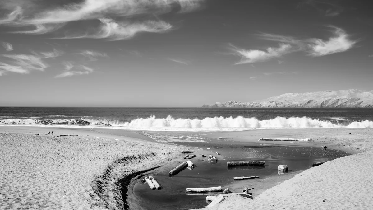
Why visit: Baker is a San Francisco viewpoint with a beach foreground. Choose it for a bridge-and-coast walk rather than as a swimming substitute for Southern California.
Beach experience: Sand lies below the Presidio’s slopes, with the Golden Gate Bridge visible when weather permits. Fog can hide the landmark completely.
Best things to do: Walk, picnic in designated areas and photograph the view from a comfortable distance from the water. The north end has a tradition of clothing-optional use.
When to go: Use a flexible weather window rather than promising a clear bridge view in a certain month. Windproof layers can be useful even in summer.
Where to stay: San Francisco, choosing a neighborhood for the wider trip rather than moving hotels for this short outing.
Planning tip: The NPS specifically warns about powerful rip currents and shorebreak. A sunny photo opportunity is not a reason to enter the water.
Check current details: Baker Beach visitor information.
19. Limantour Beach
- Location: Point Reyes, Northern California
- Best for: Long walks, dunes and birding
- Suggested trip: Half to one day; 2–4 nights in the area
- Best time: Spring or autumn
- Swimming: Very cold water; conditions vary despite a more sheltered aspect
- Lifeguards: No staffed-swimming assumption; verify locally
- Getting there / access: Limantour Road then a path, bridge and sand-dune approach
- Facilities: Parking, vault toilets and picnic tables; bring food and water
- Budget: Low day costs
Why visit: Limantour offers a long shoreline outing within Point Reyes without making a remote backpacking trip necessary. It suits walkers and wildlife observers who can carry their supplies.
Beach experience: A broad sand spit separates Drakes Bay from estuary habitat. Its orientation differs from Point Reyes’ exposed west-facing beaches, but that does not guarantee gentle water.
Best things to do: Walk an appropriate stretch, observe birds and use designated trails. Keep dogs and wildlife interactions within current park rules.
When to go: Spring and autumn can suit walking; wind and fog remain relevant all year. Check beach hazards before treating a calm-looking bay as a swimming opportunity.
Where to stay: Point Reyes Station or nearby communities; reserve lodging ahead for popular weekends.
Planning tip: NPS describes a paved initial path followed by deeper sand and a dune crossing. Do not label the entire trip to the water wheelchair-accessible merely because parking spaces are provided.
Check current details: Limantour Beach visitor information.
20. Trinidad State Beach
- Location: Humboldt County, Northern California
- Best for: Forest-to-coast walking and sea stacks
- Suggested trip: Half to one day; 2–4 nights in the area
- Best time: Summer or early autumn
- Swimming: Swimming not advised; cold water and sneaker waves
- Lifeguards: No guarded-swimming assumption
- Getting there / access: Signed state-park entrance from Trinidad; trail descent
- Facilities: Parking, restrooms and picnic area listed
- Budget: Low day costs
Why visit: Trinidad is a good coastal pause on a redwoods trip. The transition from forest and bluff to beach distinguishes it from California’s southern resort shorelines.
Beach experience: Sand, offshore rocks and conifer-covered slopes create a cool, rugged North Coast setting.
Best things to do: Walk an open trail, view sea stacks and observe tide pools when tides and waves allow. Leave all natural features in place.
When to go: Summer and early autumn generally suit a longer outdoor visit, while fog and cool air remain possible. Winter storms can make shore access inappropriate.
Where to stay: Trinidad for proximity or Arcata/Eureka for a wider choice of lodging and supplies.
Planning tip: The current park notice closes the College Cove access trail from Elkhead Loop and the far western Elkhead Bluff Trail. Use open routes only and recheck the notice; do not build the day around an old trail map.
Check current details: Trinidad State Beach visitor information.
Which beach is right for you?
San Diego County
Coronado and Moonlight suit a developed beach day; La Jolla Shores offers a busy bay setting with organized water activities. Torrey Pines adds scenery and reserve walking. Check county water-quality notices before choosing the day’s beach.
Orange County
Crystal Cove combines beach and bluff scenery, Laguna Main Beach adds town convenience, and Huntington has a broad surf-city setting. Coves, stairs and tide levels can complicate moving between neighboring beaches.
Los Angeles area
Santa Monica and Manhattan work for city-plus-beach visits. Zuma offers more open sand but requires traffic and access planning. Leo Carrillo suits coastal observation when tide and swell permit it.
Central Coast
Carpinteria, Pismo and Morro offer distinct town bases. Carmel and Asilomar work well within a Monterey Peninsula stay. Pack layers and allow time for walking rather than promising daily swimming.
Bay Area and Northern California
Baker is a Golden Gate scenery stop, Limantour a Point Reyes outing and Trinidad a more remote northern-coast choice. Cold water, sneaker waves and changing access are central planning issues, not minor exceptions.
Water conditions, weather and beach rules
Read the local signs and flag legend, ask an on-duty lifeguard and obey closures. Flag meanings can vary between destinations; an attractive photograph or an unstaffed tower is not a safety assessment. Waves, rip currents and shorebreak can affect capable swimmers, and Great Lakes beaches have dangerous currents too. Use the National Weather Service beach guidance before planning water activities. If in doubt, stay out.
Check the responsible health authority’s water-quality notices as well as the weather. Clear-looking water can still have an advisory, and runoff after rain may change conditions. Review NOAA tide predictions for U.S. locations and local hydrographic guidance elsewhere. Low tide is not permission to cross an inlet, enter a cave or walk to an offshore island.
Keep children under active adult supervision. For surfing or snorkeling, choose conditions and an operator suited to actual ability; do not enter alone or assume rentals include instruction. Give turtles, seals, seabirds and other wildlife space. Never feed, handle or disturb animals, nests or coral, and respect marked habitat closures.
Budget, access and a workable beach day
Compare the complete outing: accommodation, parking or beach tags, park admission, ferry or boat tickets, equipment and meals. Budget labels are relative editorial estimates, not live prices. Use the linked operator pages for current fees and booking rules. Public beach access does not automatically include a nearby hotel’s toilets, loungers or parking.
Confirm the exact entrance, current parking arrangements and the last return ferry or shuttle. If accessibility matters, ask about the full route: parking surface, gradients, stairs, mat endpoint, restroom layout and beach-wheelchair reservations. Carry drinking water, sun protection and layers appropriate to the coast; build in a weather alternative.
Check local rules before bringing pets or planning fires, alcohol, fishing, camping or overnight parking. Restrictions may differ by beach section, time or season. Stay on designated dune paths and take litter away. A quiet stretch of sand is not an invitation to ignore protected-area rules.
Use the California Water Boards beach resources and the relevant county’s current advisory page. Coastal fog and cool water can persist in summer. Northern and exposed beaches deserve particular caution around sneaker waves and drift logs; a pleasant walking day may still be unsuitable for entering the ocean.
Frequently asked questions
Are California beaches warm enough for swimming?
Water can feel cold even in summer, especially farther north. Suitability also depends on surf, currents, water quality and ability. Ask local lifeguards rather than deciding from air temperature.
Which California beaches work without a long road trip?
Build a regional stay: Coronado and La Jolla around San Diego, Santa Monica and Manhattan around LA, or Carmel and Asilomar around Monterey. Traffic and access still need planning.
Can I take my dog or have a beach fire?
Rules vary by beach section, time and season. Check the responsible agency’s current rules for dogs, fire rings, alcohol, fishing, camping and overnight parking; permission at one beach does not transfer to another.
Plan the rest of your trip
25 Best Beaches in the USA to Visit in 2026 · 20 Best Beaches in Florida: Clear Water, White Sand & Beautiful Coastal Spots · 15 Best Family Beaches in the USA for Kids & Parents · 20 Best Tropical Beaches in the World to Visit in 2026
- California destinations
- California road trip
- Seven-day California itinerary
- Los Angeles guide
- San Francisco guide
Sources, selection and image credits
This is a research-based editorial selection, not a numerical ranking or a claim of firsthand visits. DayZora compared public access, setting, facilities, regional variety and practical travel fit using the linked park, government and visitor sources. Lifeguard availability is identified only where supported; unconfirmed service is explicitly marked. Suggested stays, age fit, accommodation areas and relative budgets are editorial judgments. Operational notices were reviewed for this edition and should be checked again before departure.
Featured photograph: Crystal Cove beach and coastal bluffs in Orange County, California. Photo: Norbert Nagel (2026), CC BY-SA 4.0. Cropped/resized; derivative retains source license. Archival illustration, not a current-condition report.