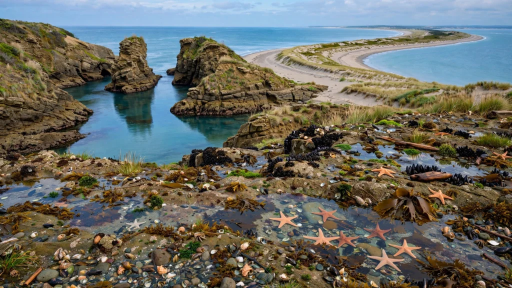
There is a particular kind of road trip fatigue that comes from spending eight hours staring at the same interstate rest-stop signs, counting down the miles to a famous overlook that — when you finally arrive — is packed shoulder-to-shoulder with tour buses. The American highway system is an engineering marvel, but it was designed for speed, not wonder. The most memorable drives in this country happen on the two-lane roads that run parallel to the famous ones, through towns you’ve never heard of, past landscapes that don’t fit on a postcard because no one thought to photograph them.
An off the beaten path road trip isn’t really about being contrarian. It’s about trading the efficiency of the interstate for the texture of the backroad: the roadside peach stand that only takes cash, the canyon overlook with no name and no railing, the motel where the owner hands you a hand-drawn map to a waterfall “the tour buses don’t know about yet.” These are the trips you tell stories about for years.
The three routes below are designed as complete, drive-ready itineraries — four to five days each, with day-by-day stops, honest notes on what the driving actually feels like, where to refuel (your car and yourself), and the best seasons to go. They span desert, mountain, and alpine country, so you can pick the landscape that calls to you or — better — collect all three.
Route 1: The Desert Southwest Backroad Loop
Red rock country is famous, but fame in the Southwest tends to concentrate at a handful of trailheads and viewpoints. This loop strings together the quieter corners of the desert — the state parks and tribal viewpoints that sit a half-hour past the turnoff everyone else takes. Total driving across five days is roughly 1,100 miles, most of it on open two-lane highways where the speed limit drops and the scenery soars.
Best season
Late October through early April is the sweet spot. Summer temperatures in the low desert regularly push past 105°F, which turns hiking into a dawn-only activity and makes a long car day genuinely uncomfortable. Winter brings occasional snow to the higher elevations around Monument Valley, but the desert floor stays mild and the light is extraordinary — low, golden, and raking across the rock faces. Spring brings wildflowers after wet winters, though crowds thin out again once you leave the national parks behind.
Day 1: Valley of Fire State Park
Start in Las Vegas — not for the Strip, but for the rental car and the fully stocked grocery run — and drive northeast about an hour into Valley of Fire State Park. This is Nevada’s oldest and largest state park, and it sees a fraction of the traffic of Zion or Arches despite holding some of the most surreal sandstone on Earth. The Fire Wave trail (about 1.5 miles round trip) winds through swirled orange and white rock that looks airbrushed. The White Domes trail loops through a slot-canyon-like wash where old movie sets once stood. Because this is a state park rather than a national park, you’ll often have a trail to yourself even on a weekend morning.
Spend the night in the small town of Overton, Nevada, at the park’s edge — a classic small-town motel stay. Eat dinner at a local diner or pick up supplies for the next few days; services get sparse fast on this route.
Day 2: The loneliest stretch — southern Utah’s back doors
Drive northeast from Overton toward St. George, Utah, then climb into the red rock country via back highways instead of the interstate. A highlight today is the drive itself: Highway 9 through the small towns east of St. George threads past crimson cliffs that most travelers only glimpse from the highway at 80 mph. Stop in the tiny community of Kanarraville or at a roadside pullout for a short leg-stretch hike — many visitors report that these unnamed washes and side canyons, found by simply following a dirt road that looks interesting, become their favorite memories of the trip.
Overnight in Kanab, Utah — the self-styled “Little Hollywood” that has served as a base for Western film crews since the 1930s. Kanab’s main street has several locally owned diners and cafes, and its location makes it the natural hub for the next two days.
Day 3: Grand Staircase country
East of Kanab sprawls the Grand Staircase–Escalante National Monument — nearly 1.9 million acres of slot canyons, hoodoos, and empty dirt roads. Pick one adventure for the day: the easy walk to the Toadstool Hoodoos (balanced-rock formations about 45 minutes from Kanab), or the longer drive down Hole-in-the-Rock Road, a maintained dirt road that leads to a string of trailheads into some of the most remote-feeling canyon country in the lower 48. Check road conditions at the visitor center before heading down dirt roads; after rain, they turn to impassable gumbo.
Driving-feel note: this is washboard and dust country. Drive slower than you think you need to, keep the windows up on dirt stretches, and carry more water than seems reasonable — typically at least a gallon per person per day in the desert.
Day 4: Monument Valley’s quiet side
Drive southeast to Monument Valley, but skip the crowded main overlook at midday. The tribal park’s famous Mittens viewpoint is at its best at sunrise, when the buttes glow ember-red and the tour buses haven’t arrived. After the sunrise visit, drive the self-guided 17-mile loop road (rough-hewn dirt; high-clearance vehicles handle it best, though passenger cars make it in dry conditions at low speed) and continue to lesser-visited viewpoints along the valley’s edges. Many visitors report that Goosenecks State Park, a small detour north with a vertigo-inducing overlook of the San Juan River’s hairpin meanders, rivals the main valley for sheer drama — with a tenth of the crowd.
Overnight in the small town of Kayenta, Arizona, or at a tribally operated lodge near the park entrance. Dinner options are limited; plan a simple meal and an early night.
Day 5: Goblin Valley and the drive out
Head north into Utah’s San Rafael country to Goblin Valley State Park — a valley floor scattered with thousands of mushroom-shaped hoodoos you can scramble freely among (the park famously has almost no marked trails; wandering is the point). It’s a half-day stop, easily paired with a walk through nearby Little Wild Horse Canyon, a family-friendly slot canyon that’s often empty on weekdays. From here, drive to your endpoint — many travelers loop back toward Salt Lake City or Las Vegas, roughly a 4- to 5-hour drive depending on the route.
Driving-feel notes for the whole loop: gas stations can be 60–100 miles apart on the Utah and Arizona back highways. Adopt the desert rule: when your tank hits half, start looking for fuel. Cell service drops out for long stretches — download offline maps before Day 1. And the winding climbs around the Grand Staircase demand attention: narrow shoulders, sudden sandstone drops, and the occasional free-range cow.
Route 2: Blue Ridge Backroads and Waterfall Country
The Blue Ridge Parkway gets the glory — and in October, the leaf-peeping traffic to match. But the mountains on either side of the Parkway are laced with older, narrower state routes that run through farming valleys, past covered bridges, and up to waterfalls the Parkway never touches. This four-day route trades the famous overlooks for the mountain towns and back roads where Appalachian culture still runs deep. Total driving is roughly 600 miles — shorter than the desert loop, but slower, on roads that twist like ribbon.
Best season
Late April through June for waterfalls at full flow and rhododendron blooms, or late September through October for fall color — though the Parkway itself clogs in October, which is exactly why the backroad detours below pay off. Summer is lush but humid, with afternoon thunderstorms that can slick mountain roads quickly. Winter can ice the higher elevations; check conditions if you go between December and March.
Day 1: Asheville’s back door
Base yourself in Asheville, North Carolina — but instead of joining the Parkway procession, head southwest on state routes into the Nantahala and Cullasaja gorges. The drive down US-19 and NC-28 follows whitewater rivers through tunnels of green, with pullouts at waterfalls you can walk to in minutes. Dry Falls, just off the highway, lets you walk behind the cascade without a hike at all. Eat in one of the small mountain towns along the way — Bryson City or Dillsboro — where family-run diners serve the kind of breakfast that keeps you full until dinner.
Overnight in a small-town motel or a family-run inn outside the Asheville bustle; rates typically drop noticeably once you’re 20 minutes from downtown.
Day 2: Waterfall alley
The Cashiers–Highlands plateau in western North Carolina holds one of the highest concentrations of waterfalls in the eastern US, thanks to heavy rainfall and steep escarpments. Build your day around three or four: Glen Falls (a series of cascades through rhododendron forest), Bridal Veil Falls (where the old highway passes behind the water), and the short walk to Silver Run Falls for a swim if it’s warm. None require serious hiking; all require pulling off a two-lane road and paying attention to the small brown signs.
Day 3: The Parkway detours
Now use the Parkway the way locals do — as a connector between detours, not the destination. Hop on for a stretch near Mount Mitchell, the highest peak east of the Mississippi, then get off at the next exit and drop into the Toe River valley. The small towns here — Burnsville, Bakersville — host craft galleries and old-time music venues that feel untouched by the tourism machine. If it’s a weekend evening, ask around about a jam session; mountain music here is a living tradition, not a performance for visitors.
Driving-feel note: Blue Ridge backroads are famously twisty. Motion-sensitive passengers should sit up front, and you’ll average well under the speed limit — budget extra time for every leg. Fog can settle suddenly at elevation; if visibility drops, pull fully off the road rather than creeping along the shoulder.
Day 4: Small towns and the drive home
Finish with a slow morning in the mountain towns along the French Broad River valley — antique shops, a riverside walk, a long lunch — then loop back to your start. If you’re heading east, the drive through the Hickory Nut Gorge (where Chimney Rock stands guard over Lake Lure) is a dramatic finale, with the road switchbacking down the escarpment.
Where to stay and eat, generally: this route rewards the mom-and-pop motel with rocking chairs on the porch and the diner where the menu hasn’t changed in 30 years. Ask your hosts what’s good — innkeepers in these towns are typically walking guidebooks. Gas is easy to find in the valleys; fill up before climbing into the high country, where stations thin out.
Route 3: The Pacific Northwest Cascade Loop
The North Cascades Highway (State Route 20) is routinely called one of America’s most beautiful drives — and yet most travelers only ever see the famous Diablo Lake overlook and turn around. This five-day loop goes deeper: the full highway crossing, the timber towns of the Methow Valley, and alpine lakes reached by short trails that stay quiet because they’re a half-hour from the famous ones. Total driving is roughly 800 miles, on some of the best-engineered mountain roads in the country.
Best season
This is a short-season route. The North Cascades Highway typically opens in late April or May after the snow is plowed and closes in November — always check the state DOT’s current status before committing to this itinerary. July through September is prime: wildflower meadows, swimmable alpine lakes, and long daylight. Late September brings golden larches at the higher elevations, a brief and spectacular window. Avoid the shoulder months unless you’ve confirmed the pass is open.
Day 1: Into the Cascades
Start from the Seattle side and drive east on SR-20. Stop at the Gorge Creek overlook and the famous Diablo Lake viewpoint — go early, before the tour buses — then keep going past where most visitors stop. The Washington Pass overlook, with its jagged Liberty Bell spires, marks the crest, and the descent into the Methow Valley on the east side is one of the great downhill drives in the West. Overnight in Winthrop, a former mining town remade as an Old West–themed village that, despite the theme, has genuinely good food and a river running through it.
Day 2: The Methow Valley slowdown
Winthrop and neighboring Twisp sit in a high, dry valley that feels more like the Rockies than the rainy Cascades. This is your rest-and-wander day: browse the bookstores and gear shops, rent a bike on the valley’s extensive trail network, or drive the short spur up to Hart’s Pass — one of the highest roads in Washington, a narrow dirt track clinging to a ridgeline, with meadows that explode with wildflowers in late July. Dinner at a farm-to-table spot in Twisp; this valley punches well above its weight for food.
Day 3: Timber towns and the Okanogan
Head south and west through the Okanogan highlands — rolling ponderosa country dotted with small timber towns that time forgot. Stop in one for lunch (the kind of cafe where the pie case is the main attraction), then continue to the eastern shore of Lake Chelan, a 50-mile-long fjord-like lake gouged by glaciers. The town of Chelan at the lake’s foot is your overnight; take an evening stroll along the waterfront and watch the light fade on the surrounding hills.
Day 4: Alpine lakes without the crowds
Instead of the famous Enchantments (permit lottery, crowds, logistics), explore the quieter alpine basins of the central Cascades. The drive over Stevens Pass on US-2 leads to trailheads for lakes like Lake Valhalla or Blanca Lake — hikes in the 3- to 8-mile round-trip range that deliver the full turquoise-alpine-lake experience with far fewer people than the marquee destinations. Go on a weekday if you can; even the “quiet” trails here fill up on sunny Saturdays.
Day 5: The long way back through Snoqualmie country
Return west via the back roads south of I-90 — old logging routes through second-growth forest, past waterfalls like Twin Falls and the small towns of the Snoqualmie Valley. It’s a gentler finale after the high country, and it lands you back near Seattle with time for a proper meal.
Driving-feel notes: the North Cascades Highway is a driver’s road — wide, smooth, and gloriously winding, but with sheer drops and no guardrails in places. Take it at a pace that lets you actually look at the scenery (use the pullouts). Gas up in Marblemount on the west side or Winthrop on the east; there is essentially nothing between them. Logging roads and high-country spurs demand slow speeds and, in places, high clearance.
Packing and Planning for an Off the Beaten Path Road Trip
Backroad routes reward preparation more than interstate slogs do, because the margin for improvisation is thinner. A little planning turns potential stress into the whole point of the trip.
Car prep before you leave
- Get a full inspection — tires (including the spare), brakes, fluids, and battery. Dirt and mountain roads punish weak tires.
- Pack a real spare, a jack you know how to use, and a portable tire inflator. Many visitors report that a slow leak from a sharp rock is the most common backroad mishap.
- Carry a paper road atlas as backup. It sounds old-fashioned until your phone dies in a canyon with no service.
- Check that your rental agreement allows unpaved roads if you plan to drive them — some contracts exclude it.
Navigation and connectivity
Download offline maps for your entire route before departure — every state and county you’ll cross. Offline navigation apps typically let you save large regions; do it on Wi-Fi the night before. Screenshot or print your lodging confirmations, because you may not be able to pull them up at check-in. Tell someone your rough itinerary and check in when you have signal.
Gas, food, and water planning
- Gas: on the desert and Cascade routes, stations can be 60–100 miles apart. The half-tank rule is non-negotiable: at half a tank, you start looking. Note which towns have stations and which don’t when you plan each day.
- Water: carry at least a gallon per person per day in the desert, and a few liters everywhere else. A refillable jug beats a pile of plastic bottles.
- Food: small-town diners and grocery stores are part of the experience, but they keep small-town hours — many close early or on Sundays. Carry a day’s worth of non-perishable food as insurance.
Where to stay: the small-town playbook
Book the first and last nights in advance, and leave the middle flexible if you’re traveling off-season — many small towns have more motel rooms than they advertise online, and the owner at the front desk will often recommend the next town’s best spot. Look for independently owned motels with good reviews mentioning cleanliness and hot water; they typically cost a fraction of chain hotels and come with local intelligence at check-in. In the mountains, family-run inns and cabins are the equivalent. Camping is superb on all three routes if you’re equipped — but reserve ahead for popular campgrounds in summer.
A quick comparison: the three routes at a glance
| Route | Days | Rough mileage | Best season | Driving character |
|---|---|---|---|---|
| Desert Southwest loop | 5 | ~1,100 miles | Oct–Apr | Open two-lane highways, dirt spurs, long gas gaps |
| Blue Ridge backroads | 4 | ~600 miles | Apr–Jun, Sep–Oct | Twisty mountain roads, slow going, frequent stops |
| Cascade loop | 5 | ~800 miles | Jul–Sep | Engineered mountain passes, sheer drops, short season |
Frequently Asked Questions
How is an off the beaten path road trip different from a normal one?
The difference is routing philosophy, not distance. A normal road trip optimizes for the famous stops via the fastest roads. An off the beaten path road trip deliberately takes the slower parallel routes — state highways, scenic byways, and county roads — and builds the days around small towns, lesser-known parks, and viewpoints that don’t appear in most guidebooks. You typically drive fewer miles per day but see more.
Do I need a 4WD vehicle for these routes?
For the paved portions, no — any reliable car works. The optional dirt spurs (Hole-in-the-Rock Road, Hart’s Pass, the Monument Valley loop road) are easier and more comfortable with high clearance or 4WD, but they’re optional detours, not requirements. Check current road conditions locally before attempting any unpaved stretch, and never drive a dirt road after heavy rain unless you’ve confirmed it’s passable.
Is it safe to drive roads with no cell service?
Millions of people do it every year. The precautions are simple: offline maps downloaded in advance, a paper atlas backup, a full tank strategy (the half-tank rule), extra water and food, and someone who knows your rough plan. The absence of cell service is part of what keeps these places quiet — treat it as a feature, not a bug.
How far in advance should I book lodging?
For the first and last nights, book when you commit to dates — small towns have limited rooms and they fill up during festivals and leaf season. Mid-trip nights can often stay flexible outside of peak season; many backroad motels keep walk-in rooms. In summer on the Cascade route and October in the Blue Ridge, book everything ahead.
Can I do these routes with kids?
Yes, with adjustments. The Blue Ridge route is the most family-friendly — short waterfall walks, small towns, and manageable driving days. The desert loop works well for older kids who can handle longer car stretches; keep hikes short and carry extra water and snacks. The Cascade route’s alpine hikes can be shortened to lake-viewpoint turnarounds. In all cases, build in the unscheduled stops — the roadside ice cream stand, the creek to throw rocks in — because those are the parts kids remember.
The Road Less Driven Is Worth It
The interstate will always be there, efficient and forgettable. But the trips that rearrange something in you — the ones where you crest a pass and gasp, where a diner owner redraws your whole afternoon with a single suggestion, where you stand at an overlook with no name and hear nothing but wind — those happen on the backroads. Pick the route whose landscape pulls at you, download your maps, fill the tank at half, and go find out what’s down that road everyone else drives past.